Ilha da Armona
| Ilha da Armona | ||
|---|---|---|
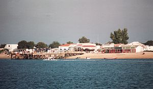
| Armona Landungsbrücken | ||
| Waters | Atlantic Ocean | |
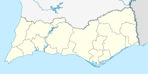
| Geographical location | 37 ° 2 ′ N , 7 ° 46 ′ W | |
|
|
||
| length | 9 km | |
| width | 0.1-1.5 km | |
| Highest elevation | Dunes 4 m |
|
| Residents | about 1000 | |
| main place | Armona | |
| Ilha da Armona with the main town (right) and the eastern tip of the Ilha da Culatra (left) in front of the lagoon and the city of Olhão | ||
The Ilha da Armona is an inhabited Portuguese Atlantic island .
location
It is located on the southern coast of the country in the natural park Ria Formosa . The island is located east of the cities of Faro and Olhão on the Gulf of Cádiz and belongs to the district ( concelho ) Olhão in the Algarve region .
Armona, together with the neighboring islands (including the culatra island to the west and the Ilha da Tavira in the east) one by only a few channels or creeks dotted island chain , which is upstream of the mainland coast and as a natural barrier protection between the islands and the mainland nearby lagoon forms. The island chain and lagoon are the main components of the nature park today.
description
The flat sand and dune island is about 9 kilometers long, between 0.1 and 1.5 km wide and has an area of several square kilometers. Like the neighboring beach islands, it was created by sediments that were eroded away from the cliffs of the western Algarve and deposited here over time due to the prevailing flow conditions further east . In the south on the Atlantic coast, the island has a wide sandy beach that extends continuously over the entire length with an inland belt of dunes that is only a few meters high and has hardly any vegetation . On the northern side, facing the mainland, there are mostly economically unused swamps and marshes .
The eastern part of the island is also known as Ilha da Fuseta or Ilha da Fuzeta . Since both parts of the island are only connected by an isthmus, which is around 100 meters wide , it is reasonable to assume that they were originally two independent islands that were connected to one another through land growth over the years.
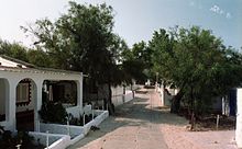
The main town is the homonymous settlement Armona in the far west of the island. The vast majority of the estimated more than 1000 permanent residents also live here (exact data are not available). The place has a ferry dock and smaller sandy beaches, where the islanders' fishing boats anchor. From here a boardwalk for pedestrians leads to the south beach. There are no paved roads or paths to the east on the island. About 6 km east of Armona there is another unspecified settlement at the narrowest point on the island. Many of their buildings, mostly holiday homes, were built in the immediate vicinity of the beach without a permit. While some were destroyed in a flood , other illegally constructed structures were removed on behalf of the administration.
Economy and tourism
Up until a few years ago, the main line of business was almost exclusively fishing . Only recently has tourism also played an economic role. There is (so far) on the island neither package nor mass tourism , which is not least due to the somewhat remote location. From Faro Airport the distance in is a straight line only 16 km, but there is neither a shuttle bus connection nor transfer- transit lines . For the still quite limited number of individual tourists , accommodations are available in private quarters , guesthouses or holiday homes . In the vicinity of the village there is a campsite with an attached cottage settlement . There are also some gastronomic establishments such as restaurants, bars and cafes and, to a lesser extent, opportunities for sporting activities.
The island has no significant sights. Its most important attraction is the kilometer-long, fine sandy beach, which is not overcrowded even in the main season when day tourists visit Armona in addition to stationary guests and which still has secluded and lonely sections.
Ferry connection
In the summer months there is practically an hourly ferry connection to and from Olhão, the frequency of which is somewhat thinner in the winter months. In addition, there are crossings from Fuseta to the eastern part of the island, especially in summer .
Individual evidence
- ↑ Information ( Memento of August 14, 2012 in the Internet Archive ) on the website of the ICNF (Instituto da Conservação da Natureza e das Florestas) ( pt. )
- ↑ Geografia do Concelho Olhão on the official website ( pt. ), As of 2012, accessed on March 1, 2013
- ↑ Distances according to Google Earth , measured on March 2, 2013
- ^ Article on TVI 24 (Portuguese television station) online from March 2, 2010, accessed on March 2, 2013
- ↑ Ferry timetable on the website of the municipality of Olhão


