Issumer Fleuth
| Issumer Fleuth | ||
|
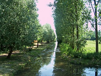
Issumer Fleuth at the confluence with the Nenneper Fleuth |
||
| Data | ||
| Water code | EN : 2866 | |
| location | North Rhine-Westphalia , Germany | |
| River system | Rhine | |
| Drain over | Niers → Maas → Hollands Diep → North Sea | |
| River basin district | Meuse | |
| source | At Kamp-Lintfort 51 ° 31 '23 " N , 6 ° 28" 52 " E |
|
| Source height | 24 m above sea level NN | |
| muzzle | At Kevelaer in the Niers coordinates: 51 ° 35 ′ 20 ″ N , 6 ° 17 ′ 7 ″ E 51 ° 35 ′ 20 ″ N , 6 ° 17 ′ 7 ″ E |
|
| Mouth height | 19 m above sea level NN | |
| Height difference | 5 m | |
| Bottom slope | 0.2 ‰ | |
| length | 24.8 km | |
| Catchment area | 129.088 km² | |
| Left tributaries | Nenneper Fleuth | |
| Medium-sized cities | Kevelaer | |
The Issumer Fleuth (pronounced "Flöt") is an approximately 25 km long, non-navigable, right tributary of the Niers in North Rhine-Westphalia , Germany . It is being built near Kamp-Lintfort . From the source it flows in a north-westerly direction, crosses the Fleuthkuhlen nature reserve and flows into the Niers in Kevelaer , Winnekendonk . At Issum , the Nenneper Fleuth flows into the Issumer Fleuth. The catchment area is approx. 120 km² and lies between Issum, Kevelaer and Geldern .
