Jägersberg – Schirknitzberg
|
Jägersberg – Schirknitzberg
|
||
|
Jägersberg-Schirknitzberg nature reserve |
||
| location | Brandenburg , Germany | |
| surface | 1,596.99 ha | |
| WDPA ID | 318610 | |
| Geographical location | 52 ° 11 ' N , 13 ° 30' E | |
|
|
||
| Setup date | October 11, 1999 | |
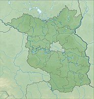
The Jägersberg-Schirknitzberg nature reserve is a 1,596.99 hectare nature reserve in Zossen in the Teltow-Fläming district in the state of Brandenburg .
location
The nature reserve is located southwest of the city center and extends there west of the federal highway 96 along the district of Wünsdorf . To the north it is bounded by the street Töpchiner Weg . From there, the district runs about 3.8 km in a south-easterly direction to the Kallinchen – Zehrensdorf intersection, from where it leads about 2.2 km south to the Zehrensdorf clay pit. Between the Eichberg and the clay pit, the border runs south to south-east and finally reaches the road to Töpchin . The border runs along some forest paths for around 750 m in a south-south-west direction and from there around two kilometers in a south-south-east direction to Marschallstraße . The further border runs around 600 m to the anti-tank ditch , which it follows around 800 m in a westerly direction to a forest path. From there it runs around 600 m northwards along a forest path, there again crosses Marschallstrasse and runs around one kilometer along the boundary between Zehrensdorf and Zesch am See . At another intersection, the border meets Marschallstrasse again and runs from there in a northerly direction for around 1.8 km along a road. The border then leads about 1.75 km in a west-northwest direction along a forest path until it meets the bypass road . After around 2.3 km in a north-westerly direction, it bypasses the former firing range, meets the bypass road again, which it now follows for around 2.3 km in a north-westerly direction.
history
The area around Wünsdorf was included in the course of expanding the area of the military training areas in Jüterbog and Kummersdorf-Alexanderdorf from 1907. The local population was resettled and from 1910 numerous barracks were built in the forest. After being used by the Wehrmacht , the group of Soviet armed forces in Germany moved into the area after the end of the Second World War . Since a large part of the area was not open to the public, numerous plant and animal species were able to develop largely undisturbed. After the fall of the Berlin Wall , the State Development Company for Urban Development, Housing and Transport of the State of Brandenburg mbH (LEG) began developing a concept in 1992 to prepare for post-military use. After the troops withdrew in 1994, Wünsdorf and the surrounding areas were developed. In 1999 the forest was designated as a nature reserve. In 2017, the landscape was comprehensively mapped in order to draw conclusions for suitable protective measures.
Flora and fauna
The protection purpose consists in the preservation of "highly endangered forms of vegetation, plant communities and plant species nutrient-poor and largely base-poor locations". This applies in particular to the forest equestrian grass - sessile oak forest and the lichen - pine forest .
In the district, wooded areas alternate with mixed deciduous forests, forests and pioneer forests with open spaces, which consist of dry sandy heaths, lime-rich sand lawns and dunes with open grass areas. In addition, there are acidic oak forests and bog forests.
Numerous bird species such as the goat milker and the woodlark have been identified in the area, as well as other endangered species such as the sand lizard and the natterjack toad . The great noctule bat , the common bat , the Bechstein's bat , the great mouse-eared bat , the great bearded bat , the little bearded bat and the little noctule were also detected .
Individual evidence
- ↑ Frank Pechhold: Unique heathland is mapped . In: Märkische Allgemeine , September 27, 2017, accessed on October 12, 2018.
- ^ Ordinance on the Jägersberg-Schirknitzberg nature reserve , website of the State of Brandenburg, accessed on October 12, 2018
- ↑ Jägersberg-Schirknitzberg , Natura2000 website in Brandenburg, accessed on October 12, 2018.
Web links
- Ordinance on the Jägersberg-Schirknitzberg nature reserve , website of the State of Brandenburg, accessed on October 12, 2018


