Horstfelder and Hechtsee
|
Horstfelder and Hechtsee
|
||
|
View from the Notte Canal into the NSG |
||
| location | Brandenburg , Germany | |
| surface | 248.27 hectares | |
| WDPA ID | 14405 | |
| Geographical location | 52 ° 13 ' N , 13 ° 25' E | |
|
|
||
| Setup date | March 17, 1986 | |
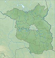
Horstfelder und Hechtsee is a 248.27 hectare nature reserve in the Teltow-Fläming district in Brandenburg .
Location and history
The nature reserve is located in the natural areas of Central Brandenburg Plateau and Lowlands and East Brandenburg Heath and Lake District . It consists of flat undulating ground moraine , studded hills terminal moraines , marshy lowlands and dunes, with flat and slightly sloping Sandern alternate. It originated between the Saale complex and the Glacial Vistula on the edge of a glacial valley .
The protected area is located east of the eponymous Horstfelde district of the city of Zossen . It is bounded in the north by the federal road 246 , the Zossen district of Next Neuendorf and the Königsgraben . To the east is the city center of Zossen; The Notte Canal flows from the south in a north-easterly direction along the nature reserve. In the south is the municipality of Am Mellensee , to the southwest of the district of Saalow .
In the northern part of the protected area is the Horstfelder See , which consists of two partial lakes; in the south the now almost completely silted up Hechtsee . At an earlier point in time it was connected to the Horstfelder See via the Nottefließ. To the south of the lake, the Saalowgraben crosses from west to east and drains into the Notte Canal. There are other small bodies of water in the area that were created by excavations or silting up.
Flora and fauna
A study in 2015 assumed that the potential natural vegetation in the northern part of the area of a black alder - lowland forest in combination with an oak-hornbeam forest would be. The experts further concluded that in the area in the northwest, a wire deschampsia - and bent grass -Eichenwald, south of it a chickweed - English oak - hornbeam forests would join. In the southern area there is a quarry forest and a swamp area with black alders. In the 21st century, however, the area is characterized by the change in wet and damp locations: moors and swamps take up around 57.6% of the area. Extensive stocks of reed beds grow on the dominant waters . There is also the ash willow , the laurel willow and, on lime-rich soils, the buckthorn . Due to agricultural use, the black elder has spread on the fringes. Grass and shrubbery cover around 29.1% of the area, while forest and forest areas only take up around 8.2%. The beach carnation , the moor sedge , the black-headed sedge , the Reichenbach's quivering grass harrow , the hemlock , the broad-leaved orchid , the sand straw flower , the swamp pea and the common buttercup have all been shown to be particularly valuable because they are endangered .
In the field of still life otters , which the waters chain on the Mellensee to Prierowsee uses (district of Dabendorf ). Using nets and similar measures, six of the 18 bat species living in Brandenburg , including the broad-winged bat and the noctule bat , were able to be detected. They mainly use the area for hunting. Indirect evidence revealed a population of the narrow diaper snail as well as the highly endangered bellied diaper snail . There are also the spotted darter and the small snail snail . The nature reserve is still used by numerous breeding birds , such as the bittern , the white stork , the red kite , the sea eagle and the kingfisher .
Use, condition and development
Around 92% of the area is privately owned, followed by trusts, public authorities, a small proportion of cooperative ownership and church ownership. In the context of hunting leases, hunting takes place, while fishing and fishing are no longer practiced.
An action plan recommends numerous measures to improve the condition of the area. For example, a sufficient water level should be ensured, the water quality improved and the peatland and shallow water complex developed. Individual areas should be mowed in the short term, and in the medium and long term natural regeneration should be carried out, among other things by removing foreign tree species.
literature
- Ministry for Rural Development, Environment and Agriculture of the State of Brandenburg (Ed.): Management plan Horstfelder and Hechtsee , short version, January 2015, p. 26.
Individual evidence
- ↑ Water for the Horstfelder See , website Natura 2000 Brandenburg, accessed on July 15, 2019.


