Kınalı-Tekirdağ-Çanakkale-Balıkesir Highway
| Otoyol O- in Turkey | |

|
|
| |
|
| map | |
| Under construction In planning | |
| Basic data | |
| Operator: | Private |
| Overall length: | 321 km |
| of which under construction: | 88 km |
| of which in planning: | 233 km |
|
İl ( provinces ): |
|
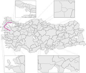
The Kınalı-Tekirdağ-Çanakkale-Balıkesir Highway is a planned Turkish toll highway. It begins in the north at Otoyol 3 near Silivri in Istanbul and ends in the south at Otoyol 5 near Balıkesir .
The reasons given for the construction are the better and faster bypassing of the coastal regions around Tekirdag , Canakkale and Balikesir as well as a reduction in travel time, especially between Malkara and Balikesir. The main aim is to relieve traffic between the Aegean region , Europe and the eastern part of Istanbul and create an efficient alternative route to Otoyol 5 .
The project includes the Çanakkale 1915 bridge as well as viaducts with a total length of approx. 17.5 km and 5 tunnels with a total length of approx. 7 km. The approximately 100 km long section between Malkara and Lapseki and the bridge are currently under construction. It is not yet clear which number the route will receive.
Web links
- ÇED document (official report on the ecological impact of the project, contains many graphics and maps)
Individual evidence
