
Kampung Alor
| Kampung Alor | |||

|
|||

|
|||
| Data | |||
| surface | 0.42 km² | ||
| population | 3,531 (2015) | ||
| Chefe de Suco | Afonso Soares (election 2009) |
||
| Aldeias | Population (2015) | ||
| Anin Fuic | 2,738 | ||
| Hamahon | 307 | ||
| Rai Lacan | 486 | ||
|
|||

Kampung Alor ( Campo Alor , Kampong Alor , Campaalor , Kampong Arab , Campo Mouro ; formerly 7 Decembro) is an East Timorese suco in the administrative office of Dom Aleixo ( municipality of Dili ) and part of the state capital Dilis .
geography
| Kampung Alor | ||
| places | position | height |
| Karketu | 8 ° 33 ' S , 125 ° 34' E | 0 m |
| Moro | 8 ° 33 ' S , 125 ° 34' E | 0 m |

The Suco is located in the northeast of the Dom Aleixo administrative office, directly on the banks of the Strait of Wetar , with Avenida de Portugal as the coastal road. To the west is the Suco Fatuhada and south of the Avenida Nicolau Lobato is the Suco Bairro Pite . To the east, Kampung Alor borders the Vera Cruz administrative office with its Sucos Motael and Colmera . During the rainy season, the Maloa flows along the eastern border of Kampung Alor . The Suco is also bordered by a canal to the west, to the west of the Rua de Salmão . The main streets in north-south direction are Rua do Tuberão , Rua de Baleia and the old center of the district, Rua de Campo Alor .
Before the 2015 territorial reform, Kampung Alor had an area of 0.49 km². Then it gave up the narrow strip of land west of the canal on Rua de Salmão to Fatuhada. Now Kampung Alor has an area of 0.42 km².
The Karketu district forms the north and the Moro ( Mouro ) district to the south . Here is a pre-secondary school, the National Library of East Timor and on Rua de Campo Alor the Annur Mosque , the largest mosque in East Timor. Along the Rua de Campo Alor there are street stalls selling clothing, the Kampung Alor Pusat Grosir , which also extends into the Travessa de Tuna Tasi . Opposite the corner of Travessa de Tuna Tasi / Rua de Campo Alor is the headquarters of the Serviçio Autónomo de Medicamentos e Equipamentos de Saúde (SAMES). The embassies of the People's Republic of China and Japan are located on Avenida de Portugal and to the east on Rua de Baleia , the building of the Ministry of Finance , one of the tallest buildings in the country.
In the Suco there are the three Aldeias Anin Fuic ( Atarac Laran , Ai-Tarak Laran , Aitarak Laran ), Hamahon and Rai Lacan .

Serviçio Autónomo de Medicamentos e Equipamentos de Saúde

Rua de Campo Alor

Travessa de Tuna Tasi

Rua de Campo Alor
Channel at SAMES
Building opposite the Treasury

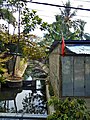
Street shrine in the Travessa de Tuna Tasi

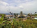
Residential house in Kampung Alor


Residents
The Suco has 3,531 inhabitants (2015), of which 1913 are men and 1618 women. The population density is 8342.5 inhabitants / km². There are 678 households in the Suco. Almost 83% of the population name Tetum Prasa as their mother tongue. Minorities speak Tetum Terik , Baikeno , Fataluku , Kemak and Makasae .
history

Kampung Alor used to be the area where the Arab population settled at the end of the 19th century. They are descendants of the Yemeni tribe of the Kathiri from Hadramaut . In the middle of the 20th century they were still growing rice, making copra and fishing. In addition to the mosque, they also ran a Koran school. In 2002, the Annur Mosque was set on fire by demonstrators protesting against Prime Minister Alkatiri . It has been repaired.
During the invasion of East Timor by Indonesia on December 7, 1975, heavy fighting broke out when Indonesian troops landed in Kampung Alor.
The east of Sucos was only built upon after independence.
politics

In the 2004/2005 elections , Agostinho Gomes da Silva was elected Chefe de Suco. In the 2009 elections won Afonso Soares .
Web links
- Results of the 2010 census for the Suco Kampung Alor ( tetum ; PDF; 8.1 MB)
- Results of the 2015 census for Suco Kampung Alor (tetum; PDF)
- Seeds of Life: Suco information sheets Dom Aleixo (tetum)
- Victoria Stead: Homeland, Territory, Property: Contesting Land, State, and Nation in Urban Timor-Leste (2015). Scientific work on the threatened displacement of the residents of Aitarak Laran for the construction of a national library and a cultural center.
Individual evidence
- ↑ a b c d Direcção-Geral de Estatística : Results of the 2015 census , accessed on November 23, 2016.
- ↑ City map of Dili ( Memento from June 30, 2007 in the Internet Archive ) (PDF; 1.3 MB)
- ↑ Timor-Leste: Poverty in a Young Nation ( Memento from December 25, 2010 in the Internet Archive ) (PDF; 1.2 MB)
- ↑ Fallingrain.com: Directory of Cities, Towns, and Regions in East Timor
- ^ Timor-Leste GIS-Portal ( Memento from June 30, 2007 in the Internet Archive )
- ↑ Direcção Nacional de Estatística: Population Distribution by Administrative Areas Volume 2 English ( Memento from January 5, 2017 in the Internet Archive ) (Census 2010; PDF; 22.6 MB)
- ↑ UNMIT: Timor-Leste District Atlas version 02, August 2008 ( Memento from March 4, 2016 in the Internet Archive ) (PDF file; 583 kB)
- ↑ Jornal da Républica with the Diploma Ministerial n. 199/09 ( Memento of February 3, 2010 in the Internet Archive ) (Portuguese; PDF; 323 kB)
- ↑ Results of the 2010 census for Suco Kampung Alor ( tetum ; PDF; 8.1 MB)
- ^ ETAN, December 31, 2002, CNS: East Timor bishop apologizes for rioting, attack on mosque
- ^ Timor Archives, Invasion 1975 - Photographs
- ↑ Secretariado Técnico de Administração Eleitoral STAE: Eleições para Liderança Comunitária 2004/2005 - Resultados ( Memento of August 4, 2010 in the Internet Archive )
- ↑ Secretariado Técnico de Administração Eleitoral STAE: Eleições para Liderança Comunitária 2009 - Resultados ( Memento of August 4, 2010 in the Internet Archive )
Bairro Pite | Bebonuk | Comoro | Fatuhada | Kampung Alor | Madohi | Manleuana