Klíč
| Klíč | ||
|---|---|---|
|
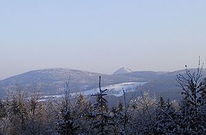
View to Kleis in winter |
||
| height | 760 m | |
| location | Czech Republic | |
| Mountains | Lusatian Mountains | |
| Dominance | 7.1 km → Pěnkavčí vrch | |
| Coordinates | 50 ° 47 '19 " N , 14 ° 34' 22" E | |
|
|
||
| Type | Kegelberg | |
| rock | Phonolite | |
| Development | Construction of the Kleishütte in 1850 | |
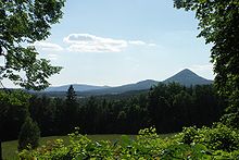
The Klíč (German Kleis ) is one of the most striking cone mountains in the Lusatian Mountains in northern Bohemia ( Czech Republic ). The 60 meter high rock face on the southwest side with the large block heap underneath , which gives the mountain its typical shape, is impressive . In 1967 the upper part of the mountain was declared a national nature reserve due to the occurrence of rare plant species and can only be walked on the marked hiking trail. The reserve is 40 hectares.
Location and surroundings
The Klíč is located immediately north of the town of Nový Bor ( Haida ). The municipalities of Svor ( Röhrsdorf ) and Polevsko ( Blottendorf ) are located directly at the foot . On the southeast side run the European route 442 and the route of the Bohemian Northern Railway from Česká Lípa to Rumburk . Directly below the summit is the Kleisquelle (in Czech today Kamzičí studánka - Gemsenborn - called), which is used to supply Nový Bor with drinking water. To the west lies the Šporka valley .
history
Because of its advanced position as the southernmost foothills of the Lusatian Mountains, the Kleis was strategically unsuitable for the location of a castle in the Middle Ages. So he only served as an observation post for the north located on the paths over the mountains castles millstone and Tollenstein .
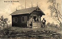
In 1850 a small refuge was built on the summit, which was replaced in 1872 by a larger, also wooden hut. Like many other mountain buildings in the Bohemian part of the Lusatian Mountains, this burned down after the end of the Second World War through arson in 1945. In 1893, the Haida department of the mountain association for northernmost Bohemia built a paved serpentine ascent to the summit, which is still quite well preserved today.
Chamois were settled after 1900, and they can still be found today on the debris cone below the stone slope or in the summit area. The Czech name Klíč can be traced for the first time in 1928 .
In the second half of the 20th century, when the forest died out , the vegetation on the mountain changed and the spruce stands have now disappeared.
view

Since there is only sparse tree growth above 700 m, the Klíč offers a very good view of the mountains of the Central Bohemian Uplands and the Ralsko ( Roll ). To the north and east, the Lusatian, Jeschken , Jizera and Giant Mountains form an impressive panorama. To the west there is a unique view over the table mountains of Saxon-Bohemian Switzerland and into the Ore Mountains .
Paths to the summit
- The Klíč is located on the red marked main hiking trail, which connects Svor and Nový Bor. From this a marked fork leads to the summit.
- The European long-distance hiking trail E10 passes near the mountain. From the junction at the Kleisquelle, the summit can be reached in about 20 minutes via the red marked hiking trail.


