
Little Saynbach
| Little Saynbach | ||
 The Kleine Saynbach in the municipality of Nordhofen |
||
| Data | ||
| Water code | DE : 27124 | |
| location |
Westerwald
|
|
| River system | Rhine | |
| Drain over | Saynbach → Rhine → North Sea | |
| source | south of Obersayn, municipality of Rothenbach 50 ° 32 ′ 22 ″ N , 7 ° 53 ′ 22 ″ E |
|
| Source height | approx. 460 m above sea level NHN | |
| muzzle | between Ellenhausen and Oberhaid in the Sayn coordinates: 50 ° 30 '47 " N , 7 ° 43' 20" E 50 ° 30 '47 " N , 7 ° 43' 20" E |
|
| Mouth height | approx. 225 m above sea level NHN | |
| Height difference | approx. 235 m | |
| Bottom slope | approx. 14 ‰ | |
| length | 16.7 km | |
| Catchment area | 33.75 km² | |
The Kleine Saynbach is a sixteen kilometer long left tributary of the Sayn near Ellenhausen and Oberhaid . It flows through the Rhineland-Palatinate Westerwaldkreis .
geography
course
The Kleine Saynbach rises about 15 km northeast of the Montabaurer Höhe south of Obersayn, a district of Rothenbach at an altitude of 460 m above sea level. NHN .
From here it flows northwards towards Obersayn, flows under federal highway 255 and then runs in a south-westerly direction along the southeastern foothills of the Helleberg to Arnshöfen , where it crosses under federal highway 8 , and then to Kuhnhöfen . Then it enters the municipality of Niedersayn and flows along the districts of Karnhöfen, Blaumhöfen and Niedersayn to Helferskirchen , where it meets the district of Niederdorf to the north.

The stream in front of the viaduct in Nordhofen
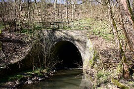
The Nordhofen Viaduct


Continuing south-west, it flows to the communities of Quirnbach and Vielbach , after which it enters the southern district of Nordhofen , where it runs under the Viaduct von Nordhofen, a viaduct on the Holzbachtalbahn Siershahn-Altenkirchen section of the Engers-Au railway line , and at the Mausmühle enters the municipality of Oberhaid .
It flows just north of Oberhaid and occurs at a height of about 225 m above sea level. NHN south of Ellenhausen as a left tributary into the Sayn .
The 16.7 kilometer long course of the Kleiner Saynbach ends about 235 meters below its source, so it has a mean bed gradient of about 14 ‰.
Catchment area
The 33.75 km² catchment area of the Kleiner Saynbach lies in the Westerwald and is drained through it via the Saynbach and the Rhine to the North Sea.
It borders
- in the northeast to the catchment area of the Enspeler Bach , which drains into the Rhine via the Nister and the Sieg (river) ,
- in the east to that of the Elbbach , which flows into the Lahn tributary to the Rhine ,
- in the southeast to that of the Ahrbach , which flows into the Gelbach ,
- in the south to that of the Glebach directly, which flows into the Lahn,
- in the southwest to that of the Masselbach , which drains over the Brexbach into the Saynbach and
- in the north to that of the Saynbach directly.
The highest point is the Kaltebaum with 471.2 m in the northeast of the catchment area.
Tributaries
- Etzelbach (from the left, south of Arnshöfen, 1.18 km, GKZ 271242)
- Beulsteinbach (from the left, south of Kuhnhöfen, 1.13 km, GKZ 2712432)
- Wolfsbach (from left, near Niederdorf (Helferskirchen), approx. 1.53 km, GKZ 271244)
- Merzelbach (from the left, west of Vielbach, approx. 3.13 km, GKZ 2712452)
- Struthbach (from the left, southwest of Nordhofen, approx. 3.25 km, GKZ 271246)
- Mausmühlbach (right-hand junction at the Mausmühle, southwest of Nordhofen / east of Oberhaid, approx. 0.84 km, GKZ 2712494)
Web links
Individual evidence
- ↑ a b topographic-map.com
- ↑ a b Rhineland-Palatinate Water Management Authority