List of architectural monuments in Paderborn core city
The list of architectural monuments in Paderborn-Kernstadt contains the listed buildings in the area of Paderborn-Kernstadt in North Rhine-Westphalia (as of December 2018). These monuments are entered in the monument list of the city of Paderborn; The basis for the admission is the Monument Protection Act North Rhine-Westphalia (DSchG NRW).
| image | designation | location | description | construction time | Registered since |
Monument number |
|---|---|---|---|---|---|---|
 more pictures |
Abdinghofkirche / basilicas | Am Abdinghof 9 card |
11th century | Dec. 1, 1983 | 1 Wikidata |
|
 more pictures |
Busdorfkirche Klostergeb., Cloister, wayside shrine |
Am Busdorf 6–8 card |
11th century | Dec. 1, 1983 | 2 Wikidata |
|
 more pictures |
Dom | Domplatz 1 card |
13th Century | Dec. 1, 1983 | 3 Wikidata |
|

|
Dome / leveling point | Dom | Altitude mark | Oct 14, 1992 | 3 a |
|
 more pictures |
Franciscan Church | Westernstrasse 21 map |
1668 | Dec. 1, 1983 | 4 Wikidata |
|
 more pictures |
Gaukirche | Market 12 card |
Late 12th century | Dec. 1, 1983 | 5 Wikidata |
|
 more pictures |
Herz-Jesu-Kirche wayside shrines, hall construction, crucifix |
Bahnhofstrasse 2 map |
Wayside shrines with rich decorations made of Teutoburg sandstone | 1895/96 wayside shrines 1697 |
Dec. 1, 1983 | 6 Wikidata |
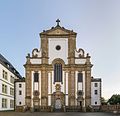 more pictures |
Catholic market parish church (formerly Jesuit church) | Camp 2 card |
1682-1692 | Nov 29, 1983 | 7 Wikidata |
|

|
Keilstein | Jesuit Wall / Jüßengasse map |
Wedge stone with IHS and three nails in a halo ( Jesuit symbol ), as well as the inscription: "Aō 1608" | 1608 | Nov 29, 1983 | 7 a |
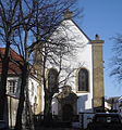 more pictures |
Capuchin Church | On the Capuchins 5-7 card |
Four-bay hall church. Built by Ambrosius von Oelde | 1681-1683 | Dec 9, 1986 | 8th |
 more pictures |
Church of the Michaelskloster | Michaelstrasse 19 map |
built by Ambrosius von Oelde | 1694-1698 | Nov 29, 1983 | 9 |
 more pictures |
Church of the State Hospital / church facade / metal plate | Kisau 14 map |
former Capuchin monastery | 1657-1661 | May 16, 1984 | 10 |
 more pictures |
Franciscan monastery facade planning, baroque Wasserkump, pond surround, statue |
Westernstrasse 19–21 map |
1663-1664 | Dec. 1, 1983 | 11 |
|
 more pictures |
Michael's Monastery | Michaelstrasse 17 map |
built by Ambrosius von Oelde | 1694-1698 | Nov 29, 1983 | 12 Wikidata |

|
Motherhouse of the SCC with enclosures and Josefshaus enclosing walls, Konradus chapel, Apostelplatz, Hochkreuz, statues, Fatima chapel, grotto, individual items |
Warburger Strasse 2 / Busdorfwall 2 map |
Aug 6, 1984 | 13 |
||
 more pictures |
Alexius Chapel | Am Abdinghof 4 card |
On the grounds of the St. Michael monastery | 1670-1673 | Nov 29, 1983 | 14 Wikidata |

|
Old Chapel (Liborikapelle) | Kamp, in the garden of the Theodorianum card |
Gothic period, renovated in 1644 | Dec 16, 1986 | 15th |
|
 more pictures |
Bartholomew Chapel | Am Ikenberg 4 map |
around 1017 | Dec. 1, 1983 | 16 Wikidata |
|
 more pictures |
Gerold's Chapel | Am Ikenberg 2 map |
Chapels of the older cathedral monastery. The older chapel dates from the time of Bishop Badurad (815–862). The younger is from the time of Bishop Meinwerk (1009-1036). This chapel was previously interpreted as the chapel of Gerolds , Charlemagne's brother-in-law. | 9th century / 11th century |
Nov 29, 1983 | 17th |
 more pictures |
Ikenberg Chapel | At the Ikenberg (next to No. 4) map |
11th century | Nov 29, 1983 | 18th |
|
 more pictures |
Kaiserpfalz Pfalzanlage, Königspfalz, Bischofspfalz (Saalbau) |
At the Ikenberg (next to No. 4) map |
8th and 11th centuries | June 25, 1985 | 18 b |
|
 more pictures |
Liborius Chapel with 2 wayside shrines / chapel building | Liboriberg map |
1730 | Dec. 1, 1983 | 19th |
|
 more pictures |
Jewish Cemetery | Warburger Strasse 110 map |
Nov 29, 1983 | 20th |
||
 more pictures |
Cathedral cloister Kapitelfriedhof, Westphalen Chapel, crucifix |
Domplatz 3 map |
Dec. 1, 1983 | 21st |
||
 more pictures |
East cemetery with various gravestones and Langenohl chapel / wayside shrines | Driburger Strasse / Am Ostfriedhof map |
1866 | Aug 20, 1984 | 22nd |
|

|
Wayside shrine | Corner of Driburger Strasse and Busdorfwall map |
June 20, 1984 | 23 |
||

|
Wayside shrine | Gierswall / Heierstor map |
1704 | June 20, 1984 | 24 |
|

|
Wayside shrine | Husener Strasse / Mersinweg / Grünebaumstrasse map |
The wayside shrine shows the scene of the Mount of Olives on a relief plate, dated to the 19th century. Inscriptions: In your love, keep me firmly in the plinth so that I don't spoil it ; anno di G 16 79 N Amice ad quid venisti in the gable; sic filium hominis in the roof on the left. The wayside shrine was restored in 1965 and 1990. On the former pilgrimage route "Hillige Seele", it is the first surviving wayside shrine in the direction of the chapel to the Hillige Seele . | 1679 | June 20, 1984 | 25th |

|
Wayside shrine | In Dörener field 12 (entrance cemetery) Map |
1744 | June 20, 1984 | 26th |
|

|
Wayside shrine | Liboriberg (next to Busdorfwall 2) | 1733 | June 20, 1984 | 27 |
|

|
Wayside shrine | Knickweg / Husener Straße (Haxterberg) map |
This early baroque wayside shrine made of sandstone shows a depiction of the crucifixion on Golgotha hill. The inscription on the front is no longer legible. On the former pilgrimage route "Hillige Seele" it is the third surviving wayside shrine towards the chapel to the Hillige Seele . | 18th century | June 20, 1984 | 28 |
 more pictures |
Double shrine | Neuhäuser Strasse (next to No. 66) map |
1690 | June 20, 1984 | 29 |
|

|
Wayside shrine | Paderwall map |
1745 | June 20, 1984 | 30th |
|

|
Wayside shrine | Liboriberg / Rosentor (at Franziskanermauer 1) map |
1738 | June 20, 1984 | 32 |
|

|
Wayside cross / sandstone crucifix (former Romskapelle) | Bahnhofstrasse (opposite No. 92) | June 20, 1984 | 33 |
||

|
Crucifixion group | Gierswall / Heierstor map |
1896 | June 20, 1984 | 34 |
|

|
crucifix | Corner of Heinz-Nixdorf-Ring / Riemekestrasse map |
Erected by Heinrich Hesse to commemorate the deceased | 1890 | June 20, 1984 | 35 |

|
Wayside cross | Fürstenallee (next to no. 16) map |
1882 | Jan. 5, 1990 | 36 |
|

|
Remains of the Libori chapel, St. Mary's monument, 2 allegories | Camp 4 and 6, in the garden of Theodorian map |
Dec 18, 1986 | 37 |
||
 more pictures |
Virgin Mary statue | Kamp 8 card |
Renaissance, made of bronze, on a four-part base with angel heads and inscription: Got. frid. Köller to cassel gos me in 1678. | 1678 | Dec 22, 1986 | 38 |
 more pictures |
Heiersburg is now a youth hostel in Paderborn | Meinwerkstrasse 16 map |
Jan. 21, 1985 | 39 a |
||
 more pictures |
Haxter Warte (former light tower) | Knickweg and Lichtenturmweg map |
June 20, 1984 | 40 |
||

|
Hardehauser Hof | Am Busdorf 11 map |
Built by order of Abbot Vinzenz Spanncken as the seat of the Hardehausen monastery. Attributed to Franz Christoph Nagel . | 1734 | Nov 29, 1983 | 41 |

|
Johannes Hatzfeld House | Dompropsteigasse 1 map |
built by Arnold Güldenpfennig | before 1900 | 3rd July 1984 | 43 |

|
Archbishop's General Vicariate, facades and chapter house | Domplatz 3 map |
Jan 15, 1986 | 44 |
||

|
Leokonvikt / Chapel / Axiale / Hochkreuzanlage | Leostraße 19 a, 21 map |
1895 | Aug 20, 1984 | 45 |
|
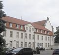 more pictures |
Liborianum | On the Capuchins 5-7 card |
1674 | May 29, 1984 | 46 |
|

|
Municipal music school | Gierswall 4 map |
May 29, 1984 | 47 |
||

|
Curia of the auxiliary bishop | Cathedral Square 12 map |
May 29, 1984 | 49 |
||
 more pictures |
Dalheimer Hof | Kamp 38 card |
Built by Johann Conrad Schlaun . Today the Archbishop's Palace. | 1718 | May 29, 1984 | 50 |
 more pictures |
Catholic University of North Rhine-Westphalia, Paderborn Department | Leostrasse 19 map |
5th July 1984 | 51 |
||

|
Pastoral Office | Kleiner Domplatz 11 map |
May 29, 1984 | 52 |
||
 more pictures |
New Dompropstei central building, bay window |
Domplatz 6 and 10 card |
May 29, 1984 | 53 |
||
 more pictures |
town hall | Rathausplatz 1 card |
It was built between 1613 and 1620 by Hermann Baumhauer as an outstanding example of the Weser Renaissance on behalf of Prince-Bishop Dietrich , including a previous building from 1473. | 1613-1620 | June 20, 1984 | 54 |
 more pictures |
Savings bank | Signs 5 card |
1716 | May 29, 1984 | 55 |
|
 more pictures |
City library former cathedral mechanics | Am Rothoborn 1 card |
built by Ambrosius von Oelde | 1676 | June 20, 1984 | 56 |
 more pictures |
Adam and Eve House | Hathumarstrasse 7 map |
one of the oldest half-timbered houses in Paderborn, housed the Museum of City History from 1977 to 2015 | around 1560 | June 20, 1984 | 57 |

|
Hathumarstrasse 9 map |
Former half-timbered house from the 17th century. Together with the Adam and Eve house, it forms an attractive assembly. | 17th century | June 20, 1984 | 58 |
|
 more pictures |
Theodorianum high school | Kamp 4 card |
1612-1614 | Nov 29, 1983 | 59 |
|

|
Residential building facade | Hermannstrasse 22 map |
May 8, 1991 | 61 |
||

|
Fürstenhof | Am Abdinghof 1 card |
The location of a canon curia since the middle of the 14th century. Renovated in the baroque style by Friedrich Christian von Fürstenberg from 1730–1735 . After secularization, the residence of the Fürstenberg-Herdringen family. After restoration (1949–1951) it was used again as a canon curia. | 1730-1735 | May 29, 1984 | 62 |

|
building | Am Stadelhof 10 card |
May 29, 1984 | 63 |
||

|
building | On the Capuchins 2 cards |
May 29, 1984 | 64 |
||

|
building | On the floorboards 2 cards |
May 29, 1984 | 65 |
||

|
Residential building facade | Hermannstrasse 24 map |
1908 | May 8, 1991 | 66 |
|

|
Residential building with a rear building | 8 cards on the floorboards |
Oct. 30, 1984 / June 27, 1997 |
67 |
||

|
Half-timbered gable house | 10 cards on the floorboards |
Oct 30, 1984 | 68 |
||

|
building | On the floorboards 12 card |
May 29, 1984 | 69 |
||

|
House / facade | Nordstrasse 10 map |
Apr 24, 1990 | 70 |
||

|
Residential building | On the floorboards 16 card |
June 14, 1984 | 71 |
||
 more pictures |
building | Bachstrasse 1 map |
Hotel Abdinghof, former brewery; Solid construction; late Gothic gable front with semicircular tops; Restored in 1954/1955. | 1563 | May 29, 1984 | 72 |

|
Half-timbered house (residential building) | On Stadelhof 10 / Baden Gasse 1-3 Map |
Aug 21, 1987 | 73 |
||
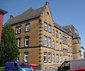 more pictures |
Residential building | Bahnhofstrasse 25 map |
Aug 21, 1987 | 74 |
||

|
Residential building | Bahnhofstrasse 27/27 a map |
31 Mar 1987 | 74 a |
||

|
Residential building | Hathumarstrasse 28 map |
Apr 24, 1990 | 75 |
||

|
building | Bus Village Wall 36 map |
May 29, 1984 | 76 |
||

|
Residential building | Bus Village Wall 34 map |
May 29, 1984 | 76 a |
||

|
building | Bus village wall 44 map |
July 9, 1984 | 77 |
||

|
Residential building | Detmolder Strasse 5 map |
Apr 11, 1985 | 78 |
||
 more pictures |
Facade and 2 gate pillars | Domplatz 18 map |
Classicist town house "Haus Schlechtendal" Original location was Westernstraße 26, built in 1798 from stones from the market church of St. Pankratius, which was demolished in 1784, destroyed except for the surrounding walls in 1945, demolished in 1956 for a new department store and rebuilt on Domplatz. |
1798 | June 28, 1984 | 79 |

|
Facade and roof of the building | Domplatz 26 map |
June 13, 1984 | 80 |
||
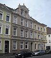
|
Building facade | Ferdinandstrasse 5 | May 29, 1984 | 81 |
||
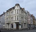
|
Facades and roof | Ferdinandstrasse 29 | May 29, 1984 | 82 |
||

|
House / facade | Florianstrasse 7 | May 29, 1984 | 83 |
||

|
Group of houses / facades | Franz-Egon-Strasse 12-18 | May 29, 1984 | 84 |
||

|
House / facade extension: building complete |
Fürstenweg 1 / Neuhäuser Strasse 48 |
May 29, 1984 Adult Sep 14 2007 |
85 |
||

|
Residential building facade | Fürstenweg 7 map |
May 29, 1984 | 86 |
||

|
Residential building facade | Fürstenweg 9 map |
May 29, 1984 | 87 |
||
 more pictures |
Half-timbered house | Giers wall 13–15 map |
Half-timbered houses | around 1730 | May 29, 1984 | 88 |

|
Residential building | Giersmauer 17 map |
May 29, 1984 | 89 |
||
 more pictures |
building | Giersmauer 27 map |
May 29, 1984 | 90 |
||

|
Building / gable front (external appearance) | Giers wall 31 map |
May 29, 1984 | 91 |
||

|
Residential building | Gierswall 24 map |
May 29, 1984 | 92 |
||

|
Gaukirchenkloster, facades and roof | Pit 1 card |
Built by Franz Christoph Nagel . Originally an elongated central building with two arched portals, flanked by two short side wings. Largely destroyed in 1949 and demolished in 1949 except for part of the west wing. | 1750 | May 29, 1984 | 93 |

|
Half-timbered house | Hathumarstrasse 1 map |
1728 | June 21, 1985 | 94 |
|

|
Residential and commercial building | Heiersstrasse 10 map |
5th July 1984 | 95 |
||

|
building | Heiersstrasse 12 map |
Ensemble with no. 12, 14: half-timbered buildings clad with slate with a crooked hip roof. | probably at the end of the 16th century | May 29, 1984 | 96 |

|
building | Heiersstrasse 14 map |
1619 | May 29, 1984 | 97 |
|

|
former post office | Kamp 22 card |
May 29, 1984 | 98 |
||

|
Buildings / plastered construction | Kilianstrasse 30 map |
May 29, 1984 | 99 |
||
 more pictures |
building | Kilianstrasse 32 map |
May 29, 1984 | 100 |
||

|
Half-timbered gable house | Krämerstrasse 8 | three-storey half-timbered gable house, the core building that was built around 1600 was renewed in 1726 | around 1600, renewed in 1726 | May 29, 1984 | 101 |

|
Half-timbered gable house | Krämerstrasse 10 | three-storey half-timbered gable house with a half-hip roof | 17th century | May 29, 1984 | 102 |

|
Building / half-timbered house | Crooked Pit 7 | Classicist half-timbered building with a mansard roof | 2nd half of the 18th century | June 13, 1984 | 103 |

|
Half-timbered semi-detached house | Laurentiusgasse 2-4 map |
June 14, 1984 | 104 |
||

|
Meyersche garden shed | Leostrasse 1 map |
17 Sep 1985 | 105 |
||

|
building | Leostrasse 25 map |
May 29, 1984 | 106 |
||

|
Residential building | Leostrasse 33 map |
Aug 6, 1984 | 107 |
||
 more pictures |
Heising's house | Marienplatz 2 | Weser Renaissance | June 20, 1984 | 108 |
|

|
Residential and commercial building | Marienplatz 2 a | 1928 | June 20, 1984 | 109 |
|

|
building | Markt 6 (former Cramersche Hofapotheke) map |
May 29, 1984 | 110 |
||

|
Building / residential and commercial building | Market 8 card |
Solid construction with a curved gable top | 1733 | May 29, 1984 | 111 |

|
Buildings / plastered construction | Market 10 card |
May 29, 1984 | 112 |
||
 more pictures |
Buildings, external facades and roof | Markt 14 (Gleseker House) map |
Late baroque gabled house with sandstone structure; rebuilt after being destroyed in the war in 1948/49 | 1723, 1779 expanded and rebuilt | June 13, 1984 | 113 |
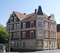
|
building | Neuhauser Strasse 22 map |
Nov 12, 1984 | 114 |
||

|
building | Neuhäuser Strasse 42 | May 29, 1984 | 115 |
||

|
Residential building | Neuhauser Strasse 50 map |
4th July 1984 | 116 |
||

|
Street facade | Neuhauser Strasse 68 c map |
June 10, 1985 | 117 |
||

|
Half-timbered gable house exterior facades in the street sides and roof | Paderberg 1 card |
Aug 20, 1984 | 118 |
||

|
Facade and roof | Rathausplatz 7 map |
built according to a design by Otto Engler for the textile department store Steinberg & Grünebaum , later "Haus Pötz", today a media center | 1909-1910 | June 13, 1984 | 119 |

|
Buildings / facades | Reumontstrasse 50 map |
May 29, 1984 | 120 |
||
 more pictures |
" Pest House " | Hospital wall 12 card |
Quarry stone construction | 1683/84 | May 29, 1984 | 121 Wikidata |

|
building | Tegelweg 13 map |
July 1, 1984 | 122 |
||

|
Duplex | Ükern 9–11 card |
Oct 17, 1984 | 123 |
||

|
Residential building | Ükern 10 card |
Nov 12, 1984 | 124 |
||

|
Agricultural bourgeoisie | Ükern 12 | July 6, 1984 | 125 |
||

|
Residential building facade | Ükern 13 card |
May 29, 1984 | 126 |
||

|
building | Weberberg 4 map |
Two-storey half-timbered eaves house with outside staircase | marked 1592 | 22 Sep 1980 | 127 |

|
building | Weberberg 6 card |
Half-timbered eaves house of a cobbler. Exemplary for a hall house of the less affluent middle class. | 1734 | May 29, 1984 | 128 |

|
Building / upper floors of the facade and roof | Westernstrasse 17 map |
May 29, 1984 | 129 |
||
 more pictures |
Stümpelsche Mühle weir system and mill wheel |
Hospital wall 27 card |
1810 | Aug 24, 1984 | 130 |
|

|
Liborius fountain | Corner of Kamp 20 / Liboristraße 1 map |
1894 | June 20, 1984 | 131 |
|
 more pictures |
Marian column with fountain | Marienplatz map |
Sculptor: Caspar von Zumbusch | 1861 | May 29, 1984 | 132 |

|
Luise Hensel memorial fountain | Liboriberg | by sculptor Rudolf Henn and architect Willy Erb (Munich), whose joint design emerged from a competition held in 1910 | June 20, 1984 | 133 |
|
| Fountain remnants | Michaelstrasse 1–3 | May 29, 1984 | 134 |
|||

|
Fountain | in the garden at Michaelstrasse 17 | May 29, 1984 | 135 |
||
 more pictures |
Fountain | Town hall square map |
June 20, 1984 | 136 |
||

|
Star monument | Liboriberg | June 20, 1984 | 137 |
||

|
Garden shed | Am Ikenberg 2 map |
May 29, 1984 | 138 |
||

|
Luise Hensel summer house | Corner of Luise-Hensel-Strasse / Driburger Strasse / Benhauser Strasse Map |
1742 | June 20, 1984 | 139 |
|

|
Fürstenberg tomb | Westfriedhof / Riemekestrasse 130 map |
1916 | June 20, 1984 | 140 |
|
 more pictures |
milestone | Near Almebrücke / Salzkottener Straße map |
Nov 6, 1986 | 141 |
||

|
portal | Am Busdorf 6–8 card |
1587 | June 13, 1984 | 142 |
|

|
Portal, outer walls and vaulted cellar | Giersstrasse 1–3 | May 29, 1984 | 143 |
||

|
Portal / baroque | Rathausplatz 9 (courtyard) | May 29, 1984 | 144 |
||

|
portal | Liboristraße 1–3 / Kamp 20 map |
Portal of the "Zucht- und Fabrikenhaus" / judicial prison at the intersection of Marienstrasse and Königstrasse (destroyed in 1945, today C&A) | 1739 | June 19, 1984 | 145 |

|
Portal / Renaissance | Kleiner Domplatz 15 map |
May 29, 1984 | 146 |
||

|
portal | Krumme Grube 3 / Gaukirchweg map |
1752 | May 29, 1984 | 147 |
|

|
2 portals | Liboristraße 8 / Jesuit wall map |
1699 | May 29, 1984 | 148 |
|

|
portal | Market 5 card |
May 29, 1984 | 149 |
||

|
Portal, back entrance | Return entrance to Rathausplatz 9 | 1731 | May 29, 1984 | 150 |
|

|
Source mount | Am Ikenberg / Am Rothoborn map |
June 20, 1984 | 152 |
||

|
Relief plate | Am Abdinghof 2 card |
May 29, 1984 | 153 |
||

|
relief | Domplatz 28 map |
1691 | May 29, 1984 | 154 |
|

|
Pillar fragment of the former Rome Chapel | Bahnhofstrasse (opposite No. 92) | 1605 | June 20, 1984 | 155 |
|
 more pictures |
lintel |
Am Haxthausenhof map |
Lintel with chronogram and coat of arms of the Kersting and Hoffmann families | 1714 | June 20, 1984 | 156 |
| Spolia | At the Ikenberg | May 29, 1984 | 157 |
|||
|
|
Spoilage | On the Capuchins 5 (in the north wall) card |
four-part sandstone with Latin inscription and chronogram | 1704 | May 29, 1984 | 158 |

|
Archway spoil | Corner of Benhauser Strasse / Luise-Hensel-Strasse map |
June 20, 1984 | 159 |
||

|
Spolia / fountain | Cathedral Square 6 | May 29, 1984 | 160 |
||

|
Wall Poland | Dompropsteigasse map |
May 29, 1984 | 161 |
||

|
Spolia | Gaukirchweg 1 / Domplatz map |
May 29, 1984 | 162 |
||

|
Spolia | in the Jesuit wall of Liboristraße 8 map |
July 30, 1984 | 163 |
||
 more pictures |
Spolia and portal / coat of arms stones / window frames | Kassel Wall 5 map |
May 29, 1984 | 164 |
||

|
Falling stone | Kleiner Domplatz 15 map |
1691 | May 29, 1984 | 165 |
|

|
Spoilage | Laurentiusgasse 8 map |
June 13, 1984 | 166 |
||

|
Spolia | Liboristraße 8 map |
May 29, 1984 | 167 |
||

|
Old archway and window frames | Am Haxthausenhof 6 card |
1672 | June 20, 1984 | 168 |
|

|
2 gate pillars | Corner of Kisau / Neuhäuser Tor / Spitalmauer map |
June 20, 1984 | 169 |
||

|
Staircase (in the garden of the monastery) | Michaelstrasse 17-19 | May 29, 1984 | 170 |
||

|
Door framing | Am Abdinghof 2 card |
1717 | May 29, 1984 | 171 |
|

|
Wappenstein (cartridge) | Am Haxthausenhof 6 card |
Alliance coat of arms of the prince-bishop's court advisor Simon Hilmar von Haxthausen († 1717) and his wife Sofie Elisabeth von Woff-Metternich († 1720) | early 18th century | June 20, 1984 | 172 |

|
Coat of arms stone | Western Wall 9 / Bolton-Wall map |
Coat of arms stone of Prince-Bishop Ferdinand von Fürstenberg | between 1668 and 1678 | June 20, 1984 | 173 |

|
office building | Tegelweg 25 map |
Administration building of PESAG | 1928-1931 | Apr 3, 1985 | 288 |

|
Car hall | Rolandsweg 111 (Tegelweg) map |
Former PESAG tram depot | 1909–1910? | Apr 2, 1985 | 289 |
 more pictures |
Spolia | Giersmauer 13 (in the courtyard) map |
Window of the Laurentius Chapel | Late 12th century | Aug 3, 1984 | 290 |
| Spolia | Liboristraße 8 (in the garden) map |
Aug 3, 1984 | 291 |
|||

|
Abdinghof cloister | Am Abdinghof 11 map |
June 20, 1984 | 294 |
||

|
Residential building | Driburger Strasse 30 map |
Nov 7, 1984 | 299 |
||

|
Half-timbered house | Heiersmauer 1 card |
Aug 6, 1984 | 303 |
||

|
Half-timbered eaves house | Hathumarstrasse 3 map |
June 21, 1985 | 311 |
||

|
Residential and commercial building | Detmolder Strasse 31 map |
with a figure of Hermann on the roof | 1909 | Aug 14, 1986 | 312 |

|
building | Riemekestrasse 19 map |
Nov 6, 1986 | 313 |
||

|
building | Riemekestrasse 21 map |
Nov 6, 1986 | 314 |
||

|
Cast iron pillars, main train station | Bahnhofstrasse | Feb 3, 1988 | 323 |
||

|
Wayside shrine | Husener Straße (near house number 200) map |
This baroque wayside shrine made of sandstone shows a female saint in the lower area and a relief of the crown of thorns in the upper area. Inscriptions: H. Bade on the right in the upper part, M. Koprian on the right in the base. On the former pilgrimage route "Hillige Seele" it is the second surviving wayside shrine towards the chapel to the Hillige Seele . | 1697 | 15th Mar 1988 | 323 a |

|
Barracks | Corner of Elsener Strasse 1–3 / Giefersstrasse map |
4th July 1988 | 325 |
||

|
Facade with roof structure | Ferdinandstrasse 21 | 1898 | Oct 17, 1988 | 326 |
|

|
Street facade / roof structure | Riemekestrasse 15 map |
March 8 1988 | 328 |
||

|
building | Riemekestrasse 54 map |
Jan. 21, 1992 | 333 |
||

|
building | Person street 42 map |
Jan. 21, 1992 | 333 a |
||

|
building | Person road 44 card |
Jan. 21, 1992 | 333 b |
||

|
building | Person road 46 map |
Jan. 21, 1992 | 333 c |
||

|
building | Person road 48 card |
Jan. 21, 1992 | 333 d |
||

|
building | Riemekestraße 56 Personstraße 41 map |
Jan. 21, 1992 | 334 334 a |
||

|
building | Personstrasse 43-45 map |
Jan. 21, 1992 | 334 b, c |
||

|
building | Personstrasse 47–51 map |
Jan. 21, 1992 | 334 d, e, f |
||

|
Alanbrooke Barracks | Elsener Strasse 5 map |
1898-1904 | December 3, 1992 | 340 |
|

|
Residential building | Neuhauser Strasse 72 map |
9 Mar 1994 | 341 |
||

|
Residential building | Le Mans Wall 15 map |
Two-storey, late classicist house | around 1880 | June 2, 1997 | 343 |
| Vaulted cellar | Signs 12 | June 2, 1997 | 344 |
|||
| Vaulted cellar | Rathausplatz 14 | July 9, 1998 | 345 |
|||

|
Immunity wall / Abdinghof monastery | At the Abdinghof card |
May 11, 1999 | 346 |
||
| barrel vaulted cellar | Pit 6 | Apr 25, 2000 | 347 |
|||

|
Field cross |
? |
1793 | 8 Sep 2000 | 348 |
|

|
Residential building | Neuhauser Strasse 132 map |
Detached, villa-like residential building | 1927 | July 23, 2001 | 349 |

|
Wappenstein (alliance coat of arms) | Marienplatz 2 map |
House brands of the married couple Conradus Glehen (mayor and wine merchant) and Margarete Vossla | 1673 | Jan. 24, 2002 | 350 |
 more pictures |
Residential house, workshop building, enclosing walls | Am Stadelhof 8 card |
Former carpentry (until 1952) | Residential building 1851 Workshop around 1860/70 |
Apr 15, 2002 | 352 |
 more pictures |
|
Stadtmuseum Galerie am Abdinghof (from 2017) Map |
Enclosing walls / cellar facilities broken off | Portal 1607 |
June 3, 2004 Partial deletion May 28, 2008 |
353 |

|
Justice building | On arch 2-4 card |
Aug 14, 2003 | 354 |
||

|
Semi-detached villa a) Einhardstrasse 3 b) Einhardstrasse 5 |
Einhardstrasse 3–5 map |
a) May 4, 2006 b) Jan. 24, 2006
|
356 |
||

|
Basement and foundations | At the Haxthausenhof 6–8 card |
early 17th century | Jan. 10, 2007 | 358 |
|

|
Paderquell area green area | between Bachstrasse / Am Damm / Mühlenstrasse / An der Wasserkunst / A. d. warm pader |
Nov 19, 2008 | 359 |
||

|
Residential building | Am Stadelhof 4 card |
July 22, 2010 | 361 |
||
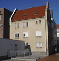
|
Residential building | Westernstrasse 11 map |
Sep 11 2014 | |||

|
Residential building | Giersstrasse 13/15 map |
1960 | Oct 26, 2016 | ||

|
Signal box | Detmolder Strasse 35 map |
Feb 13, 2017 | 365 |
||

|
Franz-Stock-Platz and Gutenbergstrasse | Franz-Stock-Platz, Gutenbergstrasse map |
June 13, 2017 | |||

|
Residential building | Rathenaustraße 41/43 map |
1930 | June 13, 2017 | ||

|
Residential and commercial building | Pit 13/15 card |
1958/59 | Feb 13, 2017 | ||

|
Residential building | Neuhauser Strasse 85 map |
1926 | Nov 28, 2017 | ||

|
historical organ of the cath. Parish Church of St. George | Neuhauser Strasse 78a map |
Instrument originally made by Friedrich Bernhard Meyer for the Busdorf Church | Late 19th century | 16th July 2018 | 373 |

|
Duplex house | Fürstenweg 34 and 34a map |
1951-1952 | 13 Aug 2018 | 374 |
Individual evidence
- ↑ a b c d e f Gerhard Liedtke: wayside shrines and crosses in Paderborn. Published by Heimatverein Paderborn eV H&S Verlag, Paderborn 1993, ISBN 3-92 95 07-01-3 .
- ^ Albert Ludorff: The architectural and art monuments of the Paderborn district. Münster 1899, p. 116 ( Paderborn University Library )
- ↑ erzbistum-paderborn.de: House of Dommusik inaugurated
- ↑ A piece of Paderborn's city history under the half-timbered house ( Memento from August 15, 2013 in the web archive archive.today )
- ↑ zeitreise-paderborn.de: Königstrasse / Königsplatz
- ↑ Administration building PESAG Paderborn at www.baukunst-nrw.de , accessed on February 18, 2020
- ↑ Resolution 0180/15 from June 11, 2015
- ↑ Procedure 0122/01 ( page no longer available , search in web archives ) Info: The link was automatically marked as defective. Please check the link according to the instructions and then remove this notice. in the council information system of the city of Paderborn
- ^ Volksbank Paderborn-Höxter-Detmold: Renaissance portal from Kötterhagen finds a new home
- ↑ Process 0157/08: Resolution on the granting of permission to demolish the architectural monument "Enclosing walls, cellar systems" in Kötterhagen 10 while maintaining the Renaissance portal and the partial deletion of the monument from the list of monuments in accordance with § 3 DSchG NW. ( Page no longer available , search in web archives ) Info: The link was automatically marked as defective. Please check the link according to the instructions and then remove this notice.
- ↑ Process 0239/14: Resolution on the entry of the monument Westernstraße 11 ( page no longer available , search in web archives ) Info: The link was automatically marked as defective. Please check the link according to the instructions and then remove this notice.
- ↑ Process 0286/16: Registration of the residential building Giersstraße 13/15 as a monument ( page no longer available , search in web archives ) Info: The link was automatically marked as defective. Please check the link according to the instructions and then remove this notice.
- ↑ a b Minutes of the meeting of the culture committee on April 26, 2017
- ↑ a b Meeting of the Culture Committee on June 13, 2017 ( page no longer available , search in web archives ) Info: The link was automatically marked as defective. Please check the link according to the instructions and then remove this notice.
- ↑ Meeting of the Culture Committee on November 28, 2017
- ↑ the Council of the City of Paderborn process 0260/18
- ↑ the Council of the City of Paderborn process 0259/18
Web links
Commons : Architectural monuments in Paderborn - collection of images, videos and audio files

