List of cultural monuments in Freudenberg (Baden)
The list of cultural monuments in Freudenberg includes immovable architectural and art monuments from all parts of Freudenberg . The basis for this list is the list of architectural and art monuments published by the Stuttgart Regional Council as of February 15, 2012. The article is part of the higher-level list of cultural monuments in the Main-Tauber district . This list is not legally binding. Legally binding information is only available on request from the Lower Monument Protection Authority of Freudenberg.
Small monuments such as wayside shrines, statues and wayside crosses have been preserved in large numbers in the city area. The reason lies in the agricultural structure that has existed since the Middle Ages. In modern times there was no densification of settlement and industry as in the metropolitan areas, so that these cultural monuments were largely preserved in the open air .
Architectural, art and cultural monuments in the Freudenberg district
Freudenberg
Architectural, art and cultural monuments in Freudenberg (with the city of Freudenberg and the Laukenhof residential area):
Complete Freudenberg facility
For the entire Freudenberg complex there is a monument conservation value plan dated February 11, 2008, from which the description of the cultural monuments was taken:
![]() Map with all coordinates of the cultural monuments of the "Entire Freudenberg facility": OSM
Map with all coordinates of the cultural monuments of the "Entire Freudenberg facility": OSM
| image | designation | location | Dating | description |
|---|---|---|---|---|
 |
Entire facility in Freudenberg / Main | (Map) | The town of Freudenberg is a former castle settlement with a well-preserved building stock from the 16th to 19th centuries. Century, almost completely preserved historical city plan and a largely preserved city wall. Protected according to § 19 DSchG
|
|
 |
City wall, side wall, ice or flood wall | Flst no. 131, 136, 140, 141, 275, 306-308), Hauptstr., Heidelg. 3 (Flstnr. 111), Mainstrasse (Flstnr. 541 / 635,3532), Ziegelg (FN 535–542, 544/4) (map) |
City fortifications with remains of the Zwinger walls, side walls (see also "Castle ruins") and ice or flood walls; the side walls that pull down from the castle ruins are free-standing, the city wall is largely integrated into buildings; 13-16 Century, up to the 19th century partially demolished or in the 20th century - with the exception of the suburb - partially rebuilt; in the north and south of the banks of the Main in the 18th century, ice and flood walls were erected (southern wall with Marian column). Protected according to §§ 2/28 (totality) DSchG
|
|
 More pictures |
Castle ruins / castle and side walls | Flst no. 131, 136, 140, 141, 275, 306–308 (map) |
Medieval castle ruins with fortification walls and forecourt; Erected in 1195, 1361 and 1499, the side walls leading down to the city at the end of the 13th century; Plant probably destroyed in the Markgräflerkrieg in 1552 and has only been poorly repaired since then; In addition to the main access route (so-called "bowling alley"), the green areas around the Schlossberg are worth preserving as a historical field of fire that was previously kept clear of forest. Protected according to §§ 28 (aggregate) DSchG
|
Burgweg: Old connecting route between the medieval core town and the eponymous castle; in the lower section S-shaped course, rising steeply to the north from the height of the town hall, from the height of Burgweg 7 running straight and steadily rising over the castle slope; the buildings in the Hauptstrasse area are representative, with the town hall (from 1499) and the former administrative building (1627), the courtyard is closed off by a round arched portal and a sandstone wall running parallel to the castle path, the rest of the buildings are smaller and consist of mainly gable-side residential buildings built over high sloping floors - and farm buildings (15th – 19th centuries); An exception is Burgweg 5, with its broad structure and a distinctive, widely visible gable roof.
| image | designation | location | Dating | description |
|---|---|---|---|---|
 More pictures |
Former administrative building (today an inn, police, museum) | Burgweg 1 (Flstnr. 277) (map) |
1627 | Three-storey, broad and largely plastered solid construction with large vaulted cellars, simple symmetrical facade design with dividing elements made of sandstone, the two richly sculpted sandstone portals each with a split gable and two-flight staircase in front, two-storey saddle roof with dormers; Building rel. 1627, various renovation measures between 1977 and 2003 (1983 redesign of the staircase and establishment of a restaurant, 2003 including installation of administration rooms, cellar expansion). The city has been running the Amtshausgalerie in the foyer of the Amtshaus since 1987. Protected according to §§ 28 (building) DSchG
|
 More pictures |
Residential building | Burgweg 3 (Flstnr. 278) (map) |
Two-storey half-timbered building above a high, plastered solid base with a round cellar arch, gable roof; the cantilevered upper floor with ornamental half-timbering from the 17th century, the rest of the half-timbered structure in large parts of a more recent date, external staircase to the elevated main floor, carved door leaf, colored statue of the Virgin on the gable side; Building rel. 1612, 1997 framework renovation. Protected according to §§ 28 (building) DSchG
|
|
 More pictures |
Cellar arch | Burgweg 8 (Flstnr. 263) (map) |
Cellar arch on the slope of a residential building worth preserving, re. "160."?; the two-storey residential building above, which is worth preserving, probably partly solid or half-timbered, plastered, gable roof; Greatly changed in the 20th century, older in essence. Protected according to §§ 2 (component) DSchG
|
|
 More pictures |
Residential building | Burgweg 10 (Flstnr. 269) | Single-storey residential building with a pitched roof built over two floors; the floors on the slope are solid, plastered, the rest of the building in exposed framework from the 15th / 16th centuries. Erected in the 20th century, clad in the 20th century, pointed arch stone walls (cellar arch), referenced in 1408; 2002 Renewal of the windows and new construction of the balcony. Together with Burgweg 6 and 8, the small building not far from the town hall forms an assembly group. Protected according to §§ 2 (building) DSchG
|
Erbsengasse: Narrow alley branching off from the main street and steadily rising towards the east within the suburb, which was laid out in the 16th century, the name Erbsengasse was already listed in the 1898 district atlas; One to two-storey buildings with residential and farm buildings alongside the street, built on sloping floors, including a cultural monument from the 16th century, the rest of the buildings dating from the 18th and 20th centuries. Century partly heavily reshaped.
| image | designation | location | Dating | description |
|---|---|---|---|---|
 More pictures |
Residential building | Erbsengasse 4 (Flstnr. 400) (map) |
Two-storey building with a massive hillside and first residential storey as well as half-timbered upper storey, partly plastered, gable roof; elevated access towards the main street with round arched, stepped stone walls with niches, coupled windows, diamond corner blocks, half-timbering with profiled thresholds and man figures; Portal walls re. 1604, 2005 interior modifications. Protected according to §§ 28 (building) DSchG
|
Fassgasse: Short connecting street running between Hauptstrasse and Mainstrasse within the suburbs laid out from the 16th century onwards, widened in a funnel shape towards Mainstrasse and Hauptstrasse, opening into Haaggasse in its eastern extension; the name Fassgasse was already listed in the 1898 district atlas; One to two-storey buildings built on sloping floors with residential and farm buildings predominantly from the 18th to 20th centuries. Century, including a cultural monument.
| image | designation | location | Dating | description |
|---|---|---|---|---|
 |
Residential building | Fassgasse 8 (Flstnr. 463) (map) |
Two-storey house built on a massive slope, the upper storey probably also massive, plastered, profiled stone window and door frames with cartouches and coats of arms, profiled eaves cornice, half-hipped roof; Building rel. 1793. Protected according to §§ 2 (buildings) DSchG
|
Haaggasse: An access lane running almost parallel to the north side wall, branching off from the main street in two arms in an easterly direction within the suburb, which was laid out from the 16th century, widened like a square up to level no. 7, then gradually narrowing; the name was already mentioned in the district atlas of 1898 and can probably be traced back to "hedge" in the sense of "border"; One to three-storey buildings from the 18th to 20th centuries built on sloping floors Century, partly above older cellars, the southern side formed by a regular, closed and eaves-standing row of buildings, the northern, probably older side, on the other hand, built more loosely and irregularly.
| image | designation | location | Dating | description |
|---|---|---|---|---|
 More pictures |
Residential building | Haaggasse 1 (Flstnr. 343/344) (map) |
Three-storey, plastered half-timbered building above a high, massive slope floor, simple, plastered facade with profiled thresholds (gable side), flat sloping gable roof; 17./18. Century, in the second half of the 20th century a terrace and wooden balcony were built facing Haaggasse.
|
|
 More pictures |
Cellar arch | Haaggasse 7 (Flstnr. 341) (map) |
Round arches made of sandstone at the basement entrance of a residential building; Garments re. 1546. Protected according to §§ 2 (component) DSchG
|
|
 More pictures |
Residential building | Haaggasse 23 (Flstnr. 318) (map) |
Three-storey half-timbered building with a gable roof built on an approximately square floor plan; between the first and second floors profiled thresholds and half-timbered figure “Wilder Mann”; on the stand re. 1720, at that time the existing building was extended (?) And redesigned. Protected according to §§ 2 (building) DSchG
|
Hallengasse: Short, parallel to the main street and the city wall, the connecting street between Staudengasse and main street within the medieval core city; the eastern side is formed by the rear of the two-storey, gable-end main street buildings, the western side consists of a closed, eaves, two-storey row of buildings built over the city wall from the 18th and 19th centuries. Century (partly over an older core).
Hauptstraße (No. 63–121 odd, 32–154 even), "core city": Historical main connection path through the medieval core city, connected to the supra-regional traffic and running parallel to the Main and the castle hill, with small to very small lanes branching off at regular intervals with two Gates fixed ("lower" and "outer" later "middle gate"); Baroque reorganization at the height of the town hall in the course of the new building of the office building and parish church (eaves!) and thus the formation of a “city center”. The rest of the street scene consists of a closed, predominantly two-storey row of residential buildings from the 15th to 20th centuries with gable ends. Centuries, including a large number of cultural monuments and high-quality, well-preserved buildings from the 16th / 17th centuries. Century (!)
| image | designation | location | Dating | description |
|---|---|---|---|---|
 More pictures |
crucifix | Hauptstrasse 32 (map) |
Red sandstone, re. 1863, in front of the residential building at Hauptstrasse 32. This is not the original location. The crucifix was only moved here after the building that was originally located at this point was demolished. The crucifix belongs to the series of small monuments erected in large numbers along the main street or attached to facades. Protected according to §§ 2 (small monument) DSchG
|
|
 More pictures |
Residential building | Hauptstrasse 42 (Flstnr. 163) (map) |
Two-storey residential building with a solid, plastered ground floor, the upper storey including the gable with storey-high half-timbered figures, profiled thresholds, saddle roof; basement portal worth preserving on the rear annex building, year not legible; the main building 16./17. Century. The main and ancillary buildings extend on a narrow, deep plot. They are arranged one behind the other in the manner of a stretch farm. Protected according to §§ 28 (building) DSchG
|
|
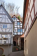 More pictures |
Basement house | Hauptstrasse 44 (Flstnr. 163) (map) |
Single-storey building erected above a high hillside or basement, the hillside solid made of red sandstone, the upper floor and the gable in constructive half-timbered construction, gable roof; the sloping floor on the cellar arch 1534, the half-timbered construction probably from the late 19th / early 20th century, in 1992 it was converted into a residential building. Protected according to §§ 2 (building) DSchG
|
|
 More pictures |
Sculpture group | Hauptstrasse 50 (Flstnr. 163) (map) |
Colored sculptural group “St. Family ”on the facade; probably 18th century; the two-storey residential building, well worth preserving, with a solid, plastered ground floor and half-timbered upper storey with wide swelling timbers, with decorative framework in the gable; Buildings in the core 16./17. Century, in the 19th and 20th centuries, however, changed considerably in some cases (half-timbered renovation on the 1st floor, loft conversion with dormer, redesign of the ground floor and expansion by an axis towards the south, including the creation of a terrace). Protected according to §§ 2 (small monument) DSchG
|
|
 More pictures |
Sculpture of “St. Nepomuk " | Hauptstrasse 52 (map) |
made of red sandstone at the corner of the building; Console re. 1747; the two-storey residential building, well worth preserving, with a massive ground floor and half-timbered upper storey, plastered, saddle roof; Buildings in the core possibly 17./18. Century, changed in the 20th century (facade, windows, ground floor, etc.). Protected according to §§ 2 (small monument) DSchG
|
|
 More pictures |
Mary sculpture | Hauptstrasse 60 (map) |
Colored sculpture of Our Lady on the main facade of a residential building; 18th century; the building is worth preserving with massive ground floor and half-timbered upper floor, plastered, gable roof; The core of the building was probably 18th century with subsequent changes (facade, windows, ground floor, roof extension with dormers, etc.). Protected according to §§ 2 (small monument) DSchG
|
|
 More pictures |
Residential building | Hauptstrasse 75 (map) |
Two-storey residential building with solid, plastered ground floor and half-timbered upper floor, gable roof; on the side facade on the ground floor pointed arch portal walls, upper floor and gable with profiled thresholds, rich ornamental framework and carved corner posts; 16th century, in the 20th century shop fitting a. a. The residential building is part of the western row of buildings on Hauptstrasse with its largely closed, gable-end, two-story development. Protected according to §§ 2 (building) DSchG
|
|
 More pictures |
Residential building | Hauptstrasse 77 (map) |
Two-storey residential building with solid, plastered ground floor and half-timbered upper floor, gable roof; Upper floor and gable with profiled thresholds and rich ornamental framework; 16./17. Century, mid-20th century shop fitting. The residential building is part of the western row of buildings on Hauptstrasse with its largely closed, gable-end, two-story development. Protected according to §§ 2 (building) DSchG
|
|
 More pictures |
Residential building | Hauptstrasse 87 (map) |
L-shaped building; the solid construction in red sandstone with half-timbered gable and mansard roof, oriented towards the main street on the gable side, simple late baroque facade design; late 18th century; the wing facing the city wall is also two-story, presumably massive, plastered, gable roof; 19th century. The house moves away from the building line of the main street. The western city wall also forms its outer wall. Protected according to §§ test case DSchG
|
|
| More pictures | Basement house | Hauptstrasse 92 (map) |
Two-storey, plastered half-timbered building over a basement built into the slope with two cellar gates, one of which is 1561, gable roof; 17./18. Century with later changes (facade, windows, etc.). Protected according to §§ 2 (building) DSchG
|
|
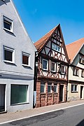 More pictures |
Residential building | Hauptstrasse 93 (Flstnr. 66) (map) |
Two-storey residential building with a solid ground floor made of red sandstone with classicist facade decor, the first floor and the gable with 17th century ornamental frameworks, saddle roof; the ground floor re. 1795, 1981 repair work, 2002 interior renovation including the installation of stairs, renewal of the windows, reshaping of the west gable; Colored sculpture of St. Joseph on the main facade (worth preserving). Protected according to §§ 28 (building) DSchG
|
|
 More pictures |
Residential building | Hauptstraße 95 (Flstnr. 63/64) (map) |
Two-storey double dwelling house with solid ground floor and half-timbered upper floor, plastered, gable roof; profiled thresholds and profiled window frames; 16./17. Century, remodeled in the 20th century (facade, window) or the rear part of the building adjacent to the western city wall was removed. Protected according to §§ 28 (building) DSchG
|
|
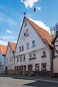 More pictures |
Residential building | Hauptstrasse 96/98 (map) |
Two-storey double dwelling house with solid ground floor and half-timbered upper floor, plastered, gable roof; gable end and two elevator hatches; 16./17. Century, 2007 renewal of the windows and the house entrance. Protected according to §§ 2 (building) DSchG
|
|
 More pictures |
Residential building | Hauptstrasse 99 (map) |
Two-storey, presumably massive, plastered house with mansard hipped roof, drilled window frames and base cornice in red sandstone on the ground floor; 18th century, modern changes in the 20th century (roof extension, facade, windows, etc.). Protected according to §§ 2 (building) DSchG
|
|
| portal | Hauptstrasse 100 (map) |
Drilled portal made of sandstone (cultural monument), 18th century; the two-storey residential building above a high base with a solid ground floor and half-timbered upper floor, plastered, gable roof, 18th century with later remodeling, 2005 renewal of the windows; The associated rear annex is also, presumably a basement house (difficult to see). Protected according to §§ 2 (component) DSchG
|
||
 More pictures |
Gasthaus (formerly "Zur Güldenen Rose" and "Ritter") | Hauptstraße 105 (Flstnr. 9) (map) |
Three-storey building with a solid ground floor and half-timbered upper storeys with wall-high decorative elements, crooked hip roof, on the ground floor window and door cladding made of sandstone: next to the arched passage portal to Hallengasse, three-part window group with late renaissance cladding with profiled bars, then richly designed main portal with ironwork, decorated arched window; the main portal re. 1675. The building was rebuilt in 1675 as the “Zur Güldenen Rose” inn, instead of the “Ritter” inn, which was once the most important inn in Freudenberg, which was largely abandoned during the Thirty Years War. Protected according to §§ 28 (building) DSchG
|
|
 More pictures |
Residential building | Hauptstrasse 120 (Flstnr. 231) (map) |
Two-story residential building with a solid, plastered ground floor and half-timbered upper floor, profiled thresholds and carved corner posts, 17th / 18th centuries. Century. Together with its neighboring building, Hauptstrasse 122, the building forms a subassembly. Protected according to §§ 2 (building) DSchG
|
|
 More pictures |
Residential building | Hauptstrasse 122 (Flstnr. 232) (map) |
Two-story residential building with a solid, plastered ground floor and half-timbered upper floor, profiled thresholds and carved corner posts; 18th century with modern changes. The building, together with its neighboring building, Hauptstrasse 120, forms an assembly. Protected according to §§ 2 (building) DSchG
|
|
 More pictures |
House and basement house | Hauptstraße 134, 132 (Flstnr. 234) (map) |
Single-storey residential building with massive ground floor and half-timbered upper floor with projections, plastered, gable roof; 17./18. Century with later remodeling (facade, window, etc.)
the associated basement house with a massive sloping and half-timbered upper floor, the cellar arch 1609, the upper floor 18./19. Century with infills made of brick, 1990 replacement of the windows. The residential and cellar house are arranged one behind the other, but offset, so that the gable facade of the cellar house is visible from the main street.
|
|
 More pictures |
Residential house with Immaculata | Hauptstrasse 138 (Flstnr. 237) (map) |
Two-storey residential building with solid, plastered ground floor and half-timbered upper floor with rich ornamental framework and wall-high struts, profiled thresholds and carved corner posts, gable roof; Building 16./17. Century, the ground floor rebuilt in the second half of the 20th century, 1993 roof extension; on the facade sculpture of Immaculata made of sandstone, ins. 1747 Protected according to §§ 28 (building) DSchG
|
|
 More pictures |
Residential building | Hauptstrasse 140 (Flstnr. 238) (map) |
Two-storey building above a high, solid sloping floor, with the exception of the gable plastered, gable roof, thresholds profiled on the gable side, drilled sandstone portal with skylight and coat of arms at the elevated main entrance; 18th century, 2001 interior and exterior renovation. The building is part of the second row above the parish church, built into the hillside gable-side building row. Protected according to §§ 2 (building) DSchG
|
|
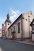 More pictures |
Former parish church of St. Laurentius, so-called Alte Laurentiuskirche | Hauptstrasse 150 (Flstnr. 255) (map) |
1691-1692 | Flat-roofed hall building with a tower on the side, exterior structure designed with pilasters and rich baroque portal and window walls; rich interior decoration; Erected in 1692 on the site of a small chapel, structural remains of the same are said to have been integrated into the choir and tower. The high-quality baroque church building, as part of the town hall and old office building group and due to its size and eaves, is an urban dominant feature within the small-scale old town. Protected according to §§ 28 (buildings) DSchG
|
 More pictures |
town hall | Hauptstrasse 152 (Flstnr. 256) (map) |
1499-1629 | Two-storey half-timbered building built over a high slope, the ground floor partly massive, multi-storey saddle roof with dormers and turrets; rich ornamental half-timbered facade with projections; Begun in 1499, expanded in the direction of Burgberg in 1605, including the creation of the magnificent side portal (ref. 1605), in 1907 the two-storey extension to the rear (formerly a school), renewed expansion in 1999. The town hall and its extensions extend over a long, narrow plot of land. As primus inter pares in the main street with an elevated location, rich gable facade and high attic roof, it impressively marks the city center together with the former office building and the old parish church. Protected according to §§ 28 (building) DSchG
|
 More pictures |
Residential building | Hauptstrasse 154 (Flstnr. 279) (map) |
Two-storey residential building with a solid, plastered ground floor and half-timbered upper storeys with wall-high decorative elements; re. 1667, in the 20th century a shop was built and a gable-sided terrace was built, in 2006 probably the roof structure was renewed and the facade was renovated; on the ground floor, on the south side facing the office building, walled-in inscription stone with the year 1534. The house stands at the branch of the Burgweg, at the northern end of the medieval core town. Protected according to §§ 28 (building) DSchG
|
Hauptstrasse (No. 123–165 odd, 156–226 even), “Vorstadt”: Historic main connection route through the early modern suburbs, connected to the supra-regional traffic and running parallel to the Main and the Burgberg, branching off small to very small alleys at regular intervals, probably in the 18th century the Sternplatz was laid out; Road once fortified with two gates ("Middle Gate" and "Outer Gate"); the streetscape of a closed, two- to three-story, eaves or gable-facing row of buildings from the 16th to 20th centuries. Century (the northern entrance to the city characterized by a distinctive, gable-facing group of buildings (No. 218, 220, 222)).
| image | designation | location | Dating | description |
|---|---|---|---|---|
 |
Coronation relief | Hauptstraße 129 (Flstnr. 428, formerly Sternplatz 7) (map) |
Coronation relief made of sandstone, partly gilded; 18th century. The relief was previously attached to the facade of the building at Hauptstrasse 82. It is one of the series of small monuments erected in large numbers along the main street or attached to facades
|
|
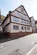
| Former synagogue (now residential building) | Hauptstrasse 139 (map) |
Three-storey building made of solid sandstone and brick with a gently sloping, hipped roof on one side, bevelled, narrow windows extending over two storeys with a recessed, round-arched end; Erected in 1891 and profaned around 1908. The building combined the prayer room, the teacher's apartment, the community room and the ritual immersion bath for women (mikveh) under one roof. The Jewish community comprised 81 people around 1864, 35 around 1900 and 13 in 1935. Persecution and murder of Jews during the Nazi era resulted in the death of at least 13 of the 15 Jewish people who lived in Freudenberg in 1933. A memorial plaque to the victims of National Socialism is located in Zollgasse. Protected according to §§ 2 (building) DSchG
|
||
 More pictures |
Residential building | Hauptstrasse 166 (Flstnr. 345) (map) |
Two-storey residential building with a massive basement and ground floor as well as a half-timbered upper storey, largely plastered, hipped roof, gable-sided approach and profiled thresholds, lift hatches in the gable triangle, a sandstone Madonna sculpture on the southern corner of the building, carved corner posts on the northern corner of the building; 17th century with changes from the 20th century (facade, windows, construction of a southern extension with terrace; roof extension with dormers 2001). Protected according to §§ 28 (building) DSchG
|
|
 More pictures |
Basement house | Hauptstrasse 182 (Flstnr. 383) (map) |
Building with a massive sloping floor, the upper floor and gable with rich ornamental framework, saddle roof; Cellar arch re. 1598. The building is in the second row of the main street, as it is clearly visible from this street, unlike many other cellar houses, it has a rich decorative facade. Protected according to §§ 2 (building) DSchG
|
|
 More pictures |
Gasthaus (formerly residential building) | Hauptstrasse 188 (Flstnr. 390/1) (map) |
Two-storey building with a solid, plastered ground floor and half-timbered upper storey with partly rich ornamental framework, carved corner posts, crooked hip roof; 17./18. Century, 2001 renovation and change of use; Pietà sculpture on the facade, 18th century; At the rear, a cellar with a cellar arch is worth preserving. Protected according to §§ 28 (building) DSchG
|
Heidelgasse: Extremely narrow, located in the medieval core town and branching off the main street to the west, leading to a former pedestrian gate in the city wall; predominantly eaves, two-storey buildings from the 16th to 19th centuries Century.
| image | designation | location | Dating | description |
|---|---|---|---|---|
 More pictures |
Residential building | Heidelgasse 3 (Flstnr. 111) (map) |
Three-storey residential building with a massive sandstone ground floor and half-timbered upper storeys; the city wall and gable roof serve as the north-western outer wall; On the eaves side, strong advances to claws and parapets with St. Andrew's crosses as well as portal with stone walls, gable-side coupled window; Portal formerly related 1594, 2000 Uncovering of the city wall (removal of the plaster). The building is directly adjacent to the medieval city wall or to the so-called pulpit protrusion at the western entrance of Heidelgasse. The upper floors are cantilevered for maximum utilization of the building space. Protected according to §§ 28 (building) DSchG
|
Köhlersgrund: Narrow alley branching off from the main road and steadily rising towards the east within the suburb, which was laid out from the 16th century, at Köhlersgrund No. 6, a small connecting alley running parallel to the main road leading to the Haaggasse in the south; the name Köhlersgrund probably goes back to the professional group that once resided here; Small-scale, one to two-storey buildings from the 18th to 20th centuries alongside the street and built on sloping floors. Century
| image | designation | location | Dating | description |
|---|---|---|---|---|
 More pictures |
Cellar arch | Köhlersgrund 1 (Flstnr. 350) (map) |
Round-arched sandstone garment, ins. 1679. Protected according to §§ 2 (component) DSchG
|
Maingasse: Short and comparatively wide connecting street between Hauptstrasse and Mainstrasse within the historic suburb; Row of buildings from the 19th century, closed on the eaves, to the south (including the former synagogue, Hauptstrasse 139), to the north predominantly built with buildings from the 20th century.
Mainstraße: parallel to the Main and Hauptstraße, expanded at the same time as the Main foreland in the 19th century or recently redesigned: partial exposure of the city wall, reorganization of traffic, creation of a new surface and flood protection, construction of uniform garage types instead of older ones, mostly wooden outbuildings and creation of public lounge areas (playground, etc.); the section south of the Main Bridge through a regular, dense, 2–3-storey row of buildings from the 16th to 20th centuries that was erected on the eaves or gable. The northern section is more suburban, with 1–2 storey, often formerly small farm properties and ancillary buildings from the 18th – 20th centuries. Century built on.
| image | designation | location | Dating | description |
|---|---|---|---|---|
 More pictures |
Marian column, so-called sea star | Mainstrasse (Flstnr. 3532) (map) |
Marian column made of sandstone from 1782, originally standing in front of the southern flood wall, subsequently moved to the wall. Protected according to §§ 2 (small monument) DSchG
|
Mariengasse: Short, in the medieval core town and from the main street to the west branching street, presumably leading to a gate tower ("Marientörle") assumed at this point; the alley through two-storey, eaves or gable-facing buildings from the 18th and 19th centuries belonging to the main street. Century.
Pfarrgasse: Short stab lane, located in the medieval core town and branching off the main street to the west, originally leading to an existing gate tower, subsequently widened in the eastern section by demolishing a building; the name goes back to the former rectory (Hs.-Nr. 3); the short lane through the gable, three-storey buildings of the 18th / 19th century Century marked (No. 1 and No. 3), the opposite side more inhomogeneously developed.
| image | designation | location | Dating | description |
|---|---|---|---|---|
 More pictures |
Former Catholic rectory (now a residential building) | Pfarrgasse 3 (Flst no. 60) | Three-storey building with a massive, natural stone ground floor and plastered half-timbered upper storeys, half-hipped roof, profiled arched portal; Portal re. 1615, the overlying half-timbered storeys rebuilt in 1778; The fencing of the garden (18th / 19th century) is also part of the cultural monument; the outbuildings worth preserving (former wash house?) single-storey, built in natural stone, half-hip roof, 18th century. The (former) residential building, which was used as a parsonage from 1700 onwards, bordered on the west side of the city wall and the former "bath gate" assumed here. The associated garden is thus already outside the fortified core city. Protected according to §§ 2 (building) DSchG
|
Reitersgasse: Short lane running between Mainstrasse and Hauptstrasse within the suburb that was laid out in the 16th century; the course of the alley through eaves and gable, mostly two-storey buildings from the 18th – 20th centuries Century, including some heavily overformed.
Ringgasse: A short lane running between Ziegelgasse and Hauptstrasse on the edge of the suburb, which was laid out in the 16th century; the course of the alley is characterized by mainly two-storey residential and farm buildings from the 19th and 20th centuries with eaves and gables.
Scheuergasse: parallel to the main street running street between Main- and Ziegelgasse in the suburb, which was laid out from the 16th century, the name goes back to the numerous barns; the eastern side of the street is dominated by the rear of the two-storey main street buildings built on a high slope, the western side by a largely closed, predominantly two-storey and eaves-facing barns and residential buildings from the 18th to 20th centuries. Century existing row of buildings formed.
Staudengasse: Short connecting street between Hauptstrasse and Mainstrasse within the city center, originally ending at the western city wall until the city was partially defused; Slightly rising, curved course, widened like a square at the confluence of Hallengasse, this widening spatially limited to the east by the towering gable side of the residential building Staudengasse 5; the alley of two-storey, eaves and gable-free buildings erected on the sloping terrain from the 18th to 20th centuries Century.
| image | designation | location | Dating | description |
|---|---|---|---|---|
| Residential building | Staudengasse 9 (Flstnr. 498) (map) |
Two-storey half-timbered house above a massive slope, largely plastered, crooked hip roof; Madonna and Child on the corner stand (high relief); 18th century with later remodeling (including 1995 renovation and reconstruction). Protected according to §§ 2 (building) DSchG
|
Sterngasse: Short street between Sternplatz and Mainstrasse within the early modern suburb, the name derived from the historic inn "Stern"; heterogeneous building and plot structure with one to two-storey main and ancillary buildings built on the sloping terrain from the 18th to 20th centuries Century.
Sternplatz: in the southern area of the suburb, which was populated from the 16th century; the name is derived from the adjacent Sterngasse or the old inn "Stern" (located in Ziegelgasse); the small square square on three sides of two-storey, mostly gable-side buildings from the 16th to 20th centuries. Century taken or opened to the main street, this in turn is connected to the main street by two narrow, the square tangential lanes; Because of the regular layout, it is probably a planned facility from the 18th century with later changes in the 20th century (elevation, redesign).
| image | designation | location | Dating | description |
|---|---|---|---|---|
 More pictures |
portal | Sternplatz 1 (map) |
Drilled portal made of sandstone with cattle head in the wedge stone, ins. "HK"; 18th century; The two-storey residential building, which is worth preserving, has a massive slope and partly also a ground floor, the rest of the building is half-timbered, gable-sided approach, saddle roof; the half-timbered storey 16./17. Century.
|
|
 More pictures |
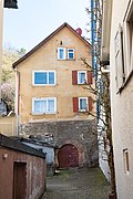
Cellar arch | Türkeigasse 2 (Flstnr. 358) (map) |
Round arched walls made of sandstone on a basement house worth preserving, the overlying residential floors worth preserving built in half-timbered, plastered, saddle roof; the bow re. 1582, the rest of the building probably 18./19. Century with later changes.
|
Rest of the city center
The following list includes the cultural monuments of the rest of the city center (not including the entire Freudenberg complex):
![]() Map with all coordinates of the cultural monuments of the rest of the core city of Freudenberg: OSM
Map with all coordinates of the cultural monuments of the rest of the core city of Freudenberg: OSM
| image | designation | location | Dating | description |
|---|---|---|---|---|
| graveyard | Friedhofweg 7 (map) |
15-20 Century | Cemetery wall with Laurentius relief and arched portal, inscribed. 1611, numerous tombs from the 15th to early 20th century, u. a. also priest epitaphs (totality).
|
|
| Laurentius Chapel | Friedhofweg 7 (map) |
12th century | Laurentiuskapelle, Romanesque building with choir tower (§ 28), 12th century.
|
|
 More pictures |
St. Laurence | Wiesenweg (map) |
1957 | Catholic Church of St. Laurentius (also New Laurentius Church), built in 1957.
|
Boxtal
Architectural, artistic and cultural monuments in Boxtal (with the village Boxtal, the Tremhof homestead and the Sägmühlen residential area ):
![]() Map with all the coordinates of the cultural monuments in the area around Boxtal: OSM
Map with all the coordinates of the cultural monuments in the area around Boxtal: OSM
| image | designation | location | Dating | description |
|---|---|---|---|---|
| St. Nicholas | Kirchstrasse 12 (map) |
13th century - 1881 | Catholic Church of St. Nicholas with tower from the 13th century in late Romanesque forms and nave from 1880/81 with arched windows, expanded in the 1960s, including triumphal arch, re. 1747, with accessories, u. a. Rochus figure, around 1900.
|
|
| Lourdes Chapel | Kirchstrasse | 1885 | One of the oldest German Lourdes chapels. It was donated by Pastor Lorenz Englert and inaugurated on July 26, 1885.
|
|
| Wayside shrine | Wengertsweg (map) |
Wayside shrine
|
||
| Wayside shrine | Wengertsweg (map) |
Wayside shrine
|
||
| Wayside shrine | Wildbachstraße 62 (near) (map) |
Wayside shrine
|
||
| Wayside shrine | Wildbachstrasse (K 2879) (map) |
Wayside shrine
|
Ebenheid
Architectural, art and cultural monuments in Ebenheid :
![]() Map with all coordinates of the cultural monuments in the area of Ebenheid: OSM
Map with all coordinates of the cultural monuments in the area of Ebenheid: OSM
| image | designation | location | Dating | description |
|---|---|---|---|---|
 More pictures |
Wayside shrine | Odenwaldstrasse (K 2831) (map) |
Wayside shrine
|
|
 More pictures |
Wayside shrine | Odenwaldstraße 11 (near) (map) |
Wayside shrine
|
|
 |
Memorial stone | Odenwaldstraße 14 (near) (map) |
Memorial stone 700 years of Ebenheid.
|
|
 More pictures |
St. Leonhard | Odenwaldstrasse 22 (map) |
1800 | Catholic branch church St. Leonhard, Gothic chapel with choir tower. 1800 renewed.
|
 More pictures |
Wayside shrine | Odenwaldstrasse (K 2831) (map) |
Wayside shrine
|
|
 More pictures |
Wayside shrine | Odenwaldstrasse (K 2831) (map) |
Wayside shrine
|
|
 More pictures |
Wayside shrine | (Map) | Wayside shrine
|
|
 More pictures |
Wayside shrine | (Map) | Wayside shrine
|
|
 More pictures |
Wayside shrine | (Map) | Wayside shrine
|
|
| Wayside shrine | (Map) | Wayside shrine
|
||
 More pictures |
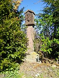
Wayside shrine | (Map) | Wayside shrine
|
|
 More pictures |
Wayside shrine |
Erlenwald nature reserve Röte-Strüt (near) (map) |
Wayside shrine
|
Rauenberg
Architectural, artistic and cultural monuments in Rauenberg (with the village of Rauenberg, the Dürrhof residential area with forest and forest house, and the village of Schafhof , which has been absorbed in Rauenberg):
![]() Map with all coordinates of the cultural monuments in the district of Rauenberg: OSM
Map with all coordinates of the cultural monuments in the district of Rauenberg: OSM
| image | designation | location | Dating | description |
|---|---|---|---|---|
| Dürrhof Chapel | Dürrhof 7 (map) |
1718 | Chapel. Pilaster structure with retracted choir and drilled windows, re. 1718.
|
|
 More pictures |
St. Wendelin | Raubachstrasse 14 (map) |
1869 | Catholic Church St. Wendelin, also St. Wendelinus from 1869. Modern extension of the nave with tower.
|
Wessental
Architectural, artistic and cultural monuments in Wessental (with the village of Wessental and the houses Antonius (Antons) -mühle and Blankenmühle ):
![]() Map with all coordinates of the cultural monuments in the district of Wessental: OSM
Map with all coordinates of the cultural monuments in the district of Wessental: OSM
| image | designation | location | Dating | description |
|---|---|---|---|---|
| Seven Sorrows of Mary | Kirchenweg 8 (map) |
1875 | Catholic Church of the Seven Sorrows of Mary. Chapel. Simple building with roof turrets and polygonal choir, re. 1875.
|
See also
- List of cultural monuments in the Main-Tauber district
- List of war memorials in Freudenberg (Baden)
- List of street names in Freudenberg (Baden) where many of the cultural monuments are located
Web links
Remarks
- ↑ This list may not correspond to the current status of the official list of monuments. This can be viewed by the responsible authorities. Therefore, the presence or absence of a structure or ensemble on this list does not guarantee that it is or is not a registered monument at the present time. The State Office for Monument Preservation Baden-Württemberg provides binding information .
Individual evidence
- ↑ a b c d e f g h i j k l m n o p q r s t Monument Preservation Baden-Württemberg: Monument Preservation Value Plan for the Freudenberg Complex (PDF). Online at www.denkmalpflege-bw.de. Retrieved March 6, 2019.
- ↑ LEO-BW.de: Church (Main Road 150, Freudenberg) . Online at www.leo-bw.de. Retrieved June 19, 2018.
- ^ Pastoral care unit Freudenberg: Old parish church St. Laurentius . Online at www.laurentius-freudenberg.de. Retrieved June 19, 2018.
- ^ Alemannia Judaica: Freudenberg (Main-Tauber-Kreis) Jewish history / prayer hall / synagogue. On the history of the prayer room / synagogue . Online at www.alemannia-judaica.de. Retrieved June 19, 2018.
- ↑ a b LEO-BW.de: Chapel (Friedhofweg 7, Freudenberg) . Online at www.leo-bw.de. Retrieved June 19, 2018.
- ↑ Pastoral care unit Freudenberg: New parish church St. Laurentius . Online at www.laurentius-freudenberg.de. Retrieved June 19, 2018.
- ↑ LEO-BW.de: Church (Church Street 12, Freudenberg) . Online at www.leo-bw.de. Retrieved June 19, 2018.
- ↑ LEO-BW.de: St. Leonhard (Odenwaldstraße 22, Freudenberg) . Online at www.leo-bw.de. Retrieved June 19, 2018.
- ↑ leo-bw.de
- ↑ LEO-BW.de: Chapel (Dürrhof 7, Freudenberg) . Online at www.leo-bw.de. Retrieved June 19, 2018.
- ↑ kath-kirche-freudenberg.de
- ↑ leo-bw.de
- ↑ LEO-BW.de: Chapel (Kirchenweg 8, Freudenberg) . Online at www.leo-bw.de. Retrieved June 19, 2018.

