List of listed objects in Wies
The list of listed objects in Wies contains the 18 listed , immovable objects of the community of Wies in the Styrian district of Deutschlandsberg . Since 2015, it has also included those monuments that are located in the former communities of Limberg bei Wies, Wernersdorf and Wielfresen, which merged with Wies from 2015.
Monuments
| photo | monument | Location | description | Metadata |
|---|---|---|---|---|

|
Catholic branch church hl. Veit ObjectID: 3653 |
KG location : Altenmarkt |
The church was the parish church of Wies until 1798. It is mentioned in a document in 1324 and is now a branch church of the pilgrimage and parish church of the Scourged Savior . Only the Gothic choir has survived from the original building; the former tower was built in 1512. The west portal is dated 1815, the roof turret is from the years after 1960. A rich fresco decoration from around 1400 has been uncovered in the church. The high altar is dated 1686, a red marble tombstone commemorates Sigmund von Eibiswald, who died in 1515. Note: The church building is located on a plot of EZ 466 KG 61103 Altenmarkt (the EZ 1435 used earlier is that of the land register 02300 Landtafel Steiermark, whose entries were taken over in 1990 in the land register of KG Altenmarkt). |
ObjectID: 3653 Status: § 2a Status of the BDA list: 2020-02-29 Name: Kath. Filialkirche hl. Veit GstNr .: .1 Chapel St. Veit, Altenmarkt bei Wies |

|
Residential house, former vicarage ObjectID: 3654 |
Kapellenstrasse 19 KG location : Altenmarkt |
The building is a baroque building with a high, two-axis gable front. Note: It is located in the southwest of the St. Veit Chapel in the Altenmarkt district on a property owned by EZ 29 KG 61103 Altenmarkt. |
ObjectID: 3654 Status: Notification Status of the BDA list: 2020-02-29 Name: Residential house, former vicarage GstNr .: 243/1 Pfarrhof Altenmarkt bei Wies |

|
Barrows in the cabbage forests ObjectID : 57821 |
Kohlwälder location KG: Etzendorf |
The site in the north of Wies is overgrown with forest, no remains can be seen in nature. Whether uneven ground can be traced back to the historical barrows , to later human influence or to natural causes can only be differentiated with an expert guide. Note: The site is on a property owned by EZ 145 KG 61113 Etzendorf. |
ObjectID : 57821 Status : Notification Status of the BDA list: 2020-02-29 Name: Barrows in the cabbage forests GstNr .: 351/6 |

|
Administration / office building ObjectID: 3906 |
Kalkgrub 63 location KG: Limberg |
The building is the former headquarters of the Kalkgrub mining company of the Graz-Köflacher Bahn. Note: It is located in the former coal mining area on Radlpass Straße B 76 in two cadastral communities: Its main part is on a plot of EZ 163 KG 61127 Limberg. Its north-eastern facade facing the main road is - according to the representation in GIS-Styria - on the adjacent property no.1109 of EZ 1111 KG 61057 Schwanberg, which is not mentioned in the overview list of the Federal Monuments Office and on which no monument protection is recorded. This abnormality does not have to be due to an error; it can also be caused by a non-identical representation of the manually drawn cadastral documents and the electronic information system. |
ObjectID: 3906 Status: Notification Status of the BDA list: 2020-02-29 Name: Administration / office building GstNr .: 364/5 Factory Directorate Kalkgrub, Limberg bei Wies |

|
Limberg Castle ObjectID: 3904 |
Limberg 1 location KG: Limberg |
Limberg Castle was first mentioned in a document in 1244. The existing building dates from the 16th century and was rebuilt between 1661 and 1681 (part of its interior fittings, such as a coffered ceiling from the mid-17th century and Renaissance doors dated 1562, were transferred to Hollenegg Castle). The exterior was renovated in 1960. The building consists of four four-storey wings that enclose a small courtyard with pillar arcades. From the forecourt, which is dated 1664, a wide staircase leads to the valley. Note: The castle is located on a property owned by EZ 81 KG 61127 Limberg. |
ObjectID: 3904 Status: Notification Status of the BDA list: 2020-02-29 Name: Limberg Castle GstNr .: .1 Limberg Castle near Wies, Styria |

|
Hofkapelle Jakobbauer ObjectID : 3942 since 2012 |
at Unterfresen 79 KG location : Unterfresen |
The building is an arbor chapel with an entrance on the west side, which is dedicated to St. Mary. Note: The property is located on a plot of EZ 61, KG 61145 Unterfresen. This EZ is referred to in the land register as "Jakabauer", a sign to the courtyard contains the spelling "Jokabauer". The monument protection of the chapel is explained in the land register with "Preservation of the Jakobbauer Hofanlage". |
ObjectID: 3942 Status: Notification Status of the BDA list: 2020-02-29 Name: Hofkapelle Jakobbauer GstNr .: .32 / 3 Kapelle Jakobbauer Unterfresen |

|
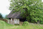
Hochstube (storage room) at the Jakobbauer ObjectID : 3941 since 2012 |
Unterfresen 80 location KG: Unterfresen |
The building consists of a wooden structure on a solidly bricked foundation, also about a floor high. It has the appearance of a " cellar floor ", a structure on a (wine) cellar entrance leading into an earth cellar. Such buildings (which can also contain a wine press) are usually located near (possibly former) vineyards, which is not to be assumed given the location of the building due to the altitude (626 m). The thickness of its foundation walls is an indication that they were not built as the basis of today's wooden structure, but could have been part of a small fortification, a " solid house ". The high room is an architectural feature. Note: The property is located on a plot of EZ 61, KG 61145 Unterfresen. This EZ is referred to in the land register as "Jakabauer", a sign to the courtyard contains the spelling "Jokabauer". The Hochstube has its own house number (Unterfresen 80), which proves that when the number was assigned (in the 19th century) it was not only regarded as part (ancillary building) of the adjacent farm (Unterfresen 79). Their monument protection is explained in the land register with "Preservation of the Jakobbauer Hofanlage". |
ObjectID: 3941 Status: Notification Status of the BDA list: 2020-02-29 Name: Hochstube (storage) at Jakobbauer GstNr .: .32 / 4 Stöckl Jakobbauer Unterfresen |

|
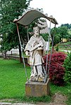
Stone figures hl. John of Nepomuk and St. Florian ObjectID: 3648 |
near Wernersdorf 54 KG location : Wernersdorf |
The statues are about 100 meters apart on the green area in front of the parish hall in the center of the village of Wernersdorf south of the L 652 Wernersdorferstraße on Buchenbergweg Note: The property belongs to EZ 49 KG 61147 Wernersdorf. |
ObjectID: 3648 Status: § 2a Status of the BDA list: 2020-02-29 Name: Steinfiguren hl. Johannes v. Nepomuk and St. Florian GstNr .: .66 St Florian St Nepomuk at Wernersdorf |

|
Elementary school ObjectID: 3932 |
Wiel 71 KG location : Wiel St. Oswald |
The school was located west of St. Katharina's Church in the old parish hall; it was closed in 2004. Your building was renovated in 2011 (roofing, windows, gable cladding, renovation of the wooden parts) and reopened as a community center, there is an apartment on the first floor. Note: The building is located on a plot of EZ 23 KG 61149 Wiel St. Oswald. |
ObjectID: 3932 Status: § 2a Status of the BDA list: 2020-02-29 Name: Primary school GstNr .: .43 Community building, Wielfresen |

|
Kath. Parish Church, St. Katharina in der Wiel ObjektID: 3933 |
Wiel, Wielfresen KG location : Wiel St. Oswald |
The church was named as a branch church of Eibiswald in 1545 . It has been a parish church since 1892, before that it had been entitled to exercise parish rights to the full extent as the “Stationskaplanei Wiel” of the then Schwanberg deanery since 1787. The choir is Gothic from the 15th century, the nave is baroque. The inscription "Aedificatum [Latin, 'built'] 1572, 1678" is located above the west portal. The interior of the church dates from the 17th and 18th centuries, the high altar painting from 1913. Note: The church is on a plot of land owned by EZ 20 KG 61149 Wiel St. Oswald. |
ObjectID: 3933 Status: § 2a Status of the BDA list: 2020-02-29 Name: Kath. Parish Church, St. Katharina in der Wiel GstNr .: .27 Parish Church Saint Katharina, Wielfresen |

|
Parish choir ObjectID : 3935 |
Wiel 61 KG location : Wiel St. Oswald |
It is a residential building in the style of the old farms of the area, the house is privately owned. Note: The building is located in the southeast of the St. Katharina Church on a plot of land owned by EZ 20 KG 61149 Wiel St. Oswald. |
ObjectID: 3935 Status: § 2a Status of the BDA list: 2020-02-29 Name: Pfarrkeusche GstNr .: .30 Pfarrkeusche, Wiel St. Oswald |

|
Rectory ObjectID: 3934 |
Wiel 65 KG location : Wiel St. Oswald |
The rectory dates from the 19th century and is also indicated by the plaque for the protection of cultural assets. Note: The building is located east of the St. Katharina Church on a property owned by EZ 16 KG 61149 Wiel St. Oswald. |
ObjectID: 3934 Status: § 2a Status of the BDA list: 2020-02-29 Name: Pfarrhof GstNr .: .29 / 1 |

|
Catholic Parish Church Scourged Savior ObjectID: 3651 |
Location KG: Wies |
The church was built 1774–1782, the tower 1800–1802. It has been the parish church of Wies since 1789. The church building has a square central room with sloping corners and a large flat dome. The fresco in it dates from 1956. The high altar dates from around 1780, the statue from the middle of the 18th century. In 1757 it was transferred from the Altenmarkt church to the (then) chapel in Wies. Side altars in the classical style are dated towards the end of the 18th century, two altars in the nave to the middle of the 19th century. The wrought iron rococo grille was brought to the church from Mahrenberg . Note: In the ordinances of the Federal Monuments Office, plots no . 68/1 and no. 535/2. The overview list names the plots no. For the church . 68/1 and no. 849/1. The three named plots have different owners, for all three the protection status is noted in the land register: The church building itself is located on plot no . 68/1 EZ 66 KG 61150 Wies , his property belongs to the "Pfarrkirche Wies" land register deposit . The property that surrounds the church is property no. 535/2 EZ 466 KG 61150 Altenmarkt . This property is owned by the “Roman Catholic Parish Church of the Savior in Wies, Altenmarkt” (until 1990: EZ 1435 02300 Landtafel Steiermark, from which the original information in the 2001 ordinance comes). Property no. 849/1 belongs to EZ 212 KG 61150 Wies, it is owned by the State of Styria (regional road administration). |
ObjectID: 3651 Status: § 2a Status of the BDA list: 2020-02-29 Name: Catholic parish church Scourged Savior GstNr .: .68 / 1; 849/1; 535/2 Parish Church of Wies |

|
Burgstall Castle ObjectID: 3656 |
Am Schlossberg 11 KG location : Wies |
The castle is mentioned in 1280 as "Pürchstal zu Lakenberg". In the last quarter of the 16th century it was expanded into a renaissance castle. It is a four-wing complex with three-story arcades (walled up on the east side) in the inner courtyard. In the passage there is a renaissance portal, on the south side a chapel from the end of the 17th century is added. There are two square towers in the northern defensive wall. Note: The building is located on a property owned by EZ 262 KG 61150 Wies. |
ObjectID: 3656 Status: § 2a Status of the BDA list: 2020-02-29 Name: Castle Burgstall GstNr .: 495 Castle Burgstall Residential building Wies |

|
Former bulk box ObjectID: 3657 |
Am Schlossberg 14 KG location : Wies |
It is the former bulk box (storage building) of the castle. Note: The building is located on the east side of Burgstall Castle on a lower level on a plot of EZ 227 KG 61150 Wies. |
ObjectID: 3657 Status: § 2a Status of the BDA list: 2020-02-29 Name: Former Schüttkasten GstNr .: .43 / 1 Former Schüttkasten Schloss Burgstall Wies |

|
Fortifications ObjectID: 3658 |
Am Schlossberg 11 KG location : Wies |
The fortifications are preserved with a wall and two towers. It belongs to Burgstall Castle. Note: The system is located on a property owned by EZ 262 KG 61150 Wies. |
ObjectID: 3658 Status: § 2a Status of the BDA list: 2020-02-29 Name: Fortification system GstNr .: 495 Fortification system Castle Burgstall Wies |

|
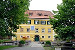
Former Gasthaus Leitinger ObjectID: 3660 |
Oberer Markt 14 Location KG: Wies |
The core of the building dates from the 18th century and was remodeled in the 19th century. It is used as a municipal office. Note: The property is located in the west of the market square on a plot of land owned by EZ 116 KG 61150 Wies. |
ObjectID: 3660 Status: Notification Status of the BDA list: 2020-02-29 Name: Former Gasthaus Leitinger GstNr .: .54 Oberer Mark 14 Wies |

|
Ecce Homo Pillar ObjectID: 3666 |
Location KG: Wies |
The column with the statue, which represents Jesus of Nazareth in the Ecce Homo scene , is in the church square of Wies, the statue and column are dated to the end of the 18th century. In 1959 the statue was transformed into a war memorial, the base statues date from this time. Note: The memorial is located on property no. 535/10 KG 61150 Wies , its entry in the land register is EZ 466 with the designation “Pfarrs VAL Altenmarkt” KG 61103 Altenmarkt . The owner is the "Roman Catholic Parish Church of the Savior in Wies, Altenmarkt" (until 1990 the property belonged to EZ 1435 of the land register 02300 Landtafel Steiermark, this information can still be found in older documents). |
ObjectID: 3666 Status: § 2a Status of the BDA list: 2020-02-29 Name: Ecce-Homo column GstNr .: 535/10 Ecce Homo column Wies |
literature
- Helmut-Theobald Müller (ed.), Gernot Peter Obersteiner (overall scientific management): History and topography of the Deutschlandsberg district. ( District topography ). Graz-Deutschlandsberg 2005. ISBN 3-901938-15-X . Styrian Provincial Archives and District Authority Deutschlandsberg 2005. In the series: Great historical regional studies of Styria. Founded by Fritz Posch †. ZDB ID 568794-9 .
Web links
Individual evidence
- ↑ a b Styria - immovable and archaeological monuments under monument protection. (PDF), ( CSV ). Federal Monuments Office , as of February 18, 2020.
- ^ A b c Kurt Woisetschläger , Peter Krenn : Dehio Handbook - The art monuments of Austria: Styria (excluding Graz). Topographical inventory of monuments, ed. from the Federal Monuments Office, Department for Monument Research. Publisher Anton Schroll. Vienna 1982. ISBN 3-7031-0532-1 . P. 617.
- ↑ Geographical Information System GIS of the State of Styria, Digital Atlas Styria, Map Service: Planning & Cadastre. Queryed July 4, 2011.
- ^ Land register of the district court in Deutschlandsberg, KG 61127 Limberg, EZ 163. As of July 4, 2011.
- ↑ District Court of Deutschlandsberg, land register KG 61057 Schwanberg, EZ 1111. As of July 4, 2011.
- ^ Dehio Styria. P. 272.
- ↑ Church ordinance sheet for the Seckau diocese. Born in 1892, VIII, No. 50, ZDB -ID 607471-6 pp. 51–52: Awarding of the pastor's title to the previously named local curates, vicars, etc., independent, permanently employed pastoral heads.
- ^ Dehio Styria. P. 443.
- ^ Dehio Styria. Pp. 616-617.
- ↑ a b c Dehio Styria. P. 66.
- ↑ § 2a Monument Protection Act in the legal information system of the Republic of Austria .