List of listed objects in Eibiswald
The list of listed objects in Eibiswald contains the 38 listed , immovable objects of the municipality Eibiswald in the Styrian district of Deutschlandsberg .
Since 2015, it has also included those listed objects that were previously located in the former communities of Aibl , Großradl , Sankt Oswald ob Eibiswald , Soboth and Pitschgau , which were merged with Eibiswald .
Monuments
| photo | monument | Location | description | Metadata |
|---|---|---|---|---|

|
Secondary school ObjectID: 3983 |
Aichberg 4 KG location : Aichberg |
The building is the former directorate of the Eibiswald steelworks and was then used as the Eibiswald secondary school. Note: The building is located in the north of the village of Eibiswald, but is already on a property owned by EZ 118 KG 61102 Aichberg. |
ObjectID: 3983 Status: § 2a Status of the BDA list: 2020-02-29 Name: Hauptschule GstNr .: .65 Hauptschule Eibiswald Aibl |

|
Site (Latènezeit) and burial mound near the Aichberger ObjektID : 130127 since 2015 |
Aichberg location KG: Aichberg |
It is an archaeological site of a burial ground that is dated to the Latène period or the Hallstatt period. It is one of those sites (burial necropolises) that attracted increased attention from the middle of the 19th century and therefore mostly did not remain undisturbed. Finds or their whereabouts have not been published. Note: The protected property is located in the north-northwest of the village of Eibiswald, it belongs to deposit number 3 of the cadastral community 61102 Aichberg. |
ObjektID : 130127 Status : Notification Status of the BDA list: 2020-02-29 Name : Site (Latènezeit) and burial mound at Aichberger GstNr .: 551 Aichberg burial mound in Eibiswald |

|
Tower hill and castle site Bischofegg ObjectID: 3916 |
Bischofegg location KG: Bischofegg |
It is the archaeological excavation site of a medieval castle complex. Without an expert guide, the remains of the system are no longer easily recognizable, there is no more masonry, only uneven floors. Note: The place of discovery lies on plots of several land register corporations (deposit numbers): Plots No. 264, 299, 301, 303 in EZ 1 and No. 257 and 260/2 in EZ 4, all KG 61107 Bischofegg. The farm name ( Vulgoname ) of the farm EZ 1 is indicated in the land registry with "Schlohswahtl" (sic!), Reminiscent of the former castle. |
ObjectID: 3916 Status: Notification Status of the BDA list: 2020-02-29 Name: Tower hill and Burgstelle Bischofegg GstNr .: 264; 299; 301; 303; 257; 260/2 |

|
Residence of the former Bischofegger mill ObjectID: 3918 |
Bischofegg 9 KG location : Bischofegg |
It is the house of a former mill on Saggaubach. Note: The house is located on a plot of EZ 7 KG 61107 Bischofegg about thirty meters north of the mill building, which is also listed. The other buildings in the complex, such as the farm building to the west, are not listed. |
ObjectID: 3918 Status: Notification Status of the BDA list: 2020-02-29 Name: House of the former Bischofegger Mühle GstNr .: .13 |

|
Industrial mill, former Bischofegger mill ObjectID: 3913 |
Bischofegg 54 KG location : Bischofegg |
The buildings form the system of a former mill on the Saggaubach. The former factory building of the mill is protected. Note: The building is about 30 meters south of the residential building, which is also listed, at the junction of the L 654 Ulrich Straße from the Südsteirische Grenzstraße B 69 on a plot of land owned by EZ 86 KG 61107 Bischofegg. The other buildings in the complex are not listed. |
ObjectID: 3913 Status: Notification Status of the BDA list: 2020-02-29 Name: Industriemühle, former Bischofegger Mühle GstNr .: .17 |

|
Catholic parish church of St. Maria ObjectID: 4043 |
Lower market location KG: Eibiswald |
The church was mentioned in a document in 1170, the choir and tower substructure have been preserved from the Romanesque and Gothic construction, frescoes from the 13th century and a Gothic pointed arch portal were discovered in 1967. Baroque modification in 1678. High altar in 1779. Note: The building is on a plot of EZ 94 KG 61112 Eibiswald. |
ObjectID: 4043 Status: § 2a Status of the BDA list: 2020-02-29 Name: Catholic parish church hl. Maria GstNr .: .51 Parish Church Eibiswald |
|
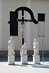
Figure shrine ObjektID: 4065 |
Lower market location KG: Eibiswald |
The group of statues dates from the Baroque period (designation "IS 1707") and represents St. John with the women mourning under the cross of Christ . It is north of the parish church. Note: The memorial is located on a property owned by EZ 94 KG 61112 Eibiswald. |
ObjectID: 4065 Status: § 2a Status of the BDA list: 2020-02-29 Name: Figure picture stock GstNr .: .51 Figure group crucifixion Eibiswald |

|
Catholic branch church Kreuzkirche ObjectID: 4045 |
Location KG: Eibiswald |
The church on the through road west of the Upper Market is named as a branch church in 1617 . It was renewed in 1672 by Wolf Max von Eibiswald and around 1790 rebuilt, reduced in size and brought into its current form. In the west of the outer facade there is a roof turret . It has a choirless hall that is spanned by two square vaults seated on belts . The frescoes in the interior were painted by Toni Hafner . The baroque altarpiece dates from the end of the 17th century and shows St. Notburga. Note: It is located on a plot of EZ 94 KG 61112 Eibiswald. |
ObjectID: 4045 Status: § 2a Status of the BDA list: 2020-02-29 Name: Katholische Filialkirche Kreuzkirche GstNr .: .113 Katholische Filialkirche Kreuzkirche |
|
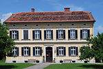
Vicarage ObjectID: 4044 |
Eibiswald 45 KG location : Eibiswald |
The two-storey building dates from the 2nd half of the 19th century. It has a simple facade structure Note: It is located on a plot of EZ 580 KG 61112 Eibiswald. |
ObjectID: 4044 Status: § 2a Status of the BDA list: 2020-02-29 Name: Pfarrhof GstNr .: .47 Pfarrhof Eibiswald |

|
Lerchhaus ObjektID : 4062 |
Eibiswald 82 KG location : Eibiswald |
The Lerchhaus dates from around 1612. Note: It is located on a plot of EZ 76 KG 61112 Eibiswald. |
ObjectID: 4062 Status: § 2a Status of the BDA list: 2020-02-29 Name: Lerchhaus GstNr .: .12 / 1 |

|
Outbuildings Object ID: 4047 |
Eibiswald 1 location KG: Eibiswald |
The building is the service yard of Eibiswald Castle. From at least the 15th century it replaced the functions of the castle complex, which was previously located south of it in Sterglegg in Großradl. Note: The building is located on a plot of EZ 498 KG 61112 Eibiswald. |
ObjectID: 4047 Status: § 2a Status of the BDA list: 2020-02-29 Name: Farm building GstNr .: .1 / 1 Schloss Eibiswald Wirtschaftshof |

|
Figure shrine St. Johannes von Nepomuk ObjectID: 4064 |
Location KG: Eibiswald |
The statue is a stone figure from the 18th century. She stands on the Johannesbrücke . Note: The wayside shrine is located on a bridge on the local thoroughfare over the Saggaubach on property no. 920/1 EZ 50001 (collective deposit for the river bed) KG 61112 Eibiswald. |
ObjectID: 4064 Status: § 2a Status of the BDA list: 2020-02-29 Name: Figurine picture stick hl. Johannes von Nepomuk GstNr .: 920/1 |

|
Marian column ObjectID: 4067 |
Upper market location KG: Eibiswald |
The monument on the upper market is dated 1738; of the seven statues made between 1721 and 1727, three (St. Sebastian , Rochus and Rosalia ) are still preserved, the statue of Mary was renewed by Jakob Gschiel in 1877 and restored in 1959. Note: The monument is located on the local square of Eibiswald on a plot of land owned by EZ 93 KG 61112 Eibiswald. |
ObjectID: 4067 Status: § 2a Status of the BDA list: 2020-02-29 Name: Mariensäule GstNr .: 923/1 |

|
Market Fountain ObjectID: 4069 |
Upper market location KG: Eibiswald |
The fountain at the Obere Markt consists of a fountain pipe with two outlets made of cast iron. Note: The fountain is located on the local square of Eibiswald on a plot of land owned by EZ 93 KG 61112 Eibiswald. |
ObjectID: 4069 Status: § 2a Status of the BDA list: 2020-02-29 Name: Marktbrunnen GstNr .: 923/1 Brunnen at the upper place Eibiswald |
|
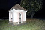
Johannes Chapel ObjectID: 4070 |
at Eibiswald 206 KG location : Eibiswald |
It is a cuboid chapel building with a statue of St. Johannes Nepomuk encloses. Note: The chapel is located on a plot of EZ 249 KG 61112 Eibiswald. |
ObjectID: 4070 Status: § 2a Status of the BDA list: 2020-02-29 Name: Johannes-Kapelle GstNr .: 599/2 Johanneskapelle Eibiswald |
|
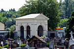
Grave monument ObjectID: 4073 |
near Eibiswald 147 KG location : Eibiswald |
The white, arcaded building contains the graves of an inn and brewery owner family from Deutschlandsberg. Note: The memorial is located in the southeast corner of the cemetery property of EZ 94 KG 61112 Eibiswald. |
ObjectID: 4073 Status: § 2a Status of the BDA list: 2020-02-29 Name: Grave monument GstNr .: 638 Grave of the Götz family, Eibiswald |

|
Road bridge, Johannesbrücke ObjectID : 118086 |
Location KG: Eibiswald |
The bridge is a stone structure from the 18th and 19th centuries. Note: The bridge is located on the local thoroughfare and leads over the Saggaubach , it is located on the properties No. 927/1, 927/2, both EZ 50000 (collective contribution street properties) and 920/1 EZ 50001 (collective contribution of the stream bed, public water property of the State of Styria), all KG 61112 Eibiswald. |
ObjectID : 118086 Status: § 2a Status of the BDA list: 2020-02-29 Name: Straßenbrücke, Johannesbrücke GstNr .: 927/1; 927/2; 920/1 Johannesbrücke Eibiswald |

|
Eibiswald Castle ObjectID: 4046 |
Eibiswald 1 location KG: Eibiswald |
Eibiswald Castle was a fief of the Wildonians, later the Eibiswald family. After a fire in 1572 it was rebuilt as a four-wing complex. His courtyard has three-story arcades on three sides. Stucco ceilings date from the 2nd half of the 17th century. It replaced the castle in Sterglegg, which was south of Eibiswald in Großradl and whose location is also a listed building. Note: The castle is located on a property owned by EZ 346 KG 61112 Eibiswald. |
ObjectID: 4046 Status: Notification Status of the BDA list: 2020-02-29 Name: Schloss Eibiswald GstNr .: .1 / 2 Schloss Eibiswald |
|
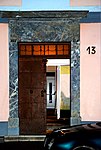
Marble portal ObjektID: 4050 |
Eibiswald 13 KG location : Eibiswald |
The portal consists of the high lintel, in which there is a relief, and the door reveals. It is located in an otherwise unprotected facade. Note: The portal is located in the west of the village of Eibiswald on a property belonging to EZ 10 KG 61112 Eibiswald. |
ObjectID: 4050 Status: Notification Status of the BDA list: 2020-02-29 Name: Marble portal GstNr .: .101 / 1 |

|
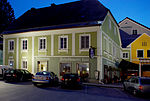
Facade of the Simperl Inn ObjectID : 4052 |
Eibiswald 22 KG location : Eibiswald |
The core of the building dates from around 1664. Note: The facade is on the local thoroughfare on land owned by EZ 18 KG 61112 Eibiswald. |
ObjektID: 4052 Status: Notification Status of the BDA list: 2020-02-29 Name: Facade of the Gasthaus Simperl GstNr .: .27; .35 |
|
Facade ObjectID: 4056 |
Eibiswald 40 KG location : Eibiswald |
The facade is dated to the 2nd quarter of the 19th century. Note: It is located opposite the parish church Eibiswald on a plot of EZ 35 KG 61112 Eibiswald. |
ObjectID: 4056 Status: Notification Status of the BDA list: 2020-02-29 Name: Façade GstNr .: .59 / 1 |

|
Gasthaus Kloepferkeller ObjectID: 4059 |
Eibiswald 59 KG location : Eibiswald |
The facade dates from the end of the 18th century, a corner figure represents St. Nepomuk represents. Note: The house is located on a plot of EZ 39 KG 61112 Eibiswald. The house of the Kloepfermuseum with the local history collections is in a different house; it is not listed as a listed building in the documents. |
ObjectID: 4059 Status: Notification Status of the BDA list: 2020-02-29 Name: Gasthaus Kloepferkeller GstNr .: .45 / 1 |

|
Village chapel Pitschgau ObjectID: 3912 |
Location KG: Pitschgau |
The village chapel of Pitschgau dates from the 19th century. Note: It is located on a plot of EZ 45 in KG 61132 Pitschgau. |
ObjectID: 3912 Status: § 2a Status of the BDA list: 2020-02-29 Name: Dorfkapelle Pitschgau GstNr .: .16 / 2 |

|
Crucifix / Cross, "Crucifixion Group " ObjectID: 3924 |
near Hörmsdorf 23 KG location : Hörmsdorf |
The monument consists of a crucifixion group (cross with accompanying statues). Note: It is to the west of the junction of Wolfmüllerweg from the southern Styrian border road B 69 at the western tip of property 410/1, which belongs to EZ 23 KG 61119 Hörmsdorf. The visualization in the zoning plan is entered about 150 meters too far to the east. The property is not located on property 410/2, which is named as a location in the overview list of the Federal Monuments Office. |
ObjectID: 3924 Status: Notification Status of the BDA list: 2020-02-29 Name: Kruzifix / Kreuz, "Kreuzigungsgruppe" GstNr .: 410/1 |
|
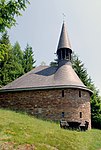
Mess chapel St. Clement ObjectID: 8744 |
Rothwein location KG: Rothwein |
The chapel was built in the 1930s at the end of the road from Mauthnereck to Rothwein, which should open up the area that has belonged to Austria since 1919. Note: The chapel is located on a property owned by EZ 38 KG 61137 Rothwein. |
ObjectID: 8744 Status: § 2a Status of the BDA list: 2020-02-29 Name: Messkapelle Hl. Klemens GstNr .: 102/5 |
|
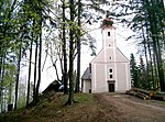
Catholic branch church St. Anton in Bachholz / St. Antonius the Hermit ObjectID: 4039 |
Sankt Lorenzen 76 KG location : St. Lorenzen |
The church is mentioned in a document in 1617. A new building took place in 1711-15. The high altar dates from 1732, the rest of the furnishings date from the end of the 17th to the first half of the 18th century. The church was renovated between 2003 and 2007, and in 2008 it was awarded a “ Styrian landmark ”. On May 4th, 2008 the 125 kg heavy Antoni bell was consecrated. Together with the 83 kg bell from 1842, it forms the peal of the church. Note: The church building is located on a plot of land owned by EZ 114 KG 61139 St. Lorenzen (plot no . 144 also specified in the BDA ordinance no longer exists). It can only be reached on footpaths or on non-public forest roads. |
ObjektID: 4039 Status: § 2a Status of the BDA list: 2020-02-29 Name: Catholic Filialkirche St. Anton in Bachholz / St. Antonius the Hermit GstNr .: .143 Filialkirche St. Anton in Bachholz St. Antonius the Hermit |

|
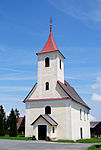
Catholic branch church St. Leonhard on the level ObjektID: 4038 |
St. Lorenzen location KG: St. Lorenzen |
The core of the church is Romanesque, it was extended in the late Gothic style. On the north wall there is a fresco of Christophorus from around 1500. The church is first mentioned in 1545, until 1829 it was a branch of Mahrenberg im Drautal. A late Gothic carved figure of St. Leonhard has been preserved from the 3rd quarter of the 15th century. Note: The church is located south of the L 665 road on a property owned by EZ 51 KG 61139 St. Lorenzen. |
ObjectID: 4038 Status: § 2a Status of the BDA list: 2020-02-29 Name: Catholic branch church St. Leonhard in the level GstNr .: .103 St. Leonhard in the level, Aibl |
|
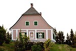
Catholic Parish Church of St. Lawrence ObjectID: 4037 |
St. Lorenzen location KG: St. Lorenzen |
The church is mentioned in a document in 1399. It has been a parish church since 1892, until then it had been a pastoral care station ( local curatie ) of the parish Eibiswald in the then Deanery Schwanberg from 1790 , but was already fully authorized to exercise parish rights. The interior is from the 17th and 18th centuries and was renovated in 1946. Note: The building is located on a plot of EZ 36 KG 61139 St. Lorenzen. |
ObjectID: 4037 Status: § 2a Status of the BDA list: 2020-02-29 Name: Catholic parish church Hl. Laurentius GstNr .: .54 / 1 Parish church Sankt Lorenzen ob Eibiswald |
|
Rectory ObjectID: 3993 |
St. Lorenzen 18 KG location : St. Lorenzen |
The building was erected in the 19th century. Note: It is located on a plot of EZ 15 KG 61139 St. Lorenzen. |
ObjectID: 3993 Status: § 2a Status of the BDA list: 2020-02-29 Name: Pfarrhof GstNr .: .55 |

|
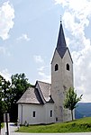
Catholic parish church St. Oswald ObjectID: 3614 |
St. Oswald ob Eibiswald KG location : St. Oswald ob Eibiswald |
The church is mentioned in a document in 1399, it received its existing form from 1723–1728. It has been a parish church since 1892, until then it had been a pastoral care station ( local curatie ) of the parish Eibiswald in the then dean's office Schwanberg from 1783 , but was already entitled to exercise the rights of a parish in full. The exterior was restored in 1981. It is a baroque building , with the year 1723 above the west portal. The high altar is dated to the first third of the 18th century, its picture and tabernacle date from the 19th century. A side altar dates from the end of the 17th century with statues of St. Notburga and St. Barbara . The pulpit is dated to the middle of the 18th century. The statues on the side portals represent St. Oswald and St. Martin represent. Note: The church is located north of the southern Styrian border road B 69 on a property owned by EZ 17 KG 61111 St. Oswald ob Eibiswald. |
ObjectID: 3614 Status: § 2a Status of the BDA list: 2020-02-29 Name: Katholische Pfarrkirche St. Oswald GstNr .: .7 Sankt Oswald ob Eibiswald - parish church |
|
Catholic parish church hl. James d. Ä. ObjectID: 4024 |
Location KG: Soboth |
The church is mentioned in a document in 1545, it has been a parish church since 1789. The existing church, bearing an inscription from 1704, corresponds to the architectural style of the end of the 17th century; its predecessor burned down after being struck by lightning. Restorations took place inside in 1962 and 1981, outside in 1981. The high altar from 1692 was restored in 1858, the font is dated 1790. Note: The church is located on a property owned by EZ 21 KG 61140 Soboth. |
ObjectID: 4024 Status: § 2a Status of the BDA list: 2020-02-29 Name: Catholic parish church hl. James d. Ä. GstNr .: .60 Parish Church Soboth |

|
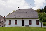
Grenzlandschule Soboth ObjectID: 3996 |
Soboth 159 KG location : Soboth |
It is one of several school buildings in the area that were built around 1926 as part of the incorporation of the Soboth into Austria through the State Treaty of St. Germain . The school was originally named after the chairman of the German School Association Südmark , Gustav Groß . Note: The building is located on a plot of land owned by EZ 90 KG 61140 Soboth. |
ObjectID: 3996 Status: § 2a Status of the BDA list: 2020-02-29 Name: Grenzlandschule Soboth GstNr .: .187 Grenzlandschule Soboth |
|
Parsonage Object ID: 3997 |
Soboth 79 KG location : Soboth |
The rectory of the St. Jakobus Church in Soboth is a single-storey building from the 17th and 18th centuries. Note: The building is located on a plot of EZ 121 KG 61140 Soboth. |
ObjectID : 3997 Status: § 2a Status of the BDA list: 2020-02-29 Name: Pfarrhof GstNr .: .58 / 1 |

|
Cemetery ObjectID: 4025 |
Location KG: Soboth |
It is the cemetery of the parish of St. Jakobus in Soboth. It is located in the southeast of the parish church. Note: The system is located on a property owned by EZ 21 KG 61140 Soboth. |
ObjectID: 4025 Status: § 2a Status of the BDA list: 2020-02-29 Name: Friedhof GstNr .: 547; .59 / 2 |

|
Catholic branch church hl. Leonhard ObjectID: 4026 |
Location KG: Soboth |
The branch church on the Zambichl was built on the site of an older chapel between 1645 and 1653 in the traditional form of a Gothic country church by Jakob Ničarc. The consecration inscription states the year 1659. Renovations were carried out on the outside in 1957 and on the inside in 1966. The high altar is dated 1659; it was restored in 1859. The organ from the second half of the 17th century comes from the parish church of Soboth. Note: The church is located away from public roads in a forest clearing in the Zambichl district of Soboth. It can be reached on footpaths of 300 (from the Soboth main road) to 500 meters (from the Soboth reservoir) and approx. 60 meters in altitude. Your building is located on a property owned by EZ 22 KG 61140 Soboth. |
ObjectID: 4026 Status: § 2a Status of the BDA list: 2020-02-29 Name: Kath. Filialkirche hl. Leonhard GstNr .: .120 Filialkirche Sankt Leonhard, Zambichl, Soboth |

|
Wayside shrine ObjectID: 4028 |
Location KG: Soboth |
The wayside shrine is by the St. Leonhard Church in Zambichl, it dates from the beginning of the 17th century. Note: The memorial is located on a property owned by EZ 22 KG 61140 Soboth. |
ObjectID: 4028 Status: § 2a Status of the BDA list: 2020-02-29 Name: wayside shrine GstNr .: 756 wayside shrine near Sankt Leonhard, Zambichl |

|
Obere Hütte - former glassworks ObjectID: 3631 |
Area "Obere Glashütte" northwest of Soboth Location KG: Soboth |
These are the remains of a production building for glass production, which was located here in the 18th and 19th centuries (in close connection with the quartz deposits and wood stocks in the area). Only a few outer walls and uneven floors inside the former building are recognizable. Note: Remnants of the building are on plot of EZ 44 (702/1), the other remains of the complex are in EZ 7 of KG 61140 Soboth. The ruins of the building are on private property and can be reached by walking about three kilometers and about 300 meters in altitude on forest roads from Soboth (footpath from St. Vinzenz or Zambichl). |
ObjectID: 3631 Status: Notification Status of the BDA list: 2020-02-29 Name: Obere Hütte - former glassworks GstNr .: 702/1; 712/1 Obere Glashütte, Soboth |

|
Turmbauerkogel - medieval tower castle ObjectID: 3962 |
Turmbauerweg 10 KG location : Sterglegg |
The castle was used until the 15th century, it was located on the old road over the Radlpass , which connected western Styria with the Drautal near Mahrenberg . It is assumed that it was the seat of servants who administered the area of Eibiswald (office and court, documented in 1265). The site was archaeologically examined in 1954 and 1968. The area is located on a north-sloping foothill of the hill country around the Radlpass, east of Radlpass Straße B 76. It is about 450 meters long (in north-south direction) and up to 50 meters wide, with one each in the north and south Turmburg ( Motte ), which are called Turmbauerkogel I (northern moth, only a truncated cone-shaped hill can be seen) and Turmbauerkogel II (southern moth, a castle hill protected all around by moat and rampart can be seen). Today the land is used for agriculture and forestry, on which there are fields, forests and meadows of a farm. Note: The facility is located on land owned by EZ 10 KG 61143 Sterglegg. |
ObjectID: 3962 Status: Notification Status of the BDA list: 2020-02-29 Name: Turmbauerkogel - medieval tower castle GstNr .: 264/1; 265; 266/1; 266/2; 267/1; 267/2; 270; 272; 411; 459; 460; 465/1; 465/2 Turmbauerkogel Sterglegg |
Former monuments
| photo | monument | Location | description | Metadata |
|---|---|---|---|---|

|
Road bridge, Roman bridge |
Eibiswald location KG: Eibiswald |
It was a stone-built bridge over the Saggaubach , for which there was no monument protection since 2009. In 2016, this bridge was largely dismantled and replaced by a concrete structure. Note: The bridge lies in the course of the Grasslweg on the properties No. 932/1 and 932/4, both EZ 374 (public property of the municipality of Eibiswald) and No. 920/1, EZ 50001 (collective deposit of the stream bed, public water property of the state Styria), all KG 61112 Eibiswald. Although it is listed as a monument in the (1st) supplementary ordinance to the ordinances according to § 2a BDSG, the monument protection was lifted by decision on June 3, 2009. |
ObjectID: missing! Status: § 2a Status of the BDA list: 2010-06-22 Name: Straßenbrücke, Römerbrücke GstNr .: 920/1; 932/1; 932/4 Roman bridge, Eibiswald |
Web links
Individual evidence
- ↑ a b Styria - immovable and archaeological monuments under monument protection. (PDF), ( CSV ). Federal Monuments Office , as of February 18, 2020.
- ↑ Fund Reports from Austria (FÖ). Published by the Department of the Federal Monuments Office for Ground Monuments in Vienna, Hofburg, Säulenstiege. Verlag Berger, Horn. ISSN 0429-8926 ZDB -ID 213982-0 . Volume 52, volume 2013. Vienna 2014. Archaeological measure No. 61102.13.01. P. 326.
- ^ Eduard von Pratobevera: Archaeological contributions, I: The sites where Celtic and Roman antiquities were found in Styria. Announcements of the Historical Association for Styria, Volume 5, year 1854, p. 110.
- ↑ V (áclav, also: Wenzel) Radimský: Urgeschichtliche research in the neighborhood of Wiesbaden in central Styria. I. The prehistoric monuments around Wies . In: Franz Hauer (Red.): Communications from the Anthropological Society in Vienna - MAG. Volume XIII (Volume III of the new series) year 1883. ISSN 0373-5656 , ZDB -ID 206023-1 . Publishing house Gerold. Vienna. Pp. 54, 60 and panel IX.
- ↑ Stanko Pahič: November seznam NORISKO-panonskih gomil. (With a German summary: New directory of the Noric-Pannonian barrows, pp. 113–212, 143–145.). In: Razprave / Dissertationes. Slovenska Akademija Znanosti in Umetnosti, Razred za Zgodovinske in Družbene Vede. Academia scientiarum et artium slovenica. Classis I: Historia et sociologia. Volume VII Part 2. Ljubljana 1972. ZDB -ID 302787-9 . P. 191.
- ^ Kurt Woisetschläger , Peter Krenn : Dehio Handbook - Die Kunstdenkmäler Österreichs: Styria (excluding Graz). Topographical inventory of monuments, ed. from the Federal Monuments Office, Department for Monument Research. Publisher Anton Schroll. Vienna 1982. ISBN 3-7031-0532-1 . Pp. 81-82.
- ↑ a b c d e Dehio Styria. P. 83.
- ↑ according to GIS Styria; GstNr 410/2 according to BDA not applicable
- ↑ Award ceremony on November 11, 2008. ( Page no longer available , search in web archives ) Info: The link was automatically marked as defective. Please check the link according to the instructions and then remove this notice. (with pictures).
- ↑ Sunday paper. Church newspaper of the Diocese of Graz-Seckau. No. 20, May 8, 2008. p. 6.
- ^ Dehio Styria . P. 415.
- ^ Dehio Styria . P. 455.
- ↑ a b Church ordinance sheet for the Seckau diocese. Born in 1892, VIII, No. 50, ZDB -ID 607471-6 , pp. 51–52: Awarding of the pastor's title to the previously named local curates, vicars, etc., independent, permanently employed pastoral heads.
- ^ Dehio Styria . Pp. 454-455.
- ^ Dehio Styria . P. 473.
- ^ Dehio Styria. Pp. 526-527.
- ↑ a b Dehio Styria. P. 527.
- ↑ Christoph Gutjahr, Georg Tiefengraber: The medieval weir system "Turmbauerkogel" near Eibiswald (Ivnik), District Deutschlandsberg, West Styria. With an archaeozoological appendix by Christoph Grill. In: Arheološki vestnik (Arh. Vest.). Volume 55, year 2004. ISSN 0570-8966 ZDB -ID 200321-1 p. 439-480. ( Article (PDF; 3.3 MB) in German, Slovenian and English abstract, Slovenian translation).
- ↑ Walter Modrijan: The medieval settlement and attachment system on the tower builder Kogel I and II. With a "excavation report" by Fritz Felgenhauer. In: Gerhard Pferschy (Hrsg.): Settlement power and economy. Festschrift Fritz Posch for his 70th birthday. In: Publications of the Styrian State Archives. Volume 12. Graz 1981. ISSN 0434-3891 ZDB -ID 561078-3 pp. 81-88.
- ↑ letter of Johann Knappitsch: Nix Kultura? In: Weekly newspaper Weststeirische Rundschau , August 26, 2016. Volume 89, No. 34, ZDB -ID 2303595-X p. 15.
- ↑ § 2a Monument Protection Act in the legal information system of the Republic of Austria .