List of listed objects in Deutschlandsberg
The list of listed objects in Deutschlandsberg contains the 48 listed , immovable objects of the Austrian municipality of Deutschlandsberg in the Styrian district of Deutschlandsberg . Since 2015, it has also included those monuments that were located in the municipalities of Bad Gams , Freiland bei Deutschlandsberg , Kloster , Osterwitz and Trahütten , which existed until 2014 and were affiliated with Deutschlandsberg .
Monuments
| photo | monument | Location | description | Metadata |
|---|---|---|---|---|

|
Joslannerl Chapel (Rosmann Chapel) ObjectID: 3695 |
at Bergegg 23 KG location : Bergegg |
The chapel was built on the basis of a vow to St. Maria von Luschari was built after an epidemic of illness (foundation inscription by the altar) and is decorated with pictures of the Stations of the Cross on the outer walls. Note: It is located on Grandlwirtstrasse north of the street above the village of Bad Gams on a plot of land owned by EZ 23 KG 61207 Gams. |
ObjectID: 3695 Status: Notification Status of the BDA list: 2020-02-29 Name: Joslannerl-Kapelle (Rosmann-Kapelle) GstNr .: 329/12 Joslannerl-Kapelle Bergegg, Bad Gams |

|
Residential building with utility wing, so-called Galthof ObjektID : 3341 since 2013 |
Burgstrasse 1 KG location : Burgegg |
The Galthof is the former farm yard of Deutschlandsberg Castle, later it was a workers' residence of the Deutschlandsberg paper mill. It was acquired by the city of Deutschlandsberg in 1969 and renovated in 1983. Note: The building is located on a plot of EZ 7 KG 61005 Burgegg in the west of the city. |
ObjectID: 3341 Status: Notification Status of the BDA list: 2020-02-29 Name: Residential building with utility wing , so-called Galthof GstNr .: .42 Galthof, Deutschlandsberg |
|
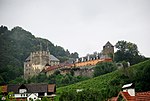
Deutschlandsberg castle ruins ObjectID: 3348 |
Burgstrasse 19 KG location : Burgegg |
The castle was the ancestral seat of the Lords of Lonsperch, Salzburg ministers in the center of the western Styrian possessions of the Archdiocese of Salzburg . It is first mentioned in 1153, the tower house dates from the 14th century. The plant was owned by Salzburg until 1803. Note: The castle is located on land owned by EZ 95 KG 61005 Burgegg. Not only the tower and the boundary walls, but also the hotel and restaurant wing as well as the inner courtyard are covered by monument protection. |
ObjectID: 3348 Status: § 2a Status of the BDA list: 2020-02-29 Name: Burgruine Deutschlandsberg GstNr .: .2 / 1; .2 / 2; 233/7; 233/11; 243/9; 331 Deutschlandsberg Castle |
|
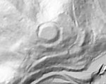
Altburgstelle Landsberg am Tanzboden ObjektID: 3345 since 2014 |
KG location : Burgegg |
Traces of settlement from the Neolithic to the Middle Ages have been found at this archaeological site. Remnants of the complex, which was temporarily inhabited together with Deutschlandsberg Castle , are only recognizable as uneven ground in the wooded area a few hundred meters northeast of the castle. |
ObjectID: 3345 Status: Notification Status of the BDA list: 2020-02-29 Name: Altburgstelle Landsberg am Tanzboden GstNr .: 243/1; 243/8 Altburgstelle Tanzboden Deutschlandsberg |

|
Signal box object ID: 129258 |
Bahnhofplatz 1 KG location : Deutschlandsberg |
The building was the mechanical signal box of the Deutschlandsberg train station. From there the switches and signals of the station were operated with wire pulls, as well as the barrier system on the L 618 Freilandstraße west of the station. Note: It has a floor area of 33 m² (building 28 m² and paved area 5 m²) and stands on the border of the cadastral communities Deutschlandsberg and Unterlaufenegg on two plots: For 21 m² in Deutschlandsberg at EZ 1921 (partial deposit of the railway book 02301 at the Graz district court -East for KG 61006 Deutschlandsberg) and for 12 m² in Unterlaufenegg in EZ 1920 (partial insert of this railway book for KG 61066 Unterlaufenegg). The building is owned by the Graz-Köflacher Bahn . Monument protection is noted for both land register entries, but property .60 is not mentioned in the overview list of the Federal Monuments Office. |
ObjektID : 129258 Status : Notification Status of the BDA list: 2020-02-29 Name: Stellwerkhütte GstNr .: .157 Signalwerk Bahnhof Deutschlandsberg |

|
Monument to Emperor Joseph II ObjectID: 3387 since 2020 |
Fabrikstrasse location KG: Deutschlandsberg |
The monument shows Emperor Josef II. Standing in civilian clothes, in his left hand he is holding a sheet of paper with the inscription “Abolition of Serfdom . Joseph". The monument is located in the eastern part of Josefpark diagonally across from the corner of Fabrikstrasse / Florian-Pojatzi- Strasse: The park was commissioned in 1880 on the occasion of the 100th anniversary of Emperor Josef II's accession as Duke of Styria ; the memorial was unveiled in 1883. |
ObjectID: 3387 Status: Notification Status of the BDA list: 2020-02-29 Name: Monument Kaiser Joseph II GstNr .: 425/1 |

|
Bürgerhaus ObjektID: 3356 |
Hauptplatz 4 KG location : Deutschlandsberg |
The core of the building is from the 17th century, its facade from the end of the 18th century. Note: The house is located on a property owned by EZ 74 KG 61006 Deutschlandsberg. |
ObjectID: 3356 Status: Notification Status of the BDA list: 2020-02-29 Name: Bürgerhaus GstNr .: .10 House at Hauptplatz 4 Deutschlandsberg |
|
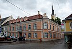
District Court ObjectID: 3357 |
Hauptplatz 18 KG location : Deutschlandsberg |
The building of the Deutschlandsberg District Court has a facade structure from the 3rd quarter of the 19th century. The building dates from 1448 and was the accommodation of the priests from the mother parish of St. Florian who came to Deutschlandsberg. It was later used as the teachers' house and the market's first schoolhouse. In 1898 it became a district court. The attached prison was vacated in October 1972. Note: The building is located on a property owned by EZ 67 KG 61006 Deutschlandsberg. |
ObjectID: 3357 Status: § 2a Status of the BDA list: 2020-02-29 Name: District court GstNr .: .2 District court Deutschlandsberg |
|
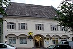
Former Dechanthof ObjectID: 3358 |
Hauptplatz 20 KG location : Deutschlandsberg |
The building was the official building of the deanery Deutschlandsberg of the Roman Catholic Church and at the same time the vicarage of the parish of Deutschlandsberg. In the years after 1876 it was fundamentally rebuilt under dean August Bossi (new kitchen, ballroom), the connecting building with apartments for the chaplains in the direction of the neighboring house to the east (district court) was built in 1881–1883. Note: It is located on a property owned by EZ 321 KG 61006 Deutschlandsberg. |
ObjectID: 3358 Status: Notification Status of the BDA list: 2020-02-29 Name: Former Dechanthof GstNr .: .43 / 2 House at Hauptplatz 20 Deutschlandsberg |

|
Bürgerhaus ObjektID: 3362 |
Hauptplatz 31 KG location : Deutschlandsberg |
The house has a Rococo facade with stucco decorations from the 2nd half of the 18th century. Note: The building is located on a property owned by EZ 54 KG 61006 Deutschlandsberg. |
ObjectID: 3362 Status: Notification Status of the BDA list: 2020-02-29 Name: Bürgerhaus GstNr .: .42 House at Hauptplatz 31 Deutschlandsberg |

|
Town hall ObjectID: 3363 |
Hauptplatz 35 KG location : Deutschlandsberg |
The building was erected around 1200 and has long been the quarters of the administrators of the area, who came from the Archdiocese of Salzburg. Around 1700 it was bought by a castle captain of Deutschlandsberg Castle, in 1787 Franz Xaver Jud, in 1811 Moritz von Fries and in 1820 a member of the Liechtenstein family. Since 1919 it has belonged to the city of Deutschlandsberg, which uses it for the municipal administration from 1925 and also had the tower built. The facade of the house was renewed in 1797 after a fire in the style of "Josephine Classicism ". Note: The building is on land owned by EZ 55 KG 61006 Deutschlandsberg. |
ObjectID: 3363 Status: § 2a Status of the BDA list: 2020-02-29 Name: Rathaus GstNr .: .53 / 1; .53 / 3; 534/17 Deutschlandsberg town hall |

|
Villa ObjectID: 3365 since 2016 |
Ignaz-Strutz-Gasse 1 KG location : Deutschlandsberg |
The building is a two-story residential building, which is only partially protected with its external appearance, the roof terrace and the staircase. |
ObjectID: 3365 Status: Notification Status of the BDA list: 2020-02-29 Name: Villa GstNr .: .108 Villa Strutz-Gasse 1, Deutschlandsberg |

|
Catholic Parish Church of All Saints ObjectID: 3340 |
Kirchengasse 3 KG location : Deutschlandsberg |
The church was built from 1688 to 1701. It has been a parish church since 1643, before that it was a branch church of Groß St. Florian . The interior was restored in 1980. The furnishings are from the 17th and 18th centuries. Note: The church is located on property owned by EZ 95 KG 61006 Deutschlandsberg. His address at Schulgasse 11 is the parish's postal address. |
ObjectID: 3340 Status: § 2a Status of the BDA list: 2020-02-29 Name: Catholic parish church of All Saints GstNr .: .1 Parish church in Deutschlandsberg |

|
District administration / health department ObjectID: 3366 |
Kirchengasse 7 KG location : Deutschlandsberg |
This building is an extension of the district administration of Deutschlandsberg, which has existed since 1872 . Note: The building is located in the north of the center of Deutschlandsberg at the northern end of Kirchengasse on a plot of land owned by EZ 83 KG 61006 Deutschlandsberg. |
ObjectID: 3366 Status: § 2a Status of the BDA list: 2020-02-29 Name: District administration / health department GstNr .: .100 District administration Deutschlandsberg, health department |

|
District Authority ObjectID: 3344 |
Kirchengasse 12 KG location : Deutschlandsberg |
The building dates from around 1872, when the district administration in Deutschlandsberg was established. Note: The building is located in the north of the center of Deutschlandsberg at the northern end of Kirchengasse on a plot of land owned by EZ 83 KG 61006 Deutschlandsberg. |
ObjectID: 3344 Status: § 2a Status of the BDA list: 2020-02-29 Name: Bezirkshauptmannschaft GstNr .: .136 Bezirkshauptmannschaft Deutschlandsberg (building) |

|
Chamber for workers and employees ObjectID: 3370 |
Rathausgasse 3 KG location : Deutschlandsberg |
The Chamber of Labor building was erected around 1960. It shows a relief by the Styrian artist Fred Hartig , whose signature can only be fully recognized again after the entrance area was converted before 2014, including the removal of the rain gutter that had previously been covering. Note: It is located on a property owned by EZ 311 KG 61006 Deutschlandsberg. |
ObjectID: 3370 Status: § 2a Status of the BDA list: 2020-02-29 Name: Chamber for workers and employees GstNr .: 543/4 Chamber of Labor in Deutschlandsberg |
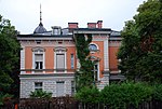
|
Villa Pieber ObjectID : 130692 since 2016 |
Villenstrasse 10 KG location : Deutschlandsberg |
The house is reminiscent of Italian Renaissance villas, it was built by the wealthy Pieber family. The building is protected, not the surrounding park. |
ObjectID : 130692 Status : Notification Status of the BDA list: 2020-02-29 Name: Villa Pieber GstNr .: .117 Villa Pieber, Deutschlandsberg |

|
Residential building, former manor house ObjectID: 3679 |
Furth 11 KG location : Furth |
The building is a residential building from the middle of the 19th century in the style in which a large number of rural houses in western Styria and in the vicinity of Graz were built. The construction was changed by the then k. k. Agricultural society promoted. This society is a forerunner of the Chamber of Agriculture, it was founded in 1819 at the suggestion of Archduke Johann . The new farmhouses it supports are then also called "Archduke Johann Houses". Note: The building is located east of the road from Bad Gams to Frauental in the south of Bad Gams, Furth district, on a property owned by EZ 10 KG 61206 Furth. |
ObjectID: 3679 Status: Notification Status of the BDA list: 2020-02-29 Name: Residential building, former manor house GstNr .: .19 Residential building Furth 11, Bad Gams |

|
Residence, bath house with wayside shrine ObjectID: 3685 |
Furth 14 KG location : Furth |
The building is a residential building from the middle of the 19th century in the style of the "Archduke Johann Houses". Characteristic is the portico-like built-over gate area with columns. Note: The building is also known as the Brabeck House. It is used for the Bad Gams Buddhist Center. The house is located near Dorfhotels Fernblick on land owned by EZ 14 KG 61206 Furth. |
ObjectID: 3685 Status: Notification Status of the BDA list: 2020-02-29 Name: Ansitz, Baderhaus with wayside shrine GstNr .: .2 / 2; 70 House Furth 14, Bad Gams |

|
Catholic Parish Church of St. Bartholomew ObjectID: 3678 |
Bad Gams location KG: Gams |
The church is mentioned in a document in 1382, the existing building was built after a fire in 1660 in the years 1727-1735. Restorations take place in 1965 and 1969/70. The pointed spire was restored in 1972 based on a construction from 1868. A bell dates from 1551, the time the church was rebuilt after it was destroyed by the Turks. The current interior dates from the 18th century. Note: The church is located on a property owned by EZ 43 KG 61207 Gams. |
ObjektID: 3678 Status: § 2a Status of the BDA list: 2020-02-29 Name: Catholic parish church St. Bartholomäus GstNr .: .1 Parish church Bad Gams |
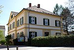
|
Rectory ObjectID: 3681 |
Bad Gams 1 KG location : Gams |
The rectory with hipped roof and central gable dates from the middle of the 19th century. Note: It is located on a property owned by EZ 278 KG 61207 Gams. |
ObjectID: 3681 Status: § 2a Status of the BDA list: 2020-02-29 Name: Pfarrhof GstNr .: .2 Pfarrhof Bad Gams |

|
Residence of the former court mill ObjectID: 3381 |
Hofmüllerweg 12 Location KG: Hinterleiten |
The building is located in the Wildbach district in the north of Deutschlandsberg in the Wildbachtal. It is essentially from the 17th century and was expanded in 1806. Note: The building is located on a property owned by EZ 31 KG 61022 Hinterleiten. |
ObjectID: 3381 Status: Notification Status of the BDA list: 2020-02-29 Name: House of the former Hofmühle GstNr .: .35 Hofmüllerhaus Wildbach Deutschlandsberg |
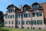
|
Workers' house, Czerweny-Hof ObjectID: 3350 since 2013 |
Dr.-Karl-Renner-Weg 7, 7a KG location : Hörbing |
It is a staff residence built in 1908 for employees of the large Deutschlandsberg match factory SOLO . The namesake Franz Czerweny was a partner in this work and supported the community in many ways in social matters such as the construction of workers' accommodation, water pipes, etc. Note: The house is on a plot of EZ 67 KG 61025 Hörbing. It is mentioned in the Dehio as “Cserweny-Hof” with the address “Rennweg 7”. |
ObjectID: 3350 Status: Notification Status of the BDA list: 2020-02-29 Name: Work residence, Czerweny-Hof GstNr .: .120 Czerweny-Haus, Deutschlandsberg |

|
Late antique pottery kiln ObjectID : 40466 |
Hörbing location KG: Hörbing |
The site is in the south of Deutschlandsberg. Your property is essentially an arable area within the area otherwise built up with residential buildings. Nothing can be seen in nature without an expert guide (parts are saved in a locked house). It is dealt with in the specialist literature. Note: The position is located on the properties of several land registers (deposit numbers): No. 97/1 of EZ 148 and No. 97/7 of EZ 497, all KG 61025 Hörbing. |
ObjektID : 40466 Status : Notification Status of the BDA list: 2020-02-29 Name: Spätantiker Töpferofen GstNr .: 97/1; 97/7 Late antique pottery kiln Hörbing Deutschlandsberg |

|
Frauental Castle ObjectID: 3374 |
Ulrichsberg 1 KG location : Hörbing |
The first building on the site of Schloss Frauenthal is believed to be a permanent house from the time of Bavarian colonization, the “Nidrinhof”, which was documented in 970. It is said to have been founded around 700 AD from Aquileia , which at that time carried out the Christian missionary work for the Kingdom of Noricum . In 1267 the name "Vraundorf" (woman village) appears. In the Middle Ages there was a “Hof zu Hl. Ulrich ” there or at least nearby . It was expanded into a nobility seat in 1542 and expanded in 1675. The castle chapel is dedicated to St. Joseph . After economic decline due to a lavish administration and family disputes, the administrator of the brass factory was appointed curator of the estate in 1741. From 1812 to 1820 the castle experienced its heyday under its owner Moritz Graf von Fries . In 1820 the Liechtenstein family came into possession of the castle. Note: The castle is located on a property owned by EZ 227 KG 61025 Hörbing. |
ObjectID: 3374 Status: Notification Status of the BDA list: 2020-02-29 Name: Schloss Frauental GstNr .: .47 Schloss Frauental, Deutschlandsberg |

|
Catholic branch church hl. Ulrich ObjectID: 3338 |
Ulrichsberg 8 KG location : Hörbing |
The basics of the church complex originate from the Bavarian colonization in the 10th century. It was a branch church of Groß St. Florian until 1786 and has belonged to the parish of Deutschlandsberg since then. The church was originally dedicated to St. Mark , founder of the Patriarchate of Aquileia and patron of the Republic of Venice . Note: The church is located on a property owned by EZ 48 KG 61025 Hörbing. Only the property of the church building is protected, for the protection of the property surrounding the building see the property with the property ID 131539, which has been protected since 2019 (remains of the early and high medieval fortifications on Ulrichsberg). |
ObjectID: 3338 Status: § 2a Status of the BDA list: 2020-02-29 Name: Kath. Filialkirche hl. Ulrich GstNr .: .57 Filialkirche Sankt Ulrich, Deutschlandsberg |

|
Remains of the early and high medieval fortifications on Ulrichsberg ObjektID : 131539 since 2019 |
at Ulrichsberg 8 KG location : Hörbing |
It is a ground monument . The protected area, on which the Ulrichskirche, which is separately listed, is dated in its foundations to the time of Bavarian colonization in the 10th century (the church itself is ascribed to the Bavarian noble family of Kelzen before 1136). In 1998, on the forecourt of the church, the remains of an approximately 100 × 100 m² large facility were discovered, which was interpreted as the courtyard of a derelict castle, including a fountain that was shut down in the 12th century. This well is provided with shaft-like passages at its bottom, the material with which the well shaft was filled came partly from the 10th century. A concrete ceiling allows the site to be preserved and further explored. The place of discovery is associated with the Nidrinhof , which is mentioned in a document from the Ottonian period in 970. The church as such is first mentioned in 1313 (or 1144). Whether a farm in Ortisei near her arose out of the Nidrinhof (where it was located) or whether it was an independent farm (perhaps only for a short time) (an upper court compared to the lower Nidrinhof) seen differently in literature. From 1401 the farm was probably a farm. Note: The protected area consists on the one hand of the property of the St. Ulrich Church (EZ 48, property .57, all KG 61025 Hörbing) and the surrounding area (737), on the other hand of the property to the west of it (EZ 1, 634/2) , which belongs to the restaurant "Kirchenwirt" (according to the land register vlg. Mehsner , then a former farm building of the church). To protect the church itself, see the object with the object ID 3338 . |
ObjektID : 131539 Status : Notification Status of the BDA list: 2020-02-29 Name: Remains of the early and high medieval fortifications on Ulrichsberg GstNr .: 634/2; .57; 737 |

|
Catholic parish church hl. Oswald ObjectID: 4005 |
KG location : Klosterwinkel |
A church at this point is already mentioned in 1434, in 1534 a new building was built after being destroyed by the Turks, and in 1642 the tower was built. In 1735 the church was rebuilt. Their altars are in the cartilage style of the 18th century, a late Gothic ciborium is currently kept in the Diocesan Museum Graz. Note: The parish church is located on property .30, deposit number (EZ) 17, cadastral community 61027 Klosterwinkel, District Court Deutschlandsberg. This deposit number also includes the cemetery (property 371), "Roman Catholic parish church Sankt Oswald" is registered as the owner. However, the ordinance of the Federal Monuments Office specifies property 370/1 of EZ 16 of the same KG as the location of the church. This property only forms the meadow around the church (under which an old cemetery is assumed), its owner is, according to the land register, another legal person, the "Roman Catholic parish of Sankt Oswald in Freiland". The overview lists (from version 2012) name both the property of the church and the surrounding property. |
ObjectID: 4005 Status: § 2a Status of the BDA list: 2020-02-29 Name: Catholic parish church hl. Oswald GstNr .: 370/1; 368; .30 Parish Church of Sankt Oswald in Freiland |

|
Alban-Berg-Villa ObjektID: 3575 |
Alban-Berg-Weg 1 KG location : Kruckenberg |
The complex was built as “Villa Kalchberg” by Johann Nepomuk Ritter von Kalchberg around 1880/1890, it later belonged to the family of Helene Nahowski , who later became the wife of Alban Berg , who himself spent several summer stays there. Note: Kruckenberg 12 is also used as the address from the time before the Alban-Berg-Weg was created . The building is located on a plot of EZ 75 KG 61032 Kruckenberg. |
ObjectID: 3575 Status: Notification Status of the BDA list: 2020-02-29 Name: Villa / country house, Villa "Alban Berg" GstNr .: .25 / 2 Alban Berg Villa |

|
Roman period settlement on the Keltenweg ObjectID : 95319 |
Keltenweg location KG: Leibenfeld |
The site is in the south of Deutschlandsberg. The remains of the Roman settlement were found during excavations in the late 1980s. They are not recognizable in nature. The listed properties are built on with two houses, next to them are house gardens and an access road. Note: In the land register, there is no reference to monument protection for both deposit figures. The location is on the properties of several land registers (deposit numbers): No. 431/1 of EZ 172, No. 431/6 of EZ 275, all KG 61036 Leibenfeld (owners are private individuals). According to the land register, the property of the settlement houses of a housing cooperative no. 436/2 of EZ 268, which was previously also protected according to the status of the lists of the Federal Monuments Office, bears no reference to monument protection according to the land register. An emergency excavation co-financed by the housing cooperative is documented for this plot of land, which confirmed that this area belonged to the late Latène to late antique settlements and work areas south of Deutschlandsberg (e.g. a pottery, to which the pottery kiln in Hörbing a few hundred meters to the east also belongs is expected), but showed no further finds. |
ObjektID : 95319 Status : Notification Status of the BDA list: 2020-02-29 Name: Roman-era settlement on Keltenweg GstNr .: 431/1; 431/6 Keltenweg site, Deutschlandsberg |

|
Roman barrows Leibenfeld ObjectID : 8778 |
Leibenfeld location KG: Leibenfeld |
It is an archaeological site of which no evidence can be seen on the surface of the earth. Note: The site is located on both sides of the Graz-Köflacher-Bahn in Leibenfeld north of the bridge on Radlpass Straße B 76. The area is overgrown with trees and bushes in the eastern part and gardens in the western part. The point can be reached from Deutschlandsberg via the old Schwanberger Straße. The site is where this road has already turned into a forest path at its end. Your properties belong to different land registers (deposit numbers): the property No. 411/2 to EZ 23, No. 415/1 to EZ 206, No. 415/2 to EZ 29, No. 418/1 to EZ 171, No. 419 for EZ 21, No. 423/1 for EZ 148 and No. 424/1 for EZ 148, all in KG 61036 Leibenfeld. |
ObjectID : 8778 Status : Notification Status of the BDA list: 2020-02-29 Name: Roman-era barrows Leibenfeld GstNr .: 415/2; 411/2; 423/1; 424/1; 419; 418/1; 415/1 Barrows Leibenfeld, Deutschlandsberg |
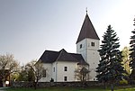
|
Catholic Parish Church of St. Jacob ObjectID: 3411 |
Location KG: Mitterspiel |
The church was built around 1188. Until the 16th century it was dedicated to St. Leonhard consecrated. A new building took place after the fire in 1734, the organ dates from 1757. After damage from a lightning strike in 1962, a renovation was carried out. Note: The church is located on the property of EZ 33 KG 61039 Mitterspiel. |
ObjectID: 3411 Status: § 2a Status of the BDA list: 2020-02-29 Name: Catholic parish church Hl. Jakob GstNr .: .36 St. Jakob (Freiland) |

|
Cemetery ObjectID: 3412 |
Location KG: Mitterspiel |
The cemetery is around the parish church of St. Jakob. Note: It is located on the church property of EZ 33 KG 61039 Mitterspiel. The location of the foundations of a previous church building is noted in the zoning plan. |
ObjectID: 3412 Status: § 2a Status of the BDA list: 2020-02-29 Name: Friedhof GstNr .: .36 |

|
Farmhouse, commonly known as Herk ObjectID: 3416 |
Freiland 36 KG location : Mitterspiel |
The building is an original farmhouse that is used as a museum. Note: It is located on a plot of EZ 23 in KG 61039 Mitterspiel. |
ObjectID: 3416 Status: Notification Status of the BDA list: 2020-02-29 Name: Farmhouse, commonly known as "Herk" GstNr .: 221 Farmhouse Museum Herk |

|
Former Stiftshof, Jacobi-Haus ObjectID: 3415 |
Freiland 37 KG location : Mitterspiel |
This is the former rectory of the parish St. Jakob in Freiland, it is currently used as a seminar house. Note: The building is located on a property owned by EZ 83 KG 61039 Mitterspiel. |
ObjectID: 3415 Status: § 2a Status of the BDA list: 2020-02-29 Name: Former Stiftshof, Jacobi-Haus GstNr .: .35 |
|
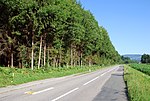
Grave mound at the vlg. Höchkiegerl ObjectID : 8747 |
vlg. Höchkiegerl location KG: Niedergams |
There is a large and a small burial mound at the site . The big hill has a diameter of around 30 meters and is four meters high. This hill ("Höchkiegerltumulus") is described as a dromos grave, it contained a small brick burial room of two by two meters, to which an approximately 2.5 m upstream entrance ( dromos ) led. The burial carried out in it is dated to the end of the 3rd or the beginning of the 4th century AD ( Roman Empire ). Against this hill one about two feet high by comparison with similar facilities grave stele assumed their base was found. This pedestal was set up in the park at the Frauental municipal office. Another burial from around the 4th or 5th century was located in the hill. Remnants of a bronze brooch are interpreted as an indication of the burial of a woman. The tomb is badly damaged and completely looted. It was opened improperly around 1930 (after the additional burial in antiquity had already caused damage) using today's terms, and a number of clay vessels are said to have been found, the whereabouts of which are unknown. Further damage was caused in 1987 by the construction of a path, so that during an excavation in 2000 only remains of the grave chamber walls and the dromos floor, pottery shards and charcoal remains were found, which did not allow an exact dating or detailed explanation of the graves. This excavation only included the site area on property 149/1. The burial mound is visible as a rise in the ground, it lies in an area covered with forest and bushes, in nature no details are discernible. Note: The site is located about 100 meters northwest of the fork in the road (towards Frauental, Deutschlandsberg or Gams) in the south of a partially overgrown forest path on property of EZ 89 KG 61229 Niedergams, which can be driven on by off-road vehicles. The southern continuation of the site is on the adjacent property in the KG Laßnitz of the Frauental community. |
ObjectID : 8747 Status : Notification Status of the BDA list: 2020-02-29 Name: Grave mound at the vlg. Höchkiegerl GstNr .: 612; 613/2 grave mound Höchkiegerl Frauental and Bad Gams |

|
Rectory ObjectID: 4012 |
Osterwitz 1 location KG: Osterwitz |
The rectory dates from the 17th century. Note: The building is located on a property owned by EZ 98 KG 61046 Osterwitz. |
ObjectID: 4012 Status: § 2a Status of the BDA list: 2020-02-29 Name: Pfarrhof GstNr .: .86 Pfarrhof Osterwitz |

|
Catholic Parish Church Sorrowful Mother ObjectID: 4010 |
KG location : Osterwitz |
The church was first mentioned in 1370. It has been a parish since 1445, it was destroyed by the Turks in 1480 and rebuilt in 1534. The church was originally consecrated to the " Immaculate Conception ". In 1898 the patronage changed to “ Our Lady of Sorrows ”. Note: The building is located on a property owned by EZ 44 KG 61046 Osterwitz. |
ObjectID: 4010 Status: § 2a Status of the BDA list: 2020-02-29 Name: Catholic Parish Church of Sorrowful Mother GstNr .: .85 Parish Church of the Sorrowful Mother of God, Osterwitz |

|
Cemetery ObjectID: 4011 |
KG location : Osterwitz |
The cemetery is around the parish church. Note: It belongs to the same property as the church, EZ 44 KG 61046 Osterwitz. |
ObjectID: 4011 Status: § 2a Status of the BDA list: 2020-02-29 Name: Friedhof GstNr .: .85 Friedhof Osterwitz |

|
Frauenbründl ObjectID: 4017 |
Osterwitz 1 location KG: Osterwitz |
The spring outlet is designed as a wayside shrine , the pictures are from the Deutschlandsberg artist Melitta Zingler from 2003. The contained water forms a small pond, which is intended as a resting area for pilgrims on the last part of the way to the parish church. |
ObjectID: 4017 Status: § 2a Status of the BDA list: 2020-02-29 Name: Frauenbründl GstNr .: 694 Frauenbründl, Osterwitz |

|
Catholic parish church of St. Nikolaus ObjectID: 3572 |
Kirchweg 2 KG location : Trahütten |
A church is first mentioned in a document in 1381. After it was destroyed by the Turks, it was rebuilt in 1534, further alterations in the 17th century, such as the tower in 1669. It has been a parish church since 1892, before that it had been authorized as a " local curatie " of the Osterwitz parish in the dean's office in Deutschlandsberg since 1788. to exercise parish rights in full. The high altar dates from the 17th century, with a picture from 1882. Two side altars are dedicated to St. Martin (right) and St. Mary (Marriage of Mary) consecrated (dated 1747, the pulpit from the same time). The altar paintings are by Philipp Carl Laubmann , in the left side altar there is the painting "Christ in the grave - radiant before the resurrection" by Jakob Wibmer behind a cover on the underside of the altar table. The font comes from the baroque period. The organ, which had been installed in the church since around 1990, was replaced in 2013 by a new electronic organ with three manuals and 57 registers, which was inaugurated on November 17, 2013, tailored to the acoustics of the church. Note: The church is located on a plot of EZ 33 KG 61064 Trahütten. |
ObjectID: 3572 Status: § 2a Status of the BDA list: 2020-02-29 Name: Catholic parish church hl. Nikolaus GstNr .: .44 Nikolauskirche (Trahütten) |

|
Old rectory with farm building ObjectID: 3573 |
Hauptstrasse 2 KG location : Trahütten |
The building dates from the 19th century and was used by Trahütten as the municipal office until the end of 2014. Note: The building is located opposite the confluence of Kirchweg and Weinebenstraße on a plot of EZ 143 KG 61064 Trahütten |
ObjectID: 3573 Status: Notification Status of the BDA list: 2020-02-29 Name: Old rectory with farm building GstNr .: 302 Old rectory with farm building |

|
Jagabauer farmhouse (former vicarage) ObjectID: 3574 |
Kirchweg 5 KG location : Trahütten |
The building is built in the style of the old farms in the area. Note: It is located south of the Trahütten church on a plot of land owned by EZ 8 KG 61064 Trahütten. |
ObjectID: 3574 Status: Notification Status of the BDA list: 2020-02-29 Name: Bauernhaus Jagabauer (former vicarage) GstNr .: .46 Bauernhaus Jagabauer |

|
Trahütten cemetery ObjectID: 3571 |
KG location : Trahütten |
The cemetery is around the church of Trahütten. Note: It is located on a plot of EZ 33 KG 61064 Trahütten. |
ObjectID: 3571 Status: § 2a Status of the BDA list: 2020-02-29 Name: Christian cemetery GstNr .: 299 Trahütten cemetery |

|
Feilhofen Castle ObjectID : 3372 |
Wildbacher Straße 2 KG location : Unterlaufenegg |
The castle was given its present form in 1804, and its facade was restored in 1974. Note: The castle is located at the beginning of the L 647 Geipersdorfer Straße on a property owned by EZ 608 KG 61066 Unterlaufenegg. |
ObjectID: 3372 Status: Notification Status of the BDA list: 2020-02-29 Name: Schloss Feilhofen GstNr .: 485/1 Schloss Feilhofen Deutschlandsberg |

|
Cemetery of the Rom. Imperial era, group of tumuli in Vochera am Weinberg ObjektID : 130202 since 2014 |
Location KG: Vochera am Weinberg |
The site can only be recognized in nature with an expert guide. It was already researched in the years after 1880, information about finds and their whereabouts are not documented. Only a horseshoe (the ancient origin of which was already in doubt) is described as a find. Another author of the time said the tumuli in Vochera were interesting because they were located off the road on a rather steep mountain slope. Another, later literature reference mentions the place at Vochera and deals with the area around the barrows, but does not go into details of this place either. Note: The site is located west of the Poßnitzweg on a property owned by EZ 131 KG 61245 Vochera am Weinberg. |
ObjectID : 130202 Status : Notification Status of the BDA list: 2020-02-29 Name: Grave field of the Rom. Imperial era, group of tumuli in Vochera am Weinberg GstNr .: 398/4 group of tumuli in Vochera am Weinberg |

|
Wildbach Castle ObjectID: 3378 |
Wildbachfeld 55 KG location : Wildbach |
The castle has been inhabited since the 14th century, it was renovated from 1534 to 1540 after being destroyed by the Turks. A renovation took place from 1740 to 1788. The furnishings come from the Rococo and Empire . The castle chapel is the Annenkapelle with an altar from around 1760, in the castle there is a memorial to the visit of Franz Schubert from October 10th to 12th, 1827. Note: The castle is located on a plot of EZ 109 KG 61072 Wildbach. |
ObjectID: 3378 Status: Notification Status of the BDA list: 2020-02-29 Name: Schloss Wildbach GstNr .: .2; .1 Wildbach Castle, Deutschlandsberg |

|
Pavilion / garden shed ObjectID: 3379 |
Wildbachfeld 55 KG location : Wildbach |
The round canopy of the pavilion, which is supposed to provide weather protection, gives the building an appearance that differs greatly from the usual architecture of the landscape. Note: The building is located at the junction from Feldbaumstrasse on a property owned by EZ 109 KG 61072 Wildbach. |
ObjectID: 3379 Status: Notification Status of the BDA list: 2020-02-29 Name: Pavilion / garden house GstNr .: .1 Garden pavilion Castle Wildbach, Deutschlandsberg |
annotation
The St. Wolfgang Church (Wolfgangikircherl) on the ridge south of Deutschlandsberg is no longer in Deutschlandsberg, but in the KG Neuberg of the community of Schwanberg , district of Hollenegg .
literature
- Maria Lichtenegger: The group of burial mounds “Bründlteiche”. With an overview of the state of research in barrow research in Styria since 1980. Diploma thesis at the KFU Graz, Graz 2007. pp. 19–35.
- Christoph Gutjahr: Prehistory and Early History and Medieval Archeology. Pages 19-39. In: Helmut-Theobald Müller (ed.), Gernot Peter Obersteiner (overall scientific management): History and topography of the Deutschlandsberg district. ( District topography ). Graz-Deutschlandsberg 2005. ISBN 3-901938-15-X . Styrian Provincial Archives and District Authority Deutschlandsberg 2005. In the series: Great historical regional studies of Styria. Founded by Fritz Posch †. ZDB ID 568794-9 . First volume, general part.
- Ordinance of the Federal Monuments Office (PDF; 35 kB) of February 20, 2001, GZ 11.337 / 2/01, with which 117 immovable monuments in the political district of Deutschlandsberg, which are presumed to be under monument protection, are placed under the provisions of Section 2a Monument Protection Act. Ordinance sheet for the service area of the Federal Ministry of Education, Science and Culture, year 2001, 5th issue No. 64/2001. Vienna 2001. ISSN 1023-6937 . Pages 142-148. The second publication provided for in Section 2a Paragraph 4 of the Monument Protection Act was published in the Official Gazette of the Wiener Zeitung No. 055 of March 19, 2001. Page 25. In effect from April 1, 2001. The Correction Ordinance of January 14, 2003 corrects the property data of the Deutschlandsberg Castle, which other supplementary ordinances to this ordinance are not relevant for Deutschlandsberg.
- Cultural property protection map 1: 50,000. Sheet 198 Deutschlandsberg. According to the Hague Convention of May 14, 1954, Austrian Federal Law Gazette No. 58/1964, edited by the Documentation Center and Convention Office of the Federal Monuments Office, Vienna 1977.
Web links
Individual evidence
- ↑ a b Styria - immovable and archaeological monuments under monument protection. (PDF), ( CSV ). Federal Monuments Office , as of February 18, 2020.
- ↑ a b c d e f g h Kurt Woisetschläger , Peter Krenn : Dehio Handbuch - Die Kunstdenkmäler Österreichs: Styria (excluding Graz). Topographical inventory of monuments, ed. from the Federal Monuments Office, Department for Monument Research. Publisher Anton Schroll. Vienna 1982. ISBN 3-7031-0532-1 . P. 71.
- ^ Dehio Styria. Pp. 70-71.
- ↑ Contemporary witnesses report: Häfn brothers were also well cooked ... (about the former prison cook Christine Pucher). In: Weststeirische Rundschau. No. 11, volume 2018 (March 16, 2018), 91st volume p. 2.
- ^ Gerhard Fischer: 140th anniversary of the inauguration of Dechant Bossi and 110th day of death. In: Weststeirische Rundschau. No. 35, year 2014 (29 January 2014), 87th year, ZDB -ID 2303595-X . Simadruck Aigner u. Weisi, Deutschlandsberg 2014, p. 2.
- ↑ Historical facts about the town hall. In: Weststeirische Rundschau. No. 35, volume 2014 (29 August 2014), 87th volume 2014, p. 3.
- ↑ Land register 61006 cadastral community Deutschlandsberg, deposit number 135, property .108.
- ^ Dehio Styria. Pp. 69-70.
- ↑ according to GIS Styria; GstNr. 543/3 according to BDA not applicable
- ↑ a b Viktor Herbert Pöttler: The rural settlement forms as well as farmhouse and farm in Styria. In: Dehio Steiermark. Page XXI (introductory part).
- ↑ Bad Gams Buddhist Center .
- ↑ a b Dehio Styria. P. 133.
- ^ Dehio Styria. P. 619.
-
^ Bernhard Hebert: A pottery furnace in Deutschlandsberg / Hörbing. In: Pro Austria Romana. Volume 39 (1989), ISSN 0478-3166 ZDB -ID 801077-8 p. 14 f.
Ulla Steinklauber, Helmut J. Windl: Reconstruction of the late antique pottery kiln from Hörbing near Deutschlandsberg, Styria . In: Archeology of Austria. Communications from the Austrian Society for Prehistory and Early History. Volume 9.2. Vienna 1998. ISSN 1018-1857 ZDB -ID 1092607-0 . Pp. 66-71. - ↑ a b Dehio Styria. P. 112.
- ^ Bundesdenkmalamt: Find reports from Austria. Volume 37, year 1998. Vienna 1999. Page 49.
- ↑ Manfred Lehner: The early castle on the Deutschlandsberger Ulrichsberg (KG Hörbing, SG and VB Deutschlandsberg, West Styria) . In: Contributions to medieval archeology in Austria (BMÖ). Edited by the Austrian Society for Medieval Archeology. ISSN 1011-0062 ZDB -ID 805848-9 . Volume 20, 2004. pp. 99–148.
- ^ Christoph Gutjahr: Prehistory and Early History and Medieval Archeology. Page 45. In: Helmut-Theobald Müller (ed.), Gernot Peter Obersteiner (overall scientific management): History and topography of the Deutschlandsberg district. ( District topography ). Graz-Deutschlandsberg 2005. ISBN 3-901938-15-X . Styrian Provincial Archives and District Authority Deutschlandsberg 2005. In the series: Great historical regional studies of Styria. Founded by Fritz Posch †. First volume, general part.
- ^ Robert Baravalle: Castles and palaces of Styria. An encyclopaedic collection of the Styrian fortifications and properties, which were endowed with various privileges. Graz 1961, Stiasny publishing house. Pp. 87 and 78.
- ^ Dehio Styria. P. 473.
- ^ Styria - immovable and archaeological monuments under monument protection. ( Memento from June 2, 2016 in the Internet Archive ) . Federal Monuments Office , as of June 6, 2012 (PDF).
- ↑ Solemn blessing of the redesigned entrance to Trahütten . In: Weststeirische Rundschau (September 23, 2011). No. 38, 84th year 2011, page 4.
- ↑ a b Dehio Styria. P. 564.
- ^ District court Deutschlandsberg, land register 61036 Leibenfeld, EZ 268, 172 and 275. Accessed July 12, 2011.
- ^ Find reports from Austria. (FÖ) Published by the Department of the Federal Monuments Office for Ground Monuments in Vienna, Hofburg, Säulenstiege. Verlag Berger, Horn. ISSN 0429-8926 ZDB -ID 213982-0 . Volume 44, year 2005. Vienna 2006. Page 558.
- ^ Bernhard Hebert: Leibenfeld near Deutschlandsberg. Introduction to research history. - Deutschlandsberg-Leibenfeld. Kutatástörténeti bevezető. In: 4th international conference on Roman barrows. Veszprém, 10-15. September 1996, Balácai Közlemények V., 1997, pp. 55-62.
- ↑ Erich Hudecek: Early burial mounds from the cemetery in Deutschlandsberg / Leibenfeld in the territory of Flavia Solva. - Korai halomsírok Flavia Solva territóriumához tartozó Deutschlandsberg / Leibenfeldből. In: 4th international conference on Roman barrows. Veszprém. P. 63. – 72.
- ^ Dehio Styria. P. 114.
- ↑ Jörg Fürnholzer: Detection excavation in the Roman grave mound at the homestead vulgo Höchkiegerl, Frauental an der Laßnitz, Styria. Find reports from Austria. Volume 43, year 2004. Vienna 2005. pp. 441–458.
- ^ Christoph Gutjahr: Prehistory and Early History and Medieval Archeology. P. 38 (with several plans for the location and find drawings). In: Helmut-Theobald Müller (ed.), Gernot Peter Obersteiner (overall scientific management): History and topography of the Deutschlandsberg district. (District topography) . Graz-Deutschlandsberg 2005. ISBN 3-901938-15-X . Styrian Provincial Archives and District Authority Deutschlandsberg 2005. In the series: Great historical regional studies of Styria. Founded by Fritz Posch †. ZDB ID 568794-9 . First volume, general part.
- ^ History of Osterwitz .
- ^ Dehio Styria. Pp. 348-349.
- ↑ Osterwitz community. Current projects. January 24, 2011, accessed March 21, 2012 .
- ↑ according to GIS Styria; GstNr. 690 according to BDA not applicable
- ↑ Church ordinance sheet for the Seckau diocese. Born in 1892, VIII, No. 50, ZDB -ID 607471-6 pp. 51–52: Awarding of the pastor's title to the previously named local curates, vicars, etc., independent, permanently employed pastoral heads.
- ↑ Jakob Widmer also in Trahütten! In: Weststeirische Rundschau . No. 38, Volume 2014 (September 19, 2014), Volume 87, p. 3.
- ↑ Trahütten has a new organ. In: Weststeirische Rundschau . No. 46, volume 2013 (November 16, 2013), 86th volume, p. 4.
- ^ Fritz Pichler: A new excavation area. In: Communications from the Anthropological Society in Vienna (MAG). Volume XVII (Volume VII of the New Series). Vienna 1887. ISSN 0373-5656 ZDB -ID 206023-1 . P. [77] (the square brackets belong to the page number, the volume has two page numbers, one with and one without these brackets).
- ^ Johann B. Dworschak: The memorial mounds of the Lassnitzthales in Styria. In: Communications from the Anthropological Society in Vienna (MAG). Volume XIV (Volume IV of the New Series). Vienna 1884. pp. [24-25].
- ↑ Stanko Pahič: November seznam NORISKO-panonskih gomil. (With a German summary: New directory of the Noric-Pannonian barrows, pp. 113–212, 143–145.). In: Razprave / Dissertationes. Slovenska Akademija Znanosti in Umetnosti, Razred za Zgodovinske in Družbene Vede. Academia scientiarum et artium slovenica. Classis I: Historia et sociologia. Volume VII Part 2. Ljubljana 1972. ZDB -ID 302787-9 . Pp. 71 and 84.
- ^ Dehio Styria. Pp. 618-619.
- ↑ § 2a Monument Protection Act in the legal information system of the Republic of Austria .