List of bridges in Hamburg / R
R.
| photo | Name, brief description | use | (First) construction | District, location |
|---|---|---|---|---|

|
Randersweidebrücke This bridge leads the street of the same name over the Kampbille. The name Randersweide refers to a "pasture that lies on a border". |
Street |
Bergedorf ( 53 ° 28 ′ 48 ″ N, 10 ° 11 ′ 54 ″ E ) |
|

|
Rathenaubrücke This bridge was originally called "Westliche Skagerrakbrücke" and leads over the Skagerrak Canal in the Alsterdorf district. The bridge was named after the writer and politician Walther Rathenau in 1958. |
Street |
Alsterdorf ( 53 ° 36 ′ 25 ″ N, 9 ° 59 ′ 49 ″ E ) |
|

|
Ratsmühlendammbrücke The street of the same name crosses the Alster with this bridge. |
Street |
Ohlsdorf , Fuhlsbüttel ( 53 ° 37 ′ 34 ″ N, 10 ° 1 ′ 44 ″ E ) |
|
|
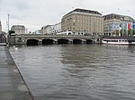
Reesendammbrücke The bridge is a listed building. |
Street. |
Hamburg-Altstadt , Neustadt ( 53 ° 33 ′ 8 ″ N, 9 ° 59 ′ 38 ″ E ) |
|

|
Reginenortbrücke spans the western entrance of the Müggenburg Canal. The bridge is a listed building. The railroad has now ceased and the footpath across the bridge is closed. |
railroad |
Veddel ( 53 ° 31 ′ 17 ″ N, 10 ° 1 ′ 41 ″ E ) |
|

|
Reichstag Bridge This bridge crosses the Insel Canal and connects the Kugelfang and Inselstrasse streets. It was named in memory of the Hamburg Reichstag delegate Wilhelm Metzger (SPD). Originally there was a wooden bridge here - from 1914 onwards, which was replaced by a reinforced concrete bridge in 1954. |
Street |
Alsterdorf ( ) |
|

|
Reiherstiegbrücke This bridge crosses the Reiherstieg near the Ellerholzbrücke. |
railroad |
Kleiner Grasbrook , Steinwerder ( 53 ° 31 ′ 38 ″ N, 9 ° 58 ′ 36 ″ E ) |
|

|
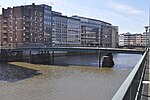
Reiherstieg bascule bridge Neuhöfer Straße crosses the Reiherstieg with this bridge. |
Street |
Wilhelmsburg ( 53 ° 30 ′ 45 ″ N, 9 ° 58 ′ 17 ″ E ) |
|
|
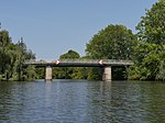
Reimersbrücke (R124) With this bridge the Reimerstwiete crosses the Nikolaifleet. Allegedly it is the oldest, but certainly one of the oldest bridges in Hamburg. |
Footpath |
Hamburg Old Town ( 53 ° 32 ′ 47 ″ N, 9 ° 59 ′ 29 ″ E ) |
|
|
Reitbrooker Mühlenbrücke (R141) This bridge was built in 1976 and connects the Reitbrooker Deich with the Allermöher Deich. It leads over the Dove Elbe. |
Street |
Reitbrook , Allermöhe ( 53 ° 28 ′ 3 ″ N, 10 ° 10 ′ 23 ″ E ) |
|

|
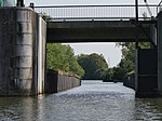
Reiterbrücke This pedestrian bridge leads the Alsterwanderweg over the Alster. In the past it was mainly used by sport riders. These were wealthy Hamburgers who kept their horses in the riding stables of the farmers of Klein-Borstel. |
Street |
Fuhlsbüttel ( 53 ° 37 ′ 58 ″ N, 10 ° 2 ′ 7 ″ E ) |
|
|
Reitschleusenbrücke The bridge leads from Ochsenwerder into the nature reserve "Die Reit". The naming is based on this. |
Street |
Ochsenwerder , Reitbrook ( 53 ° 28 ′ 35 ″ N, 10 ° 6 ′ 14 ″ E ) |
|

|
Rentzelstrasse Bridge The bridge is named after Rentzelstrasse. It crosses the tracks of the long-distance railway and the S-Bahn near the Hamburg television tower. |
Street |
St. Pauli , Rotherbaum ( 53 ° 33 ′ 50 ″ N, 9 ° 58 ′ 37 ″ E ) |
|

|
Rethe bascule bridge , as a replacement for the Rethe lift bridge . | Road, foot / bike path, railroad | 2016 |
Wilhelmsburg ( 53 ° 30 ′ 14 ″ N, 9 ° 57 ′ 58 ″ E ) |

|
Richardstraße Bridge The bridge is a listed building. |
Street | around 1900 |
Uhlenhorst , Barmbek-Süd ( 53 ° 34 ′ 11 ″ N, 10 ° 2 ′ 16 ″ E ) |

|
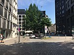
Robert Schuman Bridge (R435) Originally built as the Wandsbeker Rathausbrücke , since 1988 named after Robert Schuman ; spans the tracks of the Hamburg-Lübeck railway line along Ring 2 and is only accessible for motor vehicles; There is a tunnel under the tracks for pedestrians and cyclists. |
Street |
Wandsbek , Marienthal ( 53 ° 34 ′ 8 ″ N, 10 ° 4 ′ 23 ″ E ) |
|
|
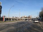
Roland's Bridge (R265) former bridge, spanned the Reichenstraßenfleet, which was filled in in 1877; today only street name |
Street |
Hamburg old town ( 53 ° 32 ′ 55 ″ N, 9 ° 59 ′ 40 ″ E ) |
|
|
Rönnhaidbrücke The Rönnhaidbrücke was built between 1969 and 1970. It is a pedestrian bridge that connects the Hamburger Meile shopping center with the Hamburger Straße subway station. |
Footpath |
Barmbek-Süd ( 53 ° 34 ′ 32 ″ N, 10 ° 2 ′ 8 ″ E ) |
|

|
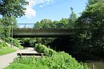
Roosen Bridge This bridge is named after the Roosen family who owned the surrounding area - including a park - between 1832 and 1920. |
Street |
Neustadt ( 53 ° 32 ′ 40 ″ N, 9 ° 58 ′ 51 ″ E ) |
|
|
Rosenbrookbrücke Double bridge over the Tarpenbek , part of Ring 2 |
Street |
Groß Borstel ( 53 ° 36 ′ 9 ″ N, 9 ° 59 ′ 10 ″ E ) |
|

|
Roßbrücke With this street the Roßweg crosses the Roßkanal. It connects Neuhof with Steinwerder. |
Street |
Steinwerder ( 53 ° 31 ′ 22 ″ N, 9 ° 56 ′ 32 ″ E ) |
|

|
Red Bridge (R305) One of originally three, today six Billebrücken (red, brown, blue, green, yellow and black bridges), which have been painted in different colors since ancient times to make it easier for peasants who are unfamiliar with reading. |
Street |
Billstedt , Billbrook ( 53 ° 31 ′ 53 ″ N, 10 ° 6 ′ 43 ″ E ) |
|

|
Rückersbrücke This bridge is named after the Rückersweg. It crosses the central canal. |
Street |
Hamm ( 53 ° 32 ′ 58 ″ N, 10 ° 3 ′ 51 ″ E ) |