List of bridges in Hamburg / S
S.
| photo | Name, brief description | use | (First) construction | District, location |
|---|---|---|---|---|

|
Saarland Bridge The name of this bridge reminded of the annexation of the Saarland to the German Empire in 1935. |
Street | 1916 |
Winterhude ( 53 ° 35 ′ 5 ″ N, 10 ° 2 ′ 1 ″ E ) |

|
Sachsenbrücke (S006) The bridge crosses the Saale harbor between Dessauer Straße and Am Seehafen. |
Street |
Kleiner Grasbrook ( 53 ° 31 ′ 41 ″ N, 10 ° 0 ′ 53 ″ E ) |
|

|
Sand bridge The sand bridge was designed by Franz Andreas Meyer. |
Street | 1887 |
HafenCity ( 53 ° 32 ′ 37 ″ N, 9 ° 59 ′ 24 ″ E ) |

|
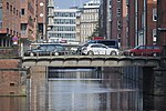
Saseler Strasse Bridge A bridge over the subway between the Ringstrasse and the Berner Heerweg. |
Street |
Farmsen-Berne , Rahlstedt ( 53 ° 37 ′ 53 ″ N, 10 ° 8 ′ 44 ″ E ) |
|
|
Schaarsteinwegbrücke (S087) The bridge is a listed building. |
Street |
Neustadt ( 53 ° 32 ′ 45 ″ N, 9 ° 58 ′ 55 ″ E ) |
|

|
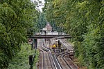
Schaartorbrücke (S089) The bridge leads the street of the same name over the Alsterfleet. |
Street |
Hamburg old town ( 53 ° 32 ′ 44 ″ N, 9 ° 59 ′ 0 ″ E ) |
|
|
Schäferhofbrücke With this bridge, the street of the same name crosses the subway between Fuhlsbüttel-Nord and Langenhorner Markt. |
Street |
Langenhorn ( 53 ° 38 ′ 35 ″ N, 10 ° 1 ′ 1 ″ E ) |
|

|
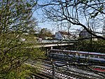
Leaning Bridge A bridge that crosses the Dove Elbe at an oblique angle - hence the name. |
Street |
Curslack , Neuengamme ( 53 ° 27 ′ 51 ″ N, 10 ° 12 ′ 5 ″ E ) |
|
|
Schiffbeker Bridge The Schiffbeker Weg crosses the subway with this bridge. Schiffbek was a village that passed into the hamlet of Hamburg-Billstedt with two others . |
Street |
Billstedt ( 53 ° 32 ′ 38 ″ N, 10 ° 6 ′ 14 ″ E ) |
|

|
Schlachthofbrücke (S918) When the Harburg train station was built, this bridge was also built. It was named after a slaughterhouse that stood northeast of the train station. |
Street |
Harburg , Wilstorf ( 53 ° 27 ′ 17 ″ N, 9 ° 59 ′ 32 ″ E ) |
|

|
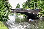
Schleemer Bridge With this bridge, Schleemer Weg crosses the subway. This is named after the abandoned Schleem settlement, which lay between Schiffbek and Steinbek . |
Street |
Billstedt ( 53 ° 32 ′ 25 ″ N, 10 ° 6 ′ 50 ″ E ) |
|
|
Schleidenbrücke The bridge is a listed building. |
Street |
Winterhude , Barmbek-Süd , Barmbek-Nord ( 53 ° 35 ′ 5 ″ N, 10 ° 2 ′ 1 ″ E ) |
|

|
Schleusenbrücke (S203) The Schleusenbrücke leads as an extension of Poststrasse over the Alsterfleet to the Rathausmarkt. |
Neustadt , Hamburg-Altstadt ( 53 ° 33 ′ 5 ″ N, 9 ° 59 ′ 31 ″ E ) |
||

|
Schleusendammbrücke With this bridge, the street of the same name crosses the Dove Elbe or the Dove-Elbe-Schleuse, to which the name refers. |
Street |
Neuengamme , Allermöhe ( 53 ° 28 ′ 0 ″ N, 10 ° 11 ′ 24 ″ E ) |
|

|
Schleusengrabenbrücke With this bridge, Bergedorfer Straße crosses the Schleusengraben , after which the bridge is named. |
Street |
Bergedorf ( 53 ° 29 ′ 17 ″ N, 10 ° 12 ′ 30 ″ E ) |
|

|
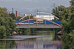
Smuggling Bridge This bridge crosses Schmuggelstieg the Tarpenbek . |
Footpath |
Langenhorn ( 53 ° 40 ′ 53 ″ N, 9 ° 59 ′ 58 ″ E ) |
|
|
Schurzalleebrücke A bridge over the Bille Canal. It is named after the Schurz Avenue, the American US-turn by the publicist Carl Schurz named |
Street |
Rothenburgsort ( 53 ° 32 ′ 11 ″ N, 10 ° 4 ′ 2 ″ E ) |
|

|
Schwanenwikbrücke The bridge is a listed building. |
Street |
Uhlenhorst , Hohenfelde ( 53 ° 33 ′ 56 ″ N, 10 ° 1 ′ 1 ″ E ) |
|

|
Black bridge leads the Heidenkampsweg over the Bille . The bridge railings of originally three, now six Billebrücken (red, brown, blue, green, yellow and black bridges) are painted in different colors. It is unclear whether the choice of color should make orientation easier for river boats or workers in the industrial park. |
Street |
Hammerbrook , Rothenburgsort ( 53 ° 32 ′ 33 ″ N, 10 ° 1 ′ 58 ″ E ) |
|
|
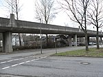
Seehafenbrücke (S892), one of the few with 3 ramps and a T-junction on the bridge. It connects Harburger Hafen with Harburger City by crossing the B 73 and the Niederelbebahn . In addition, there is a pedestrian crossing from Blohmstrasse to the B 73. The bridge is a listed building. |
Street |
Harburg , Heimfeld ( 53 ° 27 ′ 53 ″ N, 9 ° 58 ′ 42 ″ E ) |
|

|
Sengelmannbrücke The street of the same name crosses the Alster with this bridge. |
Street |
Alsterdorf , Ohlsdorf ( 53 ° 36 ′ 55 ″ N, 10 ° 1 ′ 5 ″ E ) |
|

|
Serrahnbrücke This bridge leads the Alte Holstenstraße over the Bille above the Serrahn (Bergedorfer Hafen). |
Street |
Bergedorf ( 53 ° 29 ′ 22 ″ N, 10 ° 12 ′ 35 ″ E ) |
|

|
S (c) hanghaibrücke (S945) With this bridge the Shanghaiallee crosses the Brooktorhafen in Hamburg-Hafencity . |
Street |
HafenCity ( 53 ° 32 ′ 39 ″ N, 10 ° 0 ′ 6 ″ E ) |
|

|
Sierichstrasse Bridge This girder bridge leads Sierichstrasse over the Goldbek Canal . |
Street |
Winterhude ( 53 ° 35 ′ 0 ″ N, 10 ° 0 ′ 20 ″ E ) |
|

|
Singapore Bridge Pedestrian bridge that leads over Überseering in City Nord. |
Footpath |
Winterhude ( 53 ° 36 ′ 18 ″ N, 10 ° 1 ′ 30 ″ E ) |
|

|
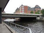
Skagerrak Bridge The Skagerrak Bridge leads Rathenaustraße over the Skagerrak Canal. The bridge is a listed building. |
Street |
Alsterdorf ( 53 ° 36 ′ 41 ″ N, 10 ° 0 ′ 32 ″ E ) |
|
|
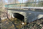
Slamatjenbrücke With this bridge the Ludwig-Erhardt-Straße crosses the Alsterfleet. The name of the bridge, first mentioned in the 17th century, suggests prostitution, because slam stands for dirt or mud and matje stands for girls. |
Street |
Hamburg-Altstadt , Neustadt ( 53 ° 32 ′ 53 ″ N, 9 ° 59 ′ 6 ″ E ) |
|
|
Sonnenwegbrücke The street of the same name crosses the Wandse with this bridge . |
Street |
Tonndorf ( 53 ° 35 ′ 34 ″ N, 10 ° 7 ′ 20 ″ E ) |
|
|
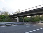
Speckenwegbrücke With this bridge, the street of the same name crosses the federal motorway. |
Street |
Bergedorf ( 53 ° 28 ′ 10 ″ N, 10 ° 15 ′ 36 ″ E ) |
|

|
Spreehafenbrücke This bridge at the Spreehafen connects Klütjenfelder Strasse and Klütjenfelder main dike . |
Street |
Kleiner Grasbrook ( 53 ° 31 ′ 26 ″ N, 9 ° 58 ′ 59 ″ E ) |
|

|
St. Annenbrücke The street of the same name crosses the Wandrahmfleet with this bridge. |
Street | 1885 |
HafenCity ( 53 ° 32 ′ 41 ″ N, 9 ° 59 ′ 51 ″ E ) |

|
St. Pauli Landungsbrücken The bridges are under monument protection. |
Investors |
St. Pauli ( 53 ° 32 ′ 43 ″ N, 9 ° 58 ′ 5 ″ E ) |
|

|
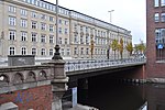
Stadthallenbrücke (S912) The Stadthallenbrücke was built between 1914 and 1916 under the Hamburg construction director Fritz Schumacher and named after the town hall , which was demolished in 1952. |
Street |
Winterhude ( 53 ° 35 ′ 30 ″ N, 10 ° 1 ′ 53 ″ E ) |
|
|
Stadthausbrücke This bridge, near which there is also an S-Bahn station of the same name, connects Hamburg's old town with Hamburg's Neustadt. |
Street |
Neustadt ( 53 ° 33 ′ 2 ″ N, 9 ° 59 ′ 9 ″ E ) |
|

|
Steintorbrücke The bridge is named after a city gate that stood nearby. At the main station it runs over the tracks of the long-distance and S-Bahn. |
Street |
St. Georg ( 53 ° 33 ′ 7 ″ N, 10 ° 0 ′ 26 ″ E ) |
|

|
Sternbrücke leads diagonally across the intersection of Max-Brauer-Allee /Stresemannstraße; as a railway bridge not listed in the street directory. |
railroad | 1873 |
Altona old town , Sternschanze ( 53 ° 33 ′ 41 ″ N, 9 ° 57 ′ 18 ″ E ) |

|
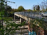
Stub Canal Bridge The bridge crosses the Stub Canal between the Saarlandstrasse underground station and the Barmbek underground and suburban railway station. |
Street |
Barmbek-Nord ( 53 ° 35 ′ 16 ″ N, 10 ° 2 ′ 7 ″ E ) |
|
|
Stoltenbrücke (S711) The bridge is named after the Stoltenstrasse, which crosses the Autobahn 24 here . |
Street |
Marienthal ( 53 ° 33 ′ 49 ″ N, 10 ° 5 ′ 41 ″ E ) |
|

|
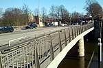
Streekbrücke A Streek stands in Low German for a dash, a line, a row or - as in this case - a section. |
Street |
Harvestehude , Winterhude ( 53 ° 35 ′ 1 ″ N, 9 ° 59 ′ 43 ″ E ) |
|
|
Süderstraßenbrücke With this bridge, the street of the same name crosses the flood basin in Hammerbrook. |
Street |
Hammerbrook ( 53 ° 32 ′ 44 ″ N, 10 ° 1 ′ 54 ″ E ) |