
Lohbach (Schwarzach)
| Lohbach | ||
 Lohbach near Großschwarzenlohe |
||
| Data | ||
| Water code | DE : 2421692 | |
| location |
Middle Franconian basin
|
|
| River system | Rhine | |
| Drain over | Schwarzach → Rednitz → Regnitz → Main → Rhine → North Sea | |
| Supreme source | east of Großschwarzenlohe in the Kessel forest between the Herres and Wasserforst mountains 49 ° 19 ′ 50 ″ N , 11 ° 9 ′ 25 ″ E |
|
| Source height | approx. 353 m above sea level NN | |
| muzzle | At the Erichmühle von Großschwarzenlohe from the left into the lower Schwarzach coordinates: 49 ° 20 '31 " N , 11 ° 6' 33" E 49 ° 20 '31 " N , 11 ° 6' 33" E |
|
| Mouth height | approx. 320 m above sea level NN | |
| Height difference | approx. 33 m | |
| Bottom slope | approx. 7.5 ‰ | |
| length | 4.4 km | |
| Catchment area | approx. 11 km² | |
The Lohbach is a year-round flowing water of the 3rd order on the edge of the municipal area of Schwanstetten and on that of Markt Wendelstein in the Middle Franconian district of Roth in Bavaria , which flows from the left and west into the lowest Schwarzach at the Erichmühle near Großschwarzenlohe .
Surname
The name, which, like that of the name-giving place Großschwarzenlohe, contains the basic word Lohe for “embers, flame, clearing” in the identifier, is derived from the charcoal burner that used to be extensively operated there.
geography
The Lohbach flows roughly from east to west and collects all forest ditches between the woods Eichenbühl and Ratzenwinkel of the Kessel forest , both to Leerstetten , and the numerous meadow ditches southeast and south of Großschwarzenlohe over a total distance of 4 to 5 kilometers .
Source branches
The Lohbach has three larger spring branches. The longest rises at about 353 m above sea level. NN 1.5 km south of Raubersried in a larger wooded area between the Gewannen Wasserfurche on this side and Herres on the other side of the municipal boundary to Schwanstetten , which are in the Kessel forest . The stream that is created here runs to the west, soon leaves the forest and then takes the meadow at about 342 m above sea level. NN the first of the other two branches from the right, which is about 350 m above sea level. NN 800 meters south of Raubersried already flows in the open corridor from a small pond at the substation and in a right-angled, approximately 1.0 km long trench approaches the main course, which is already about 1.2 km long here.
After about a further 0.8 km west of the river flows from the right from a gap between the forest Kessel and the forest island of Ratzenwinkel to the west at about 337 m above sea level. NN the third upper course. It rises in the swampy mixed wood of Eichenbühl in the Kessel forest from a spring that was first taken in 1934 and then flows through the approximately 0.2 ha large settlement pond on the border with the corridor, which the Leerstetten fire brigade used as a reservoir for extinguishing water in the 18th century. Measured from this pond, this branch has a length of around 0.8 km, on which it initially feeds the approximately 0.3 ha large angle pond , which is used for fish farming and local recreation and is heavily reed on the west bank. The further course to the north is straightened nowadays and, like the branches and meadow ditches flowing in from the east, is regularly kept free of vegetation in late winter by the farmers of the adjacent properties.
Further course

In the above-mentioned Ratzenwinkel wood , further ground and surface water escapes in a swampy area, which flows into the Lohbach in a short run from the south. Where the stream continues downwards to the southern edge of the settlement area of Großschwarzenlohe, another, unstable tributary runs in from the right, which rises in a branch on the Birkenweg at the edge of the village and runs along the settlement boundary or a little in front of it. From here on there is no more regulation of vegetation. The stream that now follows the edge of the settlement is heavily covered with bushes and lined with old trees: Linden, alder, beech and oak alternate up to the distillery site. Up to this point it is only very slightly notched into the terrain and is considered to be moderately polluted , with moderate pollution, good oxygen supply, very high biodiversity and a high number of individuals including algae, snails, small crabs, insect larvae and fish; Aquatic plants cover larger areas.
The stream then absorbs the clarified sewage from the distillery and immediately flows around the Großschwarzenloh village pond, which it also feeds in an adjustable bypass. This used to be used by the Großschwarzenlohe fire brigade as an extinguishing water reservoir and is now used for fish farming and local recreation. From here the Lohbach, deeply indented between the old trees, runs parallel to the Goldweg.
The stream is now critically polluted , especially by faeces, since dogs are carried out to defecate on the Goldweg and Zeisigweg, which brings in organic, oxygen-sapping substances; Fish killing is possible due to the resulting lack of oxygen, a decline in the number of macrophytes and a tendency towards mass development of individual plant and animal species can be observed .

In the local area of Großschwarzenlohe, the further course is largely covered, it crosses under the district road RH 1 in the old town in order to follow the western border of the village to the north. Soon it changes back to the west and then flows out to about 320 m above sea level. NN below the Erichmühle , opposite the sewage treatment plant at Kleinschwarzenlohe in the Schwarzach coming from the northeast . At the Schaftnacher Weg a shorter left estuary branches off to the left, which was artificially dug in the 19th century in order to be able to better direct the floods that recur in the meadow grounds into the lower Schwarzach as a receiving water . The second branch of the estuary is not yet recorded in the Bavarian original cadastre from 1808.
Catchment area
The Lohbach drains an area of about 11 km² westwards into the lower Schwarzach. Its northern competitor is an apparently nameless stream, which runs through the Stockwiesen between Raubersried and Wendelstein westward to Schwarzach and rises northeast of the uppermost Lohbach spring at Rotbühl in the forest. More important is the Hembach in the southeast of the catchment area, the last major tributary of the Rednitz before the Schwarzach absorbs it. In the south the short Hirtengraben also runs westwards to the Rednitz, in the southwest the not much longer Ödweihergraben from near Leerstetten again to the Schwarzach.
The highest point in the catchment area lies south of the Rotbühl in the forest between Raubersried and Sperberslohe at about 386 m above sea level. NN on the watershed to the Hembach.
Around half of the catchment area is wooded, especially the parts of the forest Kessel in the southeast and east, next to it the much smaller forest islands Ratzenwinkel and Lohe in the corridor in front. Only the old town of Großschwarzenlohe is located directly on the creek, Raubersried on the northern watershed and Leerstetten on the southern, which belongs to the municipality of Schwanstetten , are the only municipality with a territorial share alongside Markt Wendelstein with the other places mentioned.
Attractions
- At the bridge on the county road RH 1 in southern Großschwarzenlohe stood helmet Cross in Großschwarzenlohe from the year 1511. It was re-erected in bridge work in 1907 and finally after the Second World War on the occasion of renovation work on the bridge to the war memorial translocated , where also the Schwedenkreuz from the 16th century.
Flora and fauna
In its upper part, the Lohbach is a refuge for dragonflies, breeding birds, a variety of young fish, amphibians and small reptiles. In the twilight it is often used by red deer as a watering place.

Angular pond with hawk - breeding pair, looking towards the settlement pond and spring

Fish pond on the Lohbach
Water snails in the Lohbach

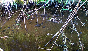
Tadpoles in the Lohbach

Fish pond with a view of Leerstetten

Atonement cross, war memorial and wayside shrine


Landscape and nature protection
Both the source and the mouth of the Lohbaches lie in the conservation area protection of the landscape in the area of the district Roth - Southern Mittelfränkisches basin east of the Swabian Rezat and Rednitz with the foothills of the Middle Franconian (LSG East) . (LSG-00428.01) The middle course may be used for agriculture, forestry and fishing and hunted outside of the protection times, but not built over.
Individual evidence
- ^ Franz Tichy : Geographical Land Survey: The natural spatial units on sheet 163 Nuremberg. Federal Institute for Regional Studies, Bad Godesberg 1973. → Online map (PDF; 4.0 MB)
- ↑ a b Height according to the contour diagram on the BayernAtlas. See the → web links .
- ↑ a b c d e Length measured on the BayernAtlas.
- ↑ Height measured on the BayernAtlas.
- ^ 'Waters in the district of Roth' water register of the government of Middle Franconia, accessed on January 16, 2015
- ↑ Lohbach source
- ↑ a b Area measured on the BayernAtlas.
- ↑ Water quality in the district of Roth , accessed on March 4, 2016
- ↑ Sühnekreuz, Lohbach , Hillegeist, Hartwig - Boddenkmäler im Wendelsteiner Raum, in: Issue No. 10, 2011, p. 34