Maja e Çikës
| Maja e Çikës | ||
|---|---|---|
|
West flank |
||
| height | 2045 m above sea level A. | |
| location | Vlora Qark , Albania | |
| Mountains | Ceraunian Mountains | |
| Coordinates | 40 ° 12 ′ 0 ″ N , 19 ° 37 ′ 0 ″ E | |
|
|
||
| rock | limestone | |
| Normal way | Northwest ridge from the Llogara pass | |
|
The mountain seen from the coast |
||
|
Ridge north of the summit with this one in the background |
||
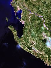
The Maja e Çikës ( Albanian for girls tip ) is 2045 m above sea level. A. the highest point of the Ceraunic Mountains in southwest Albania . The peak is part of the Mountain Stocks of Mali i Cikes ( German Girls Mountain ), located in the north of the Albanian Riviera parallel to the coast, which he separated from the hinterland, from southeast to northwest in the direction of Vlora stretches.
Location and relief
The Mali i Çikës drops steeply to the west to the Ionian Sea : a height difference of more than 2000 meters over around five kilometers. The mountain has steep cliffs, especially in the upper part. The striking mountain shapes the steep coast of the touristically important Albanian Riviera. On the east side, too, the mountain drops almost as steeply into the Shushica valley . The second highest elevation of Mali i Çikës is the Maja e Qorrës with 2018 m above sea level. A.
In the area of Mali i Çikës the Ceraunic Mountains are divided; the coastal western chain is also called Akroceraunisches Gebirge and ends in the Karaburun peninsula , which separates the bay of Vlora from the open sea. In the north, the eastern chain continues in the Lungara Mountains. Immediately to the west of the Çika , at the Llogara Pass ( 1027 m above sea level ), the Akroceraunische Mountains are overcome.
The Maja e Çikës is mostly covered with snow until the summer. Cirques are evidence of glaciation during the Ice Age. From the top there is a wide panorama over the whole Albanian Riviera to the island of Corfu .
Flora and vegetation
The western flank of Mali i Çikës is overgrown with pine forest north of the Llogara Pass at heights of up to 1,800 meters , in which black pines , Bulgarian firs and snake pines occur. This area is part of the Llogara National Park . Macchie spreads up to 800 meters on the mountainside. On the west side there is a lot of cork oak (Quercus macrolepis) between 400 and 900 meters above sea level . Common mountain shrubs include box , yew , holm oak , juniper and ilex . Also sycamore occurs. An endemic species in the Çika and Llogara area is Hypericum hapllophyllioides , a St. John's wort . The highest regions on the mountain range are without vegetation. Deer and chamois as well as golden eagles and griffon vultures live in the high, wild areas .
Web links
Individual evidence
- ↑ a b c d e Herbert Louis: Albania - a study of the country mainly on the basis of personal trips , published by J. Engelhorn's successors in Stuttgart, Berlin 1927
- ↑ Akademia e Shkencave e RPSSH (ed.): Gjeografia fizike e Shqipërisë . tape 2 : Vështrim fiziko-gjeografik krahinor. Tirana 1991, p. 400 ff .
- ↑ a b Wolfgang Fremuth (Ed.): Albania - Guide to it's Natural Treasures . Herwig Klemp Publishing House, Tirana 2000, ISBN 3-931323-06-4 .


