
Maniowy
| Maniowy | |||
|---|---|---|---|
 Help on coat of arms |
|
||
| Basic data | |||
| State : | Poland | ||
| Voivodeship : | Lesser Poland | ||
| Powiat : | Nowy Targ | ||
| Gmina : | Czorsztyn | ||
| Geographic location : | 49 ° 28 ' N , 20 ° 16' E | ||
| Height : | 556 m npm | ||
| Residents : | 2380 | ||
| Telephone code : | (+48) 18 | ||
| License plate : | KNT | ||

Maniowy is a village with a Schulzenamt of the municipality Czorsztyn in the powiat Nowotarski of the Lesser Poland Voivodeship in Poland .
geography
The place is located on the northern bank of the Czorsztyn reservoir (originally the place was on Dunajec ) on the southern slopes of the Gorce in the Podhale region on the voivodship road 969 from Nowy Targ to Nowy Sącz .
history
The place was first mentioned in 1351 as de Nigro , then as Manowe (1355), Swarcz (1409), Maniów (1414), Manyowa (1422), Mnyow (1527), Mianiovy (1529), Maniowy, Manow (1551) , Czarna Maniowa (1551), Maniowi Wysze (1563), Maniowicze, Maniów (1581). Initially the village was named after the locator Hynek, nickname Czarny (lat. Niger = "the black"): Nigrum , Swarcz , Czarne (lat., German or Polish: "black [village]"). Hynek de Niger first founded the village of Kluszkowce in 1320, then probably followed in the years 1324 to 1349 the foundation of Maniowy under German law on 38 Franconian Hufen . Then the name changed possessively (-owe, -owa, ów, -owy, uniquely patronymic -owice) derived from the personal name Mań .
The village initially belonged to the Kingdom of Poland (from 1569 the aristocratic republic of Poland-Lithuania ), Kraków Voivodeship , Sącz District. During the first partition of Poland in 1772, the new Kingdom of Galicia and Lodomeria of the Habsburg Empire came into being (from 1804). From 1855 it belonged to the Nowy Targ district .
In 1918, after the end of the First World War and the collapse of the Austro-Hungarian monarchy, the village became part of Poland. This was only interrupted by the occupation of Poland by the Wehrmacht in World War II . From 1975 to 1998 Maniowy was part of the Nowy Sącz Voivodeship .
Before the reservoir was built, the inhabitants were relocated to where they are today. The new location was created on the drawing board. The original village is now at the bottom of the reservoir.
tourism
Since the construction of the reservoir, tourism has played an increasingly important role. The tourist infrastructure is well developed. Some old buildings, such as the baroque wooden church of Saint Sebastian, were moved to the new location. The new modern church is dedicated to St. Nicholas.
water sports
The place has access to the swimming lake. There is a boat dock. It is possible to rent sailboats and kayaks.
Winter sports
A factory that makes snow cannons is located in the village. There are several small lifts.
gallery

Access to the Gorce

View from the Pienines

View from the Pienines

Wooden church

Modern church
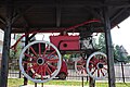
Old fire engine

.jpg)


.jpg)
.jpg)
Web links
Individual evidence
- ↑ a b c Tomasz Jurek (editor): MANIOWY ( pl ) In: Słownik Historyczno-Geograficzny Ziem Polskich w Średniowieczu. Edycja elektroniczna . PAN . 2010-2016. Retrieved April 22, 2019.
- ↑ Bogusław Krasnowolski, Zasady lokacyjnego rozmierzenia wsi podhalańskich [Principles Applied for the Measuring out of Podhalanian Villages Founded between Nowy Targ and Krościenko], [in:] Późne średniowiecze w Karpatach polskich 2007, Rzeszów 2007, Rzeszów 2007.
- ↑ Kazimierz Rymut , Barbara Czopek-Kopciuch: Nazwy miejscowe Polski: historia, pochodzenie, zmiany . 6 (L-Ma). Polska Akademia Nauk . Instytut Języka Polskiego, Kraków 2005, p. 500 (Polish, online ).
Czorsztyn | Huba | Kluszkowce | Maniowy | Mizerna | Sromowce Niżne | Sromowce Wyżne