Meighen Island
| Meighen Island | |
|---|---|
| Satellite image | |
| Waters | Arctic Ocean |
| Archipelago | Queen Elizabeth Islands |
| Geographical location | 79 ° 59 ′ N , 99 ° 30 ′ W |
| length | 48 km |
| width | 24 km |
| surface | 955 km² |
| Highest elevation | Meighen Icecap 268 m |
| Residents | uninhabited |
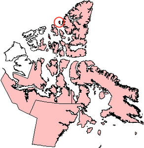
| Map of Meighen Island | |
Meighen Island is an island in the Canadian territory of Nunavut and belongs to the Queen Elizabeth Islands .
geography
The island is 955 km² in size, 48 km long and 13 to 24 km wide. It is separated from Axel Heiberg Island in the east by the 40 km wide Sverdrup Canal and from Amund Ringnes Island and Ellef Ringnes Island in the south by the Peary Canal . In the north of it is the small crescent-shaped island of Perley Island .
Meighen Island has an 80 km² ice cap . In the southern part of the Meighen Icecap , the island reaches its highest point at 268 m. At the eastern edge of the ice cap, the Broken Hills range extends from north to south . Tiptop Hill dominates the western part of the island . From the edge of the ice cap, flowing waters lead in all directions to the coast. Named rivers are the Krueger River , which flows into Bjare Bay to the southwest , and the Decca River, which drains to the west .
history
Meighen Island was discovered by Vilhjálmur Stefánsson on June 13, 1916 . In 1921 it was named after the Canadian Prime Minister Arthur Meighen . In 1957 , in a cairn erected by Stefansson, the last known message from the German polar explorer Hans Krüger was discovered , who, like his two companions, has been missing since 1930.
Individual evidence
- ↑ The Atlas of Canada - Sea Islands ( Memento from January 22, 2013 in the Internet Archive ) (English)
- ↑ The Atlas of Canada - Glaciers and Icefields ( Memento of January 22, 2013 in the Internet Archive ) (English)
- ↑ WSB Paterson: A temperature profile through the Meighen Ice Cap, Arctic Canada (PDF; 451 kB). Union de Géodésie et Géophysique Internationale. Association Internationale d'Hydrologie Scientifique. Assemblée Générale de Berne, September 25 - October 7, 1967. Rapports et discussions, pp. 440-449.
- ↑ Meighen Icecap on Bivouac.com Mountain Page
- ^ Traveling Luck World Index
- ^ William James Mills: Exploring Polar Frontiers - A Historical Encyclopedia . tape 1 . ABC-CLIO, 2003, ISBN 1-57607-422-6 , pp. 632 ( limited preview in Google Book search).
- ^ William James Mills: Exploring Polar Frontiers - A Historical Encyclopedia . tape 1 . ABC-CLIO, 2003, ISBN 1-57607-422-6 , pp. 13 ( limited preview in Google Book search).
Web links
- Meighen Island ( memento of August 26, 2012 in the Internet Archive ) in the island encyclopedia www.oceandots.com (English)


