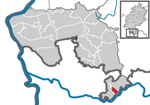
Michelbuch (unincorporated area)
Michelbuch is a municipality-free area in the Bergstrasse district in Hesse and, with the municipality code 06 4 31 200, is on a par with the other municipalities in the district. It is an uninhabited forest area.
Geographical location
The municipality-free area Michelbuch is located in the southern exclave of the Bergstrasse district in the Odenwald north of the Neckar and includes the district of the same name (Gmk.-Nr. 63031) with an area of 484 hectares, of which 482 hectares are used as forest area. In the Klafterwald on the northeastern border, the district reaches a height of 468 meters. The only residential building in the district is the Michelbuch forest house . In the south of the forest area, the former Hundheim Castle stood on a mountain spur above the Neckar valley .
Michelbuch borders the city of Hirschhorn (Neckar) to the north and east , and the Neckarsteinach districts of Neckarhausen , Darsberg and Grein to the south and west .
status
Michelbuch consists of a forest area owned by the Evangelical Foundation Care Schönau in Heidelberg , whose assets are dedicated to the Evangelical Church in Baden .
In a state treaty between the former Grand Duchies of Baden and Hesse dated May 11, 1903 (Grand Duchy of Hessian Government Gazette 1904, p. 410), the Grand Duchy of Hesse undertook to keep the former Baden enclave of Michelbuch as a "separate (independent) district ".
See also
Web links
- Michelbuch, Bergstrasse district. Historical local dictionary for Hesse (as of June 17, 2014). In: Landesgeschichtliches Informationssystem Hessen (LAGIS). Hessian State Office for Historical Cultural Studies (HLGL), accessed on July 18, 2014 .
Individual evidence
- ↑ Hessian municipal statistics 2014 GKZ, area and land use of Michelbuch on page 33 of the PDF file 1.43 MB
Coordinates: 49 ° 26 '2 " N , 8 ° 51' 43" E


