
Gorxheimertal
| coat of arms | Germany map | |
|---|---|---|

|
Coordinates: 49 ° 32 ' N , 8 ° 43' E |
|
| Basic data | ||
| State : | Hesse | |
| Administrative region : | Darmstadt | |
| Circle : | Mountain road | |
| Height : | 222 m above sea level NHN | |
| Area : | 10.45 km 2 | |
| Residents: | 4110 (Dec. 31, 2019) | |
| Population density : | 393 inhabitants per km 2 | |
| Postal code : | 69517 | |
| Area code : | 06201 | |
| License plate : | HP | |
| Community key : | 06 4 31 008 | |
| Community structure: | 3 districts | |
| Address of the municipal administration: |
Siedlungsstraße 35 69517 Gorxheimertal |
|
| Website : | ||
| Mayor : | Uwe Spitzer ( independent ) | |
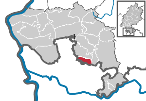
| Location of the municipality of Gorxheimertal in the Bergstrasse district | ||
  |
||


Gorxheimertal is a municipality in the Hessian Odenwald . It belongs to the Bergstrasse district and is therefore part of the Rhine-Neckar metropolitan region and the Rhine-Main metropolitan region . The nearest major cities are Mannheim (23 km) and Heidelberg (25 km).
geography
Geographical location
The municipality of Gorxheimertal lies elongated in the Grundelbach valley . This is located in the Odenwald. The transition to the next larger city, Weinheim , located directly to the west , is also the transition between Odenwald and Bergstrasse and between Hesse and Baden-Württemberg .
The Grundelbach flows through the Gorxheimertal . The two mountains Waldskopf and Daumberg rise at the eastern tip of the Trösel district and border the Gorxheimertal in the east.
Neighboring communities
Gorxheimertal borders in the north on the municipality of Birkenau (districts Buchklingen and Löhrbach ), in the east on the municipality Abtsteinach , in the southeast on the municipality Heiligkreuzsteinach and in the south and west on the city of Weinheim (both Rhein-Neckar-Kreis in Baden-Württemberg).
Community structure
The community consists of the districts Gorxheim , Unter-Flockenbach and Trösel .
history
overview
Around 900 Unter-Flockenbach was first mentioned as a forest hoof village, in 1071 Trösel as an open row hoof village. The place Gorxheim was first mentioned in 1486 in connection with a copper mine located there . Originally owned by the Lorsch Monastery , the lands were transferred to Kurmainz in 1232 , to the Electoral Palatinate in 1463 and back to Mainz in 1623. The jurisdiction and sovereign administration were exercised by the Abtsteinach district . In 1803 the valley came to the Landgraviate of Hesse-Darmstadt, which later became the Grand Duchy of Hesse . Here it belonged to the district of Lindenfels and later to the districts of Lindenfels and Heppenheim , which was renamed in 1938 to today's Bergstrasse district.
- For the history of the districts, see:
- History of Gorxheim
- History of Unter-Flockenbach
- Story of Trösel
Church building
On December 31, 1970, the municipalities of Gorxheim and Unter-Flockenbach merged to form the municipality of Grundelbachtal , which merged with the municipality of Trösel on December 31, 1971 to form today's municipality of Gorxheimertal. Local districts were not formed.
population
Population structure
According to the 2011 census , there were 4056 inhabitants in Gorxheimertal on May 9, 2011. These included 283 (6.7%) foreigners, of whom 167 came from outside the EU , 66 from other European countries and 50 from other countries. The inhabitants lived in 1805 households. Of these, 505 were single households , 536 couples without children and 587 couples with children, as well as 154 single parents and 23 shared apartments . 895 inhabitants belonged to the Protestant (22.1%) and 2282 inhabitants of the Catholic (54.9%) denomination.
Population development
| Gorxheimertal: Population from 1970 to 2015 | ||||
|---|---|---|---|---|
| year | Residents | |||
| 1970 | 3,598 | |||
| 1976 | 3,777 | |||
| 1984 | 3,910 | |||
| 1992 | 4.151 | |||
| 2000 | 4,200 | |||
| 2005 | 4.117 | |||
| 2010 | 3,990 | |||
| 2011 | 4,056 | |||
| 2015 | 4.151 | |||
| Sources: see the following list | ||||
- In 1970 the municipalities united in the municipality of Gorxheimertal had 3598 inhabitants.
- In the local elections in 1977, as of June 1976, 3777 inhabitants were taken as the basis.
- In the local elections in 1985, as of June 30, 1984, 3910 inhabitants were assumed.
- In the local elections in 1993, as of March 31, 1992, 4151 inhabitants were assumed.
- The Hessian community encyclopedia names for the year 2000: 4200 inhabitants.
- According to the Hessian State Statistical Office, 4117 inhabitants lived in Gorxheimertal on June 30, 2005.
- The Hessian State Statistical Office reported for June 30, 2010: 3990 inhabitants.
- The 2011 census counted 4056 inhabitants.
- As of June 30, 2015, the Hessian State Statistical Office reports 4151 inhabitants.
Gainful employment
The municipality in comparison with the district, administrative district Darmstadt and Hesse:
| year | local community | district | Administrative district | Hesse | |
|---|---|---|---|---|---|
| Employees subject to social security contributions | 2018 | 305 | 75.286 | 1,740,388 | 2,584,005 |
| Change to | 2000 | −21.0% | + 20.9% | + 19.2% | + 18.8% |
| of which full-time | 2018 | 57.4% | 70.6% | 72.6% | 71.5% |
| of which part-time | 2018 | 42.6% | 29.4% | 27.4% | 28.5% |
| Only marginally paid employees | 2018 | 139 | 15,568 | 222,301 | 369,892 |
| Change to | 2000 | + 21.9% | −4.6% | + 8.1% | + 7.9% |
| Branch | year | local community | district | Administrative district | Hesse |
|---|---|---|---|---|---|
| Manufacturing | 2000 | 37.6% | 39.6% | 27.0% | 30.6% |
| 2018 | *) | 32.1% | 20.4% | 24.3% | |
| Commerce, hospitality and transport | 2000 | 21.5% | 25.1% | 26.4% | 25.1% |
| 2018 | 29.5% | 25.8% | 24.7% | 23.8% | |
| Business services | 2000 | 20.7% | 11.6% | 25.1% | 20.2% |
| 2018 | 21.6% | 15.3% | 31.7% | 26.2% | |
| other services | 2000 | 19.4% | 22.0% | 20.1% | 22.5% |
| 2018 | 33.1% | 25.1% | 22.8% | 25.2% | |
| Other (or without assignment) | 2000 | 0.8% | 1.7% | 1.4% | 1.5% |
| 2018 | 15.7% | 1.1% | 0.3% | 0.4% |
*) anonymized
politics
Community representation
The local elections on March 6, 2016 produced the following results, compared to previous local elections:
| Parties and constituencies | % 2016 |
Seats 2016 |
% 2011 |
Seats 2011 |
% 2006 |
Seats 2006 |
% 2001 |
Seats 2001 |
||
|---|---|---|---|---|---|---|---|---|---|---|
| Pro valley | Pro-Gorxheimertal | 46.6 | 8th | 35.6 | 6th | 29.3 | 5 | - | - | |
| CDU | Christian Democratic Union of Germany | 26.5 | 4th | 33.6 | 6th | 37.4 | 6th | 53.9 | 12 | |
| SPD | Social Democratic Party of Germany | 26.9 | 5 | 30.8 | 5 | 33.3 | 6th | 46.1 | 11 | |
| total | 100.0 | 17th | 100.0 | 17th | 100.0 | 17th | 100.0 | 23 | ||
| Voter turnout in% | 39.4 | 44.1 | 41.4 | 46.7 | ||||||
mayor
The following mayors have been in office since the Gorxheimertal municipality was founded:
- 1972–1981 Adam Flößer
- 1982–1999 Germaid Fitz
- since 2000 Uwe Spitzer
coat of arms
The municipality of Gorxheimertal adopted the Trösel coat of arms when it was founded.
Land use
The municipality covers a total area of 1045 hectares, of which in hectares are:
| Type of use | 2011 | 2015 | |
|---|---|---|---|
| Building and open space | 95 | 95 | |
| from that | Living | 78 | 77 |
| Business | 0 | 0 | |
| Operating area | 1 | 1 | |
| from that | Mining land | 0 | 0 |
| Recreation area | 4th | 4th | |
| from that | Green area | 1 | 1 |
| traffic area | 45 | 45 | |
| Agricultural area | 377 | 377 | |
| from that | moor | 0 | 0 |
| pagan | 0 | 0 | |
| Forest area | 511 | 511 | |
| Water surface | 2 | 2 | |
| Other use | 10 | 10 | |
literature
- Literature about Gorxheimertal in the Hessian Bibliography
- Literature from and about Gorxheimertal in the catalog of the German National Library
Web links
- Gorxheimertal, Bergstrasse district. Historical local dictionary for Hessen. In: Landesgeschichtliches Informationssystem Hessen (LAGIS).
- Information on the community of Gorxheimertal. In: Hessisches Gemeindelexikon. HA Hessen Agentur GmbH , 2016.
Individual evidence
- ↑ Hessian State Statistical Office: Population status on December 31, 2019 (districts and urban districts as well as municipalities, population figures based on the 2011 census) ( help ).
- ↑ Karl-Heinz Meier barley, Karl Reinhard Hinkel: Hesse. Municipalities and counties after the regional reform. A documentation . Ed .: Hessian Minister of the Interior. Bernecker, Melsungen 1977, DNB 770396321 , OCLC 180532844 , p. 205 .
- ^ A b Population according to nationality groups: Gorxheimertal. In: Zensus2011. Bavarian State Office for Statistics , accessed in July 2015 .
- ^ Households by family: Gorxheimertal. In: Zensus2011. Bavarian State Office for Statistics , accessed in July 2015 .
- ^ Religious affiliation : Gorxheimertal. In: Zensus2011. Bavarian State Office for Statistics , accessed in July 2015 .
- ↑ Gorxheimertal, Bergstrasse district. Historical local dictionary for Hessen. (As of June 1, 2018). In: Landesgeschichtliches Informationssystem Hessen (LAGIS).
- ↑ Local elections 1977; Relevant population figures for the municipalities as of December 15, 1976 . In: The Hessian Minister of the Interior (ed.): State Gazette for the State of Hesse. 1976 No. 52 , p. 2283 , point 1668 ( online at the information system of the Hessian state parliament [PDF; 10.3 MB ]).
- ^ Local elections 1985; Relevant population of the municipalities as of October 30, 1984 . In: The Hessian Minister of the Interior (ed.): State Gazette for the State of Hesse. 1984 No. 46 , p. 2175 , point 1104 ( online at the information system of the Hessian state parliament [PDF; 5.5 MB ]).
- ↑ local elections 1993; Relevant population of the municipalities as of October 21, 1992 . In: The Hessian Minister of the Interior (ed.): State Gazette for the State of Hesse. 1992 No. 44 , p. 2766 , point 935 ( online at the information system of the Hessian state parliament [PDF; 6.1 MB ]).
- ↑ a b municipality data sheet: Gorxheimertal. (PDF; 222 kB) In: Hessisches Gemeindelexikon. HA Hessen Agency GmbH
- ^ The population of the Hessian communities (June 30, 2005). In: Hessian State Statistical Office . Archived from the original .
- ^ The population of the Hessian communities (June 30, 2010). In: Hessian State Statistical Office . Archived from the original .
- ^ The population of the Hessian communities (June 30, 2015). In: Hessian State Statistical Office . Archived from the original .
- ^ Result of the municipal elections on March 6, 2016. 431008 Gorxheimertal. Hessian State Statistical Office, accessed in April 2016 .
- ^ Result of the municipal election of March 27, 2011. 431008 Gorxheimertal. Hessian State Statistical Office, accessed in November 2019 .
- ^ Result of the municipal election of March 26, 2006. 431008 Gorxheimertal. Hessian State Statistical Office, accessed in November 2019 .
- ↑ Results of the municipal elections of 2001 and 1997. (No longer available online.) Hessian State Statistical Office, archived from the original ; accessed in October 2019 .
- ↑ Direct elections in Gorxheimertal. Hessian State Statistical Office , accessed in January 2020 .
- ↑ Hessisches Statistisches Informationssystem In: Statistics.Hessen.

Abtsteinach | Bensheim | Biblis | Birkenau | Bürstadt | Einhausen | Fürth | Gorxheimertal | Grasellenbach | Gross-Rohrheim | Heppenheim (Bergstrasse) | Hirschhorn (Neckar) | Lampertheim | Lautertal (Odenwald) | Lindenfels | Lorsch | Mörlenbach | Neckarsteinach | Rimbach | Viernheim | Wald-Michelbach | Zwingenberg
Non- parish area in the Bergstrasse
Michelbuch district