Miramichi River
|
Miramichi River Rivière Miramichi |
||
|
Centennial (Miramichi) Bridge at Newcastle |
||
| Data | ||
| location | New Brunswick (Canada) | |
| River system | Miramichi River | |
| Confluence of |
Northwest and Southwest Miramichi Rivers 46 ° 58 ′ 0 ″ N , 65 ° 35 ′ 0 ″ W |
|
| Source height | approx. 3 m | |
| muzzle |
Miramichi Inner Bay ( Gulf of Saint Lawrence ) Coordinates: 47 ° 5 ′ 0 ″ N , 65 ° 22 ′ 0 ″ W 47 ° 5 ′ 0 ″ N , 65 ° 22 ′ 0 ″ W |
|
| Mouth height | 0 m | |
| Height difference | approx. 3 m | |
| Bottom slope | approx. 0.12 ‰ | |
| length | 25 km (including source rivers 217 km) | |
| Catchment area | 12,390 km² (13,465 km² in relation to Miramichi Inner Bay) | |
| Small towns | Miramichi | |
|
Map with the location of the Miramichi River |
||
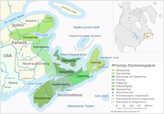
The Miramichi River ( French Rivière Miramichi ) is a river in the east-central part of the Canadian province of New Brunswick . The river has a length of 25 km (including headwaters: 217 km) and a catchment area of 13,465 km². The river flows into the Miramichi Inner Bay of the Gulf of Saint Lawrence . The name comes from the Montagnais words "Maissimeu Assi" (meaning " Mi'kmaq country").
geography
The Miramichi River drains about 23 percent of the territory of the New Brunswick Province with 12,390 km² (13,465 km² for Miramichi Inner Bay). 300 km² includes the estuary and the inner part of Miramichi Bay . The catchment area roughly corresponds to Northumberland County and parts of Victoria County , Carleton County and York Counties and smaller parts of Gloucester County and Sunbury County .
The Miramichi River measures 217 km, including the headwaters. It arises at the confluence of its two headwaters, the Southwest and Northwest Miramichi River . The tides can be felt over the entire section of the river and in the lower area of the source rivers.
Tributaries
Notable rivers in the Miramichi River system are:
Bartibog River , Napan River and Bay du Vin River flow directly into the Miramichi Inner Bay.
fauna
In the river system of the Miramichi River, the Atlantic salmon ( Salmo salar ) occurs, which can be caught while fly fishing . Furthermore, the river system forms the only known spawning area of an isolated population in the St. Lawrence Gulf of Morone saxatilis .
Other threatened animal species that use the river as a habitat are the yellow-footed plover ( Charadrius melodus ), the freshwater mussel species Alasmidonta varicosa and the forest turtle ( Glyptemys insculpta ).
Web links
- Miramichi River at Natural Resources Canada
Individual evidence
- ↑ a b c Natural Resources Canada - Rivers
- ↑ a b c d e f Water Classification - Southwest Miramichi, Year 1 Report, 2010–2011 (PDF, 1.3 MB) Miramichi River Environmental Assessment Committee. Retrieved October 21, 2018.
- ^ Rayburn, A. (1975) Geographical Names of New Brunswick. Toponymy Study 2. Surveys and Mapping Branch, Energy Mines and Resources Canada, Ottawa
- ↑ Geographical Names of Canada - ( Memento of the original dated February 7, 2009 in the Internet Archive ) Info: The archive link was inserted automatically and has not yet been checked. Please check the original and archive link according to the instructions and then remove this notice.

