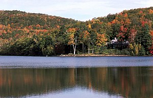
Mont Saint-Bruno
| Mont Saint-Bruno | |
|---|---|
|
The Lac Seigneurial near the summit |
|
| height | 218 m |
| location | Montérégie , Québec |
| Mountains | Montérégie hill |
| Notch height | 170 m |
| Coordinates | 45 ° 33 '20 " N , 73 ° 18' 39" W |
| Type | Inselberg |
| rock | Intrusive magmatite |
| Age of the rock | 118–138 million years |
The Mont Saint-Bruno is a 218 meter high hill in the Canadian province of Québec . It is located 20 kilometers east of Montreal and belongs to the Montérégie hills . The hill protrudes around 170 meters from the surrounding plain. The summit area is under nature protection and forms the 5.9 km² Parc national du Mont-Saint-Bruno .
geography
Mont Saint-Bruno lies on the territory of the municipalities of Saint-Bruno-de-Montarville (summit and south-east flank), Saint-Basile-le-Grand (south-east flank) and Sainte-Julie (north flank). While the hill flanks drop steeply, the summit area is heavily flattened. It also has several depressions in which the lakes Lac Seigneurial, Lac des Bouleaux, Lac du Moulin, Lac à la Tortue and Lac des Atocas lie. There is a quarry on the northwest flank . The Canadian Army operates a target range on the eastern flank.
The slopes and the summit plateau are covered with mixed forest, mainly beech , maple , oak , hickory , hemlock and pine . The IRDA, a research institute in the province of Québec, maintains an apple grove for scientific purposes.
geology
The hill was formed during the Cretaceous around 125 million years ago through the intrusion of igneous rock and horn rock . These are much more resistant to weathering than the surrounding sedimentary rock , which has been eroded over the course of millions of years. Dark-colored Mafit rocks such as gabbro and peridotite are therefore predominant, and in some places lighter rocks such as syenite .
Winter sports
On the north-west flank of the hill, next to the quarry, is the Ski Saint-Bruno winter sports area . It was opened in 1965 and is a popular destination due to its close proximity to Montreal. Eight chairlifts and ski lifts provide access to 15 slopes with a maximum height difference of 134 meters; there is also a fun park . All slopes are illuminated in the evening and can be artificially snowed. The ski school , the largest in Canada, has 550 instructors and 33,000 customers annually. Around the summit, there are 35 km of cross-country ski trails .
See also
Web links
- Parc national du Mont Saint-Bruno (French)
- Ski Saint-Bruno (French)
Individual evidence
- ^ Pierre Bédard: Geological map of Mont Saint-Bruno. (No longer available online.) Université du Québec à Montréal , archived from the original on December 16, 2013 ; Retrieved December 16, 2013 (French). Info: The archive link was inserted automatically and has not yet been checked. Please check the original and archive link according to the instructions and then remove this notice.

