
Monte Clivio
| Monte Clivio | ||
|---|---|---|
 Monte Clivio from the south |
||
| height | 739 m above sea level M. | |
| location | Varese Province , Italy / Canton Ticino , Switzerland | |
| Mountains | Varese pre-Alps | |
| Dominance | 1.08 km → Monte Rogòria | |
| Notch height | 103 m ↓ Cavagnino | |
| Coordinates , ( CH ) | 46 ° 0 '49 " N , 8 ° 47' 41" O ( 705019 / 96685 ) | |
|
||

The Monte Clivio , also called Sasso di Clivio , is a hill ( 739 m above sea level ) in the Vares Pre-Alps . It is located in the border area between Lombardy ( Italy ) and Ticino ( Switzerland ).
Location and surroundings
The summit and most of Monte Clivios are in the area of the municipality of Dumenza (Italy). Other parts of the hill belong to the Swiss municipalities of Astano and Monteggio . The border with Switzerland runs around 250 meters southeast of the summit.
On the summit there is a simple summit cross , a small chapel dedicated to St. Gratus of Aosta, and a high mast of an overhead line visible from afar , which connects the Musignano substation at the Roncovalgrande pumped storage power station with the Molino Mazzolio substation near Varese . East of the summit, the terrain falls only slightly, around 140 meters to just over 600 m above sea level. M. from, while in the west it is more than double up to around 450 m above sea level. M. drops steeply. The hill drains in the east over the Lisora into the Tresa and in the west over the Rio di Colmegna into Lake Maggiore . The view from Monte Clivio includes Lake Maggiore and, in good weather, the Monte Rosa massif .
Routes to the summit
The summit is accessible with a marked hiking trail. It bears the Italian hiking trail number 172A and branches around 100 meters above the church Santuario di Trezzo at 592 m above sea level. M. in a southerly direction from trail 172 between Dumenza and Astano.
history
From the 1890s, Italy built an extensive barrier on the border with Switzerland, which was intended to curb smuggling. A section of this border barrier, popularly known as “la Ramina”, ran over the south-eastern flank of Monte Clivio. It led from the border crossing Cavagno ( 388 m above sea level ) between Dumenza and Monteggio at over 700 m above sea level. M. about 200 meters as the crow flies below the summit and then to the border crossing Cavagnino ( 628 m above sea level ) between Dumenza and Astano. The remains of the facility can still be seen today.
photos

View from the summit in west direction

Summit cross

Path chapel on the summit
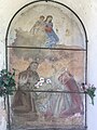
Fresco in the wayside chapel

Overhead line mast on the summit


Web links
Individual evidence
- ↑ a b c Geoserver of the Swiss Federal Administration ( information )
- ^ Giovanni Maria Staffieri: Astano. In: Malcantone. Testimonianze culturali nei comuni malcantonesi. Lugano-Agno 1985, p. 59.
- ^ Monte Clivio at www.peakfinder.org . Retrieved June 5, 2018.
- ↑ Monte Lema da Dumenza - Val Dumentina. In: Hikr.org. Retrieved June 5, 2018.
- ↑ Peter Jankovsky: Mussolini's chain link fence. In: Neue Zürcher Zeitung . June 11, 2013, p. 11.
- ^ Rolf Amgarten: About good and bad smugglers. In: Ticino newspaper . May 13, 2011, p. 5.
- ^ Paul Imhof: A monument in black and white, a hotel and La Gioconda. In: Geo Switzerland . Issue 7, 2014, pp. 5-6.