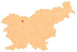
Naklo
|
Naklo Naklas |
|||
|
|||
| Basic data | |||
|---|---|---|---|
| Country |
|
||
| Historic region | Upper Carniola / Gorenjska | ||
| Statistical region | Gorenjska (Upper Carniola) | ||
| Coordinates | 46 ° 16 ′ N , 14 ° 18 ′ E | ||
| height | 407 m. i. J. | ||
| surface | 28.3 km² | ||
| Residents | 5,192 (2008) | ||
| Population density | 183 inhabitants per km² | ||
| Post Code | 4202 | ||
| License Plate | KR | ||
| Structure and administration | |||
| Mayor : | Ivan Štular | ||
| Website | |||
Naklo (German Naklas ) is a Slovenian municipality in the Ljubljana basin, near Kranj . Until the end of the Habsburg Empire, Naklo belonged to the Kronland Krain , whereby the place was part of the judicial district of Krainburg or the district of Krainburg .
Neighboring communities
City structure
Naklo consists of 13 districts:
- Bistrica, (German: "Feistritz")
- Cegelnica, (German: "brickworks")
- Gobovce, (German: "Graueneck")
- Malo Naklo, (German: "Klein Naklas")
- Naklo, (German: "Naklas")
- Okroglo, (German: "Okroglo near Krainburg")
- Podbrezje, (German: "Birkendorf in der Oberkrain")
- Polica, (German: "Politz")
- Spodnje Duplje, (German: "Nieder Duplach")
- Strahinj, (German: "Strochein")
- Zadraga, (German: "Sadraga")
- Zgornje Duplje (German: "Ober Duplach")
- Žeje (German: "Scheje bei Naklas")
Town twinning
-
 Nakło nad Notecią , Poland (2000)
traffic
Naklo is located near the intersection of the Ljubljana (Laibach) - Jesenice (Aßling) motorway and the Škofja Loka - Jezersko (Seebergsattel) road. It is located near the Ljubljana Brnik Airport .

