
Negeri Sembilan
|
|||||
  |
|||||
| Capital | Seremban | ||||
| Ruler | Tuanku Muhriz | ||||
| Prime Minister | Mohammad Hassan | ||||
| surface | 6,657 km² (2011) | ||||
| population | 1,021,064 inhabitants (2010) | ||||
| Population density | 153.4 inhabitants / km² | ||||
| languages | Malay | ||||
| License Plate | N | ||||


Negeri Sembilan (in Jawi نڬري سمبيلن, Pronunciation: [ˈnəgəri səmbiˈlan] , Negri Sembilan during British colonial times , literally translated: Nine States ) is a federal state of Malaysia . The capital of Negeri Sembilans is the city of Seremban . The royal residence is Seri Menanti in the Pilah district . Other well-known cities are Port Dickson and Nilai .
Location and geography
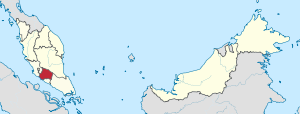
Negeri Sembilan is located on the southwest coast of the Malay Peninsula on the Strait of Malacca , around 50 km southeast of Malaysia's capital Kuala Lumpur . Negeri Sembilan borders the Malaysian state of Selangor to the west, Pahang to the north, Johor to the east and Malacca to the south .
history
The name "Negeri Sembilan" is derived from the nine earlier individual states or "Nagari" (today districts, "Luak"), which were settled by the Minangkabau , an ethnic minority that originates from Sumatra . These states were called Gunong Pasir Inas , Jelebu , Jempol , Muar , Rembau , Sungei Ujong , Terrachi and Ulu . The Minangkabau culture is still present in many places today, in the architecture and the dialect of the Malay language.
politics
In contrast to the other Malay states ( Federated Malay States and Unfederated Malay States ), the ruler of Negeri Sembilan, the Yang di-Pertuan Besar, is held by the Council of Undang (local rulers of the largest districts of Sungai Ujong, Jelebu, Johol and Rembau ) certainly.
Administrative division
Administratively, Negeri Sembilan is divided into seven districts. The capital Seremban is located in the Seremban district of the same name .
| District | Area (2011) |
Population (2010) |
|---|---|---|
| Jelebu | 1,350 km² | 39,200 |
| Jempol | 1,481 km² | 116,576 |
| Kuala Pilah | 1,039 km² | 66.092 |
| Port Dickson | 576 km² | 115,361 |
| Rembau | 406 km² | 43,011 |
| Seremban | 948 km² | 555.935 |
| Tampin | 857 km² | 84,889 |
| total | 6,657 km² | 1,021,064 |
Web links
Individual evidence
- ↑ a b Statistics Yearbook Malaysia 2011: Tables. (PDF; 2.64 MB) Department of Statistics Malaysia, December 14, 2012, accessed on October 10, 2013 (Malay, English; page 2, PDF page 2).
- ↑ a b Statistics Yearbook Malaysia 2011: Tables. (PDF; 2.64 MB) Department of Statistics Malaysia, December 14, 2012, accessed on October 10, 2013 (Malay, English; page 17, PDF page 16).
Coordinates: 2 ° 45 ' N , 102 ° 15' E