New Castle (Delaware)
| New Castle | ||
|---|---|---|
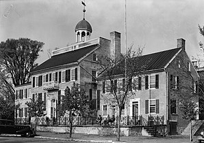
 Old New Castle Courthouse (1936) |
||
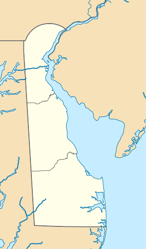
| Location in Delaware | ||
|
|
||
| Basic data | ||
| Foundation : | 1640 | |
| State : | United States | |
| State : | Delaware | |
| County : | New Castle County | |
| Coordinates : | 39 ° 40 ′ N , 75 ° 34 ′ W | |
| Time zone : | Eastern ( UTC − 5 / −4 ) | |
| Residents : | 5,285 (as of 2010) | |
| Population density : | 677.6 inhabitants per km 2 | |
| Area : | 8.3 km 2 (approx. 3 mi 2 ) of which 7.8 km 2 (approx. 3 mi 2 ) is land |
|
| Height : | 3 m | |
| Area code : | +1 302 | |
| FIPS : | 10-50800 | |
| GNIS ID : | 214379 | |
| Website : | newcastlecity.delaware.gov | |
| Mayor : | Michael J. Quaranta (2020) | |
New Castle is a city in New Castle County in the US state of Delaware , United States , with 5,392 residents (July 1, 2019 estimate). The urban area has a size of 8.2 km², of which 3.79% is water. The city is located at the mouth of the Delaware River at the end of the Delaware Bay .
history
Before the arrival of the Europeans , the Indian village of Tomakonck - Biberplatz was located here . New Castle was originally settled in 1651 by the Dutch , who founded Fort Casimir here , which was conquered by the Swedes only three years later, on Trinity in 1654 , and was accordingly renamed Trefaldigheet - Trinity . In the following year, 1655, the governor Nieuw Nederlands Petrus Stuyvesant recaptured the Swedish possession and renamed the country Nieuw Amstel. The rebuilt Fort Casimir soon became a central trading and settlement center and therefore too small. Thus the city of Nieuw Amstel was founded under the protection of the fort. In 1664 the English conquered all of Nieuw Nederland and added them to their colony, New York. The name of the city was henceforth New Castle. In 1682, William Penn (1644-1718) set foot on the American mainland for the first time and received the citizens' oath of allegiance. Until the establishment of Penns City of Philadelphia (granted city charter in 1701), New Castle should also be the administrative seat of Pennsylvania . The residents of Delaware achieved self-government within the province of Pennsylvania in 1702 , with New Castle as its seat. The three counties of Delaware were not to break away from Pennsylvania until two months after the declaration of independence and declare themselves as an independent state. The first capital was New Castle until it was moved to Dover in 1777 .
The United States' first levee, Broad Dyke , is also in the city. It was built by the Dutch in 1655.
New Castle also formed the eastern terminus of the New Castle and Frenchtown Railway , the second oldest railway line in the country, opened in 1832.
The top of the courthouse, the colonial capitol and the first Delaware state house were used as the center of the 12-mile circle line. Together with the Mason-Dixon Line, this forms the northern border between Delaware and Pennsylvania, between Glasgow and Elkton as part of the Mason-Dixon Line the western border with Maryland and on Artificial Island the border with New Jersey .
Name variants
The city has a few different names:
|
|
|
Filming location for feature films
The films The Dead Poets Club and Seduced To Undress were shot in New Castle.
sons and daughters of the town
- George Ross (1730–1779), British-American lawyer and statesman, one of the founding fathers of the United States
- Nicholas Van Dyke junior (1770–1826), lawyer and politician
- Thomas Stockton (1781–1846), politician; Delaware Governor
- Kensey Johns (1791-1857), politician
- Thomas McKennan (1794-1852), politician; Interior minister
- Robert Montgomery Bird (1806-1854), writer and playwright
- George R. Riddle (1817–1867), politician (Democratic Party); senator
- George Gray (1840–1925), Senator and Judge
- Anthony C. Higgins (1840–1912), Republican Party politician; senator
- John Dashiell Stoops (1873–1973), philosopher
- Walter W. Bacon (1879–1962), Governor of Delaware
- Thomas Holcomb (1879–1965), general and commandant of the United States Marine Corps
- Vinnie Moore (born 1964), rock musician
- Ryan Phillippe (born 1974), actor
- Devin Smith (born 1983), basketball player
Web links
- Official website of the city of New Castle
Individual evidence
- ↑ US Census Bureau, Quick Facts - New Castle city, Delaware
- ↑ a b c d e f g h i j k l m n o p q r U.S. Geological Survey. Geographic Names Phase I data compilation (1976-1981). 31-Dec-1981
- ↑ Roggeveen, Arent. Het Brandende Veen, Part 1. (Amsterdam, 1675 and English Translation)
- ↑ Visscher, NJ Map of New Netherland, New England, and Part of Virginia (c. 1655)
- ↑ Speed, John. A Prospect of the Most Famous Parts of the World. London: 1676
- ↑ Holme, Thomas. A map of the province of Pennsylvania started in 1681
- ↑ Powell, Lyman P., ed. Historic Towns of the Middle States. New York: 1899
- ↑ imdb.com
