Niamey III
| Arrondissement Niamey III | |
|---|---|
| Coordinates | 13 ° 31 ' N , 2 ° 8' E |
 Niamey III (red) in the city of Niamey Niamey III (red) in the city of Niamey
|
|
| Basic data | |
| Country | Niger |
| Niamey | |
| ISO 3166-2 | NE-8 |
| Residents | 163,175 (2012) |
Niamey III is one of the five arrondissements of the Nigerien capital Niamey .
geography

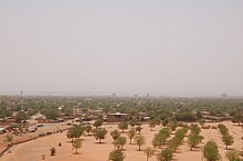
The elongated area of the arrondissement on the left bank of the Niger River leads from the city center to the northeast, where it is bordered by the wide green belt of Niamey . In the West Niamey borders III to Niamey II , in the southeast on Niamey IV and southwest side of the river, to Niamey V .
Niamey III consists of an urban area, which is divided into 17 districts (quartiers) , and a rural area with a village (village) .
The neighborhoods are:
The village is:
history
Until 1996 Niamey was divided into three municipalities ( French communes urbaines ). Under Niamey III the area now Arrondissements Niamey V has been understood hitherto. In 1996 Niamey was divided into five boroughs. The township of Niamey III emerged from parts of the former townships Niamey I and Niamey II. In 2010, the townships of Niamey were converted into arrondissements.
population
At the 2001 census, Niamey III had 175,899 inhabitants. At the 2012 census, the population was 163,175.
Economy and Infrastructure
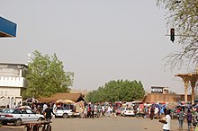
Niamey III is home to the Grand Marché , Niamey's “big market”. On the Boulevard Mali Béro is a large district where handicrafts are made and sold. The trade in building materials is also important in Niamey III. In the western part of the arrondissement there is a high density of educational and health facilities.
literature
- Abdoul Nasser Aboubacar dan Badaou: Gestion des déchets solid ménagers dans le 3ème arrondissement de Niamey . Faculté d'Agronomie, Université Abdou Moumouni de Niamey, Niamey 2015.
- Kokou Henri Motcho: La réforme communale de la communauté urbaine de Niamey . In: Revue de geographie alpine . No. 92, 2004. pp. 111–124 ( online version )
Web links
Individual evidence
- ↑ Répertoire National des localites (ReNaLoc). (RAR) Institut National de la Statistique de la République du Niger, July 2014, p. 716 , accessed on 7 August 2015 (French).
- ^ Programs d'orientation de la politique de développement de la Ville de Niamey: le Maire central Oumarou Moumouni Dogari face aux défis communaux. Le Sahel, 2012, accessed April 26, 2013 (French).
- ^ Répertoire National des Communes (RENACOM) . Institut National de la Statistique website, accessed November 8, 2010.
- ↑ Presentation of the résultats globaux définitifs du Quatrième (4ème) Recensement Général de la Population et de l'Habitat (RGP / H) de 2012. (PDF file) Institut National de la Statistique, 2014, accessed on April 21, 2014 (French ).
