
Baltic storm flood 1872

The Baltic storm flood in 1872 is the heaviest known Baltic storm flood . It struck the Baltic coast from Denmark to Pomerania on the night of November 12th to 13th, 1872 . The highest measured peak water level was about 3.3 m above sea level .
_b_859.jpg)
course


In the days before the storm floods, a storm blew from the southwest across the Baltic Sea, driving the water towards Finland and the Baltic States . The result was high water there and extremely low water on the Danish-German coasts. This enabled large amounts of water to flow from the North Sea into the western Baltic Sea. Suddenly the storm , which had meanwhile turned into a hurricane , turned to the northeast and drove the water masses back towards the southwest. Since the water could only flow back slowly into the North Sea, on the morning of November 13, 1872, large waves surprised the coastal residents and led to meter-high floods in the coastal towns.
Short term effects
Of all German coastal towns, Eckernförde suffered the most severe damage due to its location on the Eckernförde Bay, which is open far to the northeast . The entire urban area was flooded, 78 houses were destroyed, 138 damaged and 112 families were left homeless. In Mecklenburg and Western Pomerania, 32 people were killed on land by the storm floods. The Danish island of Lolland , which today still has diked areas that are below sea level, was badly hit and 28 people died. 52 people died on Falster . The island of Vilm was broken through in two places in its central part. The Habernis peninsula briefly became an island. In the Greifswald district of Wieck , almost all buildings were destroyed and nine people drowned. The rubble of the houses drifted into the center of Greifswald. Peenemünde was completely flooded.
Overall, the storm floods along the entire Baltic Sea coast cost at least 271 lives, 2,850 houses were destroyed or at least badly damaged, leaving 15,160 people homeless.
Long term effects
During this storm flood, which also flooded Prerow on the Darß , silted up the Prerower Strom , which until then had separated the island of Zingst from the Darß. In 1874 the Prerow river was finally filled in and secured with a dike; This made Zingst a peninsula.
The Koserower Vorwerk Damerow was destroyed and the island of Usedom near Koserow was divided into two parts. After another storm flood in February 1874 destroyed the remains of the building and left a layer of sand up to 60 cm thick, Damerow was abandoned.
classification
This storm flood is statistically to be assessed as a millennium event. A storm flood of similar magnitude would cause much greater damage today, as the coastal areas were not as densely populated back then as they are today.
Since the storm flood of 1872 brought with it by far the highest water level ever measured in the German Baltic Sea, this water level is used as a basis for assessment for coastal protection structures , with the exception of some Bodden areas.
Individual high water marks
In 2013 in Lübeck-Schlutup , a small memorial stone to the flood of 1872 with water level markings was erected in the front garden of the house at Küterstrasse 4, almost 200 meters from the Trave.

High water mark
at the Glambek castle ruins , Fehmarn
High water mark
in Dahme / Baltic Sea
High water mark
on the old
Travemünde lighthouse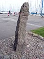
Maasholm (Schlei) Hafen high water mark
High water mark at the Wieck port authority

High water marks
from 1625 and 1872
Travemünde
Alte Vogtei
High water mark on the building of the port authority Wieck (Greifswald) (right of the door)

Memorial stone and water level oak in the Kellenhusener Forest


literature
- "Trutz Blanke Hans". The Baltic storm surge, 1872 . In: Volker Griese : Schleswig-Holstein. Memories of History. Historical miniatures. Norderstedt 2012, ISBN 978-3-8448-1283-1 .
- Heinz Kiecksee, P. Thran, H. Kruhl: The Ostseesturmflut 1872 . Boyens, Heide 1984, ISBN 3-8042-0116-4 (publications of the German Maritime Museum; 2).
- Marcus Petersen, Hans Rohde: Storm surge. The great floods on the coasts of Schleswig-Holstein and in the Elbe . 3. Edition. Wachholtz, Neumünster 1981, ISBN 3-529-06163-8 .
- Baensch: The storm surge from 12./13. November 1872 on the Baltic coast of the Prussian State . (PDF) In: Zeitschrift für Bauwesen 1875, Verlag Ernst und Sohn, Berlin, p. 155 ff. With detailed tables, diagrams and contexts.
- From the Baltic Sea Jammer . In: The Gazebo . Issue 52, 1872, pp. 858-860 ( full text [ Wikisource ]).
Web links
- Literature about the Baltic storm flood 1872 in the state bibliography MV
- Storm surge 1872 at Naturgewalten.de
- The mystery of a millennium flood - solved after 136 years . In: Hamburger Abendblatt
- The storm surge in 1872. Retrieved October 20, 2015 (Danish).
Individual evidence
- ↑ Norbert Buske , Vilm - The story of an island , thomasius Verlag 1994, page 13
- ↑ Flensburger Tageblatt : Habernis: Von der Huk in die Grüfft , from: August 12, 2011; Retrieved on: August 9, 2018
- ↑ Habernis, directions , accessed on: March 14, 2015
- ↑ Recommendations for the implementation of coastal protection works (EAK), 1993
- ↑ Memorial stone for the Baltic Sea storm surge of 1872. In: Lübecker Nachrichten of November 16, 2013, p. 12.