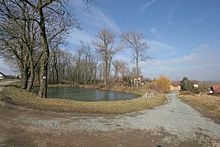
Polizy
| Polizy | ||||
|---|---|---|---|---|
|
||||
| Basic data | ||||
| State : |
|
|||
| Region : | Královéhradecký kraj | |||
| District : | Hradec Králové | |||
| Municipality : | Osice | |||
| Area : | 161.0983 ha | |||
| Geographic location : | 50 ° 9 ' N , 15 ° 42' E | |||
| Height: | 261 m nm | |||
| Residents : | 42 (March 1, 2001) | |||
| Postal code : | 503 27 | |||
| License plate : | H | |||
| traffic | ||||
| Street: | Osice - Libišany | |||
| Railway connection: | Chlumec nad Cidlinou – Międzylesie | |||
Polizy (German Polis ) is a district of the municipality Osice in Okres Hradec Králové in the Czech Republic . It is located twelve kilometers southwest of the city center of Hradec Králové .
geography
Polizy is located on a hill of the Dobřenická plošina ( Dobrzenitzer plateau ). The Čertůvka brook has its source in the village. The Chlumec nad Cidlinou – Międzylesie railway line runs northwest of the village ; One and a half kilometers south is the Osice motorway service station at Dálnice 11 / E 67 .
Neighboring towns are Lhota pod Libčany and Hubenice in the north, Praskačka in the northeast, Sedlice and Žižkovec in the east, Krásnice , Podůlšany and Staré Ždánice in the southeast, Plch and Osice in the south, Osičky in the southwest, Dobřenice in the west and Syrovátka and Trávník in the north-west.
history
The village belonged to the possessions of the Opatowitz Benedictine monastery , which was destroyed during the Hussite Wars in 1421. The first written mention of Polizy took place in 1436, when King Sigismund transferred a large part of the former monastery property to Diviš Bořek von Miletínek . At the end of the 15th century, Wilhelm von Pernstein acquired the village. When Jaroslav von Pernstein sold the Pardubitz reign to King Ferdinand I in 1560 , Polizy was one of their estates.
In 1835 the village of Polis in the Chrudim district consisted of 12 houses in which 90 people lived. The parish was Wositz . Until the middle of the 19th century, Polis remained subordinate to the Imperial and Royal Chamber of Commerce Pardubice.
After the abolition of patrimonial Polisy formed a community in the judicial district of Pardubice from 1849 . From 1868 the municipality belonged to the Pardubice district , at the same time Hubenice and Trávník were incorporated. In 1919 both districts broke away and formed their own communities. By order of the Linguistic Commission in Prague, the place name was changed to Polizy in 1920 . 1949 Polizy was assigned to the Okres Hradec Králové-okolí; this was repealed in the course of the territorial reform of 1960, since then the municipality has belonged to Okres Hradec Králové. In 1976 Polizy was incorporated into Lhota pod Libčany . On November 24, 1990, Osice, Trávník and Polizy broke away from Lhota pod Libčany and formed the Osice municipality. On March 3, 1991 the place had 36 inhabitants; in the 2001 census, 42 people lived in the 17 houses of Polizy.
Community structure
The district of Polizy forms a cadastral district.
Attractions
- Brick bell tower in the village square
- Wayside cross at the crossroads west of the village, at the top there is a lookout point
Web links
Individual evidence
- ↑ http://www.uir.cz/katastralni-uzemi/725471/Polizy
- ^ Johann Gottfried Sommer , Franz Xaver Maximilian Zippe: The Kingdom of Böhmen. Statistically and topographically presented, vol. 5 Chrudimer Kreis , Prague 1837, p. 67
- ↑ https://www.czso.cz/documents/10180/20565661/13810901.pdf/3fde2441-c81b-4a1e-9b94-551e65007f70?version=1.0


