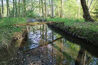
Poniglbach
| Poniglbach | ||
|
Channeled underflow |
||
| Data | ||
| location | Styria , Austria | |
| River system | Danube | |
| Drain over | Mühlgang → Mur → Drau → Danube → Black Sea | |
| source | Holler pond in Oberpremstätten 46 ° 58 '23 " N , 15 ° 23' 34" O |
|
| Source height | 353 m above sea level A. | |
| muzzle | near Werndorf in the Mühlgang Coordinates: 46 ° 54 ′ 45 ″ N , 15 ° 28 ′ 56 ″ E 46 ° 54 ′ 45 ″ N , 15 ° 28 ′ 56 ″ E |
|
| Mouth height | 300 m above sea level A. | |
| Height difference | 53 m | |
| Bottom slope | 4.6 ‰ | |
| length | 11.4 km | |
| Catchment area | 23.39 km² | |
| Left tributaries | Laabach | |
| Flowing lakes | Klingerteich, Wundschuher ponds | |
| Communities | Premstätten , Wundschuh , Wildon , Werndorf | |
| Residents in the catchment area | approx. 7500 (2017) | |
The Poniglbach is a right bank tributary of the Mur in the Austrian state of Styria . It rises in the market town of Premstätten , flows through the Kaiserwald and flows into the Mur near Werndorf .
course
The source area of the Poniglbach lies at the Höllerteich, a brick pond on the western outskirts of Oberpremstätten . In the first section, the brook flows through settlement areas and reaches the former mining area of Unterpremstätten . It crosses the Klingerteich ( GLT 104 ) and touches the embankment of a clay pit on the east side before it feeds the pools in NSG c 65 .
Initially running along its edge, the brook completely enters the Kaiserwald and divides the terrace of the same name into two halves. In the municipality of Wundschuh , the Poniglbach supplies the four Wundschuher ponds , each of which it is led past on the left bank, with water. Then the brook enters the Grazer Feld in the village of Ponigl . After passing through a Schachenwald forest and confluence with the Laabach , the Poniglbach joins the Mühlgang , which is fed to the Mur after the Werndorf power station .
history
The earliest written evidence is from 1150 and is "Ponich". The name goes back to the old Slavic punikva (river, water hole).
Hydrogeology
The Poniglbach first cuts into the gravel of the Kaiserwald terrace and erodes the Tegel of the tertiary subsoil down from the Wundschuher ponds . By opening up the coarse clastic sediments , the groundwater body is enriched . As a result of permanent observation of wells and springs, a hydrogeological connection between the Poniglbach and some stratified springs on the edge of the terrace could be demonstrated. The clay covering of the Kaiserwald terrace prevents mixing in the aquifer , which is expressed in comparatively high temperature fluctuations at the source outlets.
Due to its low and in sections only episodic water flow, there are only a few hydraulic structures on the Poniglbach in the form of extraction systems and return pipes .
Web links
Individual evidence
- ↑ a b Digital Atlas of Styria: Waters & Water Information. State of Styria , accessed April 7, 2019 .
- ↑ Extract from the digital Styrian body of water index. State of Styria , accessed on December 14, 2017 .
- ↑ BMLFUW (ed.) : List of areas of the Austrian river basins: Mur area. In: Contributions to Austria's Hydrography Issue No. 60, Vienna 2011, p. 78. PDF download , accessed on July 6, 2018.
- ↑ Excerpt from the Water Book 6/2846. State of Styria , accessed on December 16, 2017 .
- ↑ Fritz Frhr. Lochner von Hüttenbach: On the name property of the early Middle Ages in Styria (= magazine of the Historical Association for Styria . Volume 99 ). Böhlau Verlag, Vienna 2008, p. 35 ( historerverein-stmk.at [PDF; 16.9 MB ]).
- ↑ Hans Peter Leditzky & Hans Zojer: On the hydrogeology of the Kaiserwald terrace . In: Communications from the Department of Geology, Paleontology and Mining at the Landesmuseum Joanneum , Issue 39, Graz 1978, pp. 85–97. Online PDF , accessed April 3, 2019.

