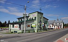
Psary (Powiat Będziński)
| Psary | ||
|---|---|---|

|
|
|
| Basic data | ||
| State : | Poland | |
| Voivodeship : | Silesia | |
| Powiat : | Będziński | |
| Geographic location : | 50 ° 23 ' N , 19 ° 7' E | |
| Residents : | 2711 () | |
| Postal code : | 42-512 | |
| Telephone code : | (+48) 32 | |
| License plate : | SBE | |
| Economy and Transport | ||
| Street : | Droga wojewódzka 913 | |
| Next international airport : | Katowice | |
| Gmina | ||
| Gminatype: | Rural community | |
| Gmina structure: | 10 school offices | |
| Surface: | 45.98 km² | |
| Residents: | 12,190 (June 30, 2019) |
|
| Population density : | 265 inhabitants / km² | |
| Community number ( GUS ): | 2401062 | |
| Administration (as of 2015) | ||
| Community leader : | Tomasz Sadłoń | |
| Address: | ul. Malinowicka 4 42-512 Psary |
|
| Website : | www.psary.pl | |
Psary is a village and seat of the rural municipality of the same name in the powiat Będziński in the Silesian Voivodeship , Poland .
geography
Psary is located approx. 15 km northeast of Katowice and belongs to the industrial region Zagłębie Dąbrowskie (German Dombrowaer coal basin ).
history
The first mention of Psary comes from the end of the 12th century. From the 14th century the village belonged to the Duchy of Siewierz until the Duchy was acquired by the Bishop of Kraków in 1443. It was not until 1790 that the duchy formally became part of the Kingdom of Poland . In 1795 the village came to Prussia ( Neuschlesien ) after the third partition of Poland . Then in 1815 the village became part of Congress Poland . In the period between the world wars, Psary was part of the Łagisza municipality and belonged to the Kielce Voivodeship .
Between 1954 and 1972 the village belonged to the Gromada Psary . On January 1, 1973, the Psary Ward was formed.
From 1975 to 1998 the village belonged to the Katowice Voivodeship .
local community
geography
The municipality of Psary extends over an area of 45.98 km². 73% of the area is used for agriculture and 13% is forested.
Sołectwo
The municipality of Psary includes the school offices ( sołectwo ) Brzękowice Górne , Brzękowice-Wał , Dąbie , Goląsza Dolna , Goląsza Górna , Góra Siewierska , Gródków , Malinowice , Preczów , Sarnów (Psary) and Strzyżowice .
education
The municipality has two kindergartens (przedszkole) , four elementary schools (szkoła podstawowa) and one middle school (gimnazjum) . There is also a library in the community.
Footnotes
- ↑ Główny Urząd Statystyczny (GUS) Portret miejscowości statystycznych w gminie Psary w 2010 r. (Exelsheet, Polish, accessed August 24, 2013)
- ↑ population. Size and Structure by Territorial Division. As of June 30, 2019. Główny Urząd Statystyczny (GUS) (PDF files; 0.99 MiB), accessed December 24, 2019 .
- ↑ Website of the municipality, Władze Gminy Psary ( Memento of the original from February 8, 2015 in the Internet Archive ) Info: The archive link was automatically inserted and not yet checked. Please check the original and archive link according to the instructions and then remove this notice. , accessed February 8, 2015
- ↑ Dz.U. 1954 no 43 poz. 191
- ↑ Dz.U. 1972 nr 49 poz. 312
- ↑ Dz.U. 1975 no 17 poz. 92 (Polish) (PDF; 802 kB)
- ↑ regioset.pl (Polish) as of April 7, 2009


