Puez group
| Puez group | |
|---|---|
|
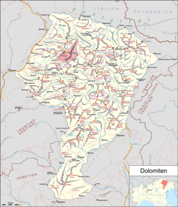
Puez group marked red on the map of the Dolomites |
|
|
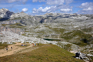
The mountain landscape of the Puez group, in the foreground the Lech de Crespëina |
|
| Highest peak | Western Puezspitze ( 2918 m slm ) |
| location | South Tyrol , Italy |
| part of | Dolomites |
| Coordinates | 46 ° 36 ' N , 11 ° 49' E |
The Puez group is a mountain group in the western Dolomites , which is located in South Tyrol ( Italy ).
Location and surroundings
The thePuez is in the south of Val Gardena and the east by the Val Badia limited. The transition between the two valleys, the Grödner Joch , separates the Puez group from the Sella group . In the north, the elevations drop into the Campilltal . In the northwest Roa-Scharte (forms Ladin Furcela dla Roa ) the transition to the Geisler group with which they are often the Puez group is summarized. The Cislesbach forms the western limit of the mountains.
The Puez Group is located in the area of the municipalities of St. Christina in Gröden , Selva di Val Gardena , Corvara , Abtei and St. Martin in Thurn and is almost completely protected in the Puez-Geisler Nature Park .
structure
The Puez group itself also includes several subgroups. The Vallunga - branching off from Val Gardena - and the Zwischenkofeltal - a Kampiller side valley - roughly divide the mountains into two blocks in a south-west-north-east direction.
In the southern part of the western block lies the Stevia and Col dala Pieres mountain range , in the northern part are the highest peaks of the group with the Puez peaks (western Puez peak: 2918 m , eastern Puez peak: 2913 m ), the Piz Duleda ( 2909 m ) and the Puezkofel ( 2723 m ), at the foot of which is the Puezhütte ( 2475 m ).
The eastern block consists mainly of the extensive Gardenazza plateau with its moon-like landscape with wide scree and stone mounds, where important ammonite finds were also made. Foothills branch off to the northeast, forming the ridge between Campiller and Val Badia. The plateau is dominated in the southeast by the Sassongher ( 2665 m ), at the southwest end, after the Lech de Crespëina , the peaks of the Cir peaks adjoin the Passo Gardena .
literature
- Hanspaul Menara and Josef Rampold : South Tyrolean mountain tours . Athesia, Bozen 1976, p. 179-181 .


