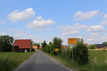
Radensdorf (Lübben (Spreewald))
|
Radensdorf
Radom City of Lübben (Spreewald)
Coordinates: 51 ° 56 ′ 28 ″ N , 13 ° 56 ′ 49 ″ E
|
|
|---|---|
| Height : | 50 m above sea level NHN |
| Area : | 10.41 km² |
| Residents : | 522 (2012) |
| Population density : | 50 inhabitants / km² |
| Incorporation : | December 6, 1993 |
| Postal code : | 15907 |
| Area code : | 03546 |
Radensdorf , Radom in Lower Sorbian , is a district of the city of Lübben (Spreewald) in the south of the Dahme-Spreewald district in Brandenburg . Until it was incorporated into Lübben on December 6, 1993, Radensdorf was an independent municipality. Radensdorf belongs to the official settlement area of the Sorbs / Wends .
location
Radensdorf is located in Lower Lusatia and the Spreewald . Neighboring towns are Biebersdorf (belongs to the municipality of Märkische Heide ) in the north, Briesensee (to Neu Zauche ) in the northeast, Neu Zauche in the east, Burglehn (to Alt Zauche-Wußwerk ) in the southeast, Lübben (Spreewald) in the west and Börnichen in the northwest. The place is on Landesstraße 44.
South of Radensdorf is the Kaupe Wotschofska , which belongs to the Lübbenau district of Lehde .
history
Radensdorf was first mentioned in a document in 1425, but was probably built as a Wendish settlement as early as the 13th century . In 1552 the place was mentioned as "Radenstorff". The place name comes from the Sorbian language and is derived from the personal name "Radom".
Up until 1674, Radensdorf was based on the rulership of Neu Zauche and from 1674 to 1874 on the Lübben-Neu Zauche rent office . From 1874 to 1945 the place was administratively part of the Steinkirchen-Hartmannsdorf office . The Wendish village church of Radensdorf was destroyed in the Second World War .
After the Congress of Vienna , the entire Lower Lusatia, including Radensdorf, came under the Kingdom of Prussia . The place belonged in the GDR to the district of Lübben and was added to the district of Lübben in Brandenburg after reunification . With the district reform in Brandenburg on December 6, 1993 , Radensdorf was incorporated into Lübben (Spreewald) and became part of the newly formed district of Dahme-Spreewald .
Population development
| Population development in Radensdorf from 1875 to 1992 | |||||||||||||
|---|---|---|---|---|---|---|---|---|---|---|---|---|---|
| year | Residents | year | Residents | year | Residents | ||||||||
| 1875 | 418 | 1939 | 423 | 1981 | 436 | ||||||||
| 1890 | 438 | 1946 | 573 | 1985 | 514 | ||||||||
| 1910 | 515 | 1950 | 566 | 1989 | 522 | ||||||||
| 1925 | 476 | 1964 | 419 | 1992 | 508 | ||||||||
| 1933 | 438 | 1971 | 388 | ||||||||||
proof
- ↑ Müller's Large German Local Book 2012: Complete local dictionary. 33. revised and exp. Ed., Walter de Gruyter, Berlin and Boston 2012, ISBN 978-3-11-027420-2 , online at Google Books , p. 1113
- ↑ Reinhard E. Fischer : The place names of the states of Brandenburg and Berlin: age - origin - meaning . be.bra Wissenschaft, 2005, p. 137 .
- ↑ Key data on Radensdorf's history. In: radensdorf.jimdo.com. Retrieved March 6, 2017 .
- ^ Changes in the municipalities of Germany, see 1993 StBA
- ↑ Radensdorf in the historical directory. Retrieved April 16, 2017 .
- ↑ Historical municipality register of the state of Brandenburg 1875 to 2005. (PDF; 331 kB) District Dahme-Spreewald. State Office for Data Processing and Statistics State of Brandenburg, December 2006, accessed on March 6, 2017 .
Web links
- Radensdorf in the RBB program Landschleicher on January 29, 2012
