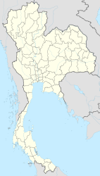
Rangsit (city)
|
รังสิต Rangsit |
||
|---|---|---|
|
|
||
| Coordinates | 13 ° 59 ′ N , 100 ° 37 ′ E | |
| Symbols | ||
|
||
| Basic data | ||
| Country | Thailand | |
| Pathum Thani | ||
| ISO 3166-2 | TH-13 | |
| Residents | 78,826 (2012) | |
| founding | 1994 | |
| Website | www.rangsit.org (Thai) | |
|
Map of the canal system in the Rangsit area, the actual city of Rangsit in the southwest
|
||
Rangsit ( Thai รังสิต ) is a city in the Thai province of Pathum Thani . It is a northern suburb of Bangkok , about 35 kilometers from the center. The metropolitan municipality ( เทศบาล นคร รังสิต , Thesaban Nakhon Rangsit ) is congruent with the tambon ("subdistrict") Prachathipat in the Thanyaburi district . There is also the Tambon Rangsit, in which the district capital Thanyaburi is located. The urbanizing settlement and economic area of Rangsit goes far beyond the boundaries of the local administrative unit. Rangsit belongs to the Bangkok metropolitan area and is an important industrial location, especially with large textile factories, and since the late 1980s it has also been a science location with several university campuses.
Rangsit room
The urbanizing metropolitan area of Rangsit, which includes the four eastern districts of Pathum Thani Province ( Khlong Luang , Thanyaburi , Nong Suea , Lam Luk Ka ), is an example of the urban and development geographic concept of Desakota . This describes regions that are neither purely urban nor purely agricultural, but in which both forms of use occur side by side and are intensively mixed with one another. The Rangsit economic area extends even beyond this original area and also includes the adjacent districts of Wang Noi in Ayutthaya Province , Nong Khae in Saraburi Province , Ongkharak in Nakhon Nayok Province and Bang Nam Priao in Chachoengsao Province .
history
Rangsit was originally characterized by agriculture. In the 1890s, a private company installed a developed irrigation system here , at the time the most modern in the central Thai basin. The main artery of this system was the Rangsit Canal . This made the country very attractive for rice cultivation and parts of the Bangkok elite, the nobility and government circles invested in land. At the same time, there was massive immigration of farmers and workers to work the productive land, so that lease prices and land value rose sharply.
As part of the ongoing industrialization of Thailand and the explosive growth of Bangkok in the 1970s and 80s, Rangsit developed into a service and industrial location.
Until 1994, Rangsit did not have official city status. Then it was declared a small town as Thesaban Tambon Prachathipat . In 2003 the survey was carried out as a medium-sized town (Thesaban Mueang Rangsit) , then in 2011 as a large city. The actual city of Rangsit had 78,826 inhabitants within its administrative limits in 2012, significantly more than the provincial capital Pathum Thani . The four districts that make up the greater Rangsit area had a total of 720,000 inhabitants in 2011 on an area of 1122.6 km².
traffic
Rangsit is intersected by Phahonyothin Road (National Road 1, the main northern main artery of Bangkok). It is built over with the chargeable Uttaraphimuk ("Don Mueang Tollway"), which ends in Rangsit. Rangsit has a train station on the northern line of the Thai Railway. The Don Mueang International Airport is located south of Rangsit, at a distance of about 10 kilometers.
Shopping centers
- Future Park Rangsit, one of the largest shopping centers in Thailand and all of Asia
- Zeer Rangsit
education and Science
- City of Rangsit
- Rangsit room
- University of Rangsit
- Rangsit campus of Thammasat University
- Rangsit Campus of Bangkok University
- Asian Institute of Technology (AIT)
- Valaya Alongkorn Rajabhat University
- Eastern Asia University
literature
- Sowatree Nathalang: Rangsit in Transition. Urbanization and Cultural Adaptation in Central Thailand. Dissertation, Macquarie University, 1999. ( Summary online ( Memento from October 29, 2013 in the Internet Archive ); PDF; 69 kB)
Individual evidence
- ↑ Sowatree Nathalang: Rangsit in Transition. Urbanization and Cultural Adaptation in Central Thailand. ( Memento of October 29, 2013 in the Internet Archive ) (PDF; 69 kB) In: The Chao Phraya Delta. Historical Development, Dynamics and Challenges of Thailand's Rice Bowl. Proceedings of the International Conference, Kasetsart University, Bangkok 2000, pp. 4-6.
- ^ Ian Brown: Economic change in South-East Asia, c. 1830-1980. Oxford University Press, 1997, p. 178.
- ↑ David B. Johston: The Closing of the Frontier. The Expansions of Rice Cultivation in Central Thailand in the 1890's. In: Contributions to Asian Studies. No. 9, Brill, Leiden 1976, pp. 27-44.
- ^ Douglas Webster: Bangkok. Evolution and adaptation under stress. In: World Cities Beyond the West: Globalization, Development and Inequality. Cambridge University Press, Cambridge 2004, pp. 94-95.


