
Reggane
|
رقان ⵔⴻⴳⴳⴰⵏ Reggane |
|||
|---|---|---|---|
|
|||
| Coordinates | 26 ° 43 ' N , 0 ° 10' E | ||
_location_map.svg) Location in the province of Adrar |
|||
| Basic data | |||
| Country | Algeria | ||
| Adrar | |||
| ISO 3166-2 | DZ-01 | ||
| height | 217 m | ||
| surface | 124,298 km² | ||
| Residents | 20,402 (2008) | ||
| density | 0.2 Ew. / km² | ||
 Reggane (2014)
|
|||

Reggane ( Arabic رقان Riqqān ; Tamazight ⵔⴻⴳⴳⴰⵏ) is a town in the province of Adrar in the Algerian Sahara .
Transport links
Reggane is on National Road 6 , an important north-south route and connection to Mali . The section south from Reggane to Gao is also known as the Tanezrouft slope . The national road 52 connects Reggane with In Salah . Reggane also has an airfield with ICAO code DAAN.
climate
Reggane has a hot desert climate with long, extremely hot summers and short, very warm winters. With only 10 mm of precipitation per year and an average temperature of 28.3 ° C, Reggane is one of the driest and hottest places in the Sahara . Both are a result of the city's low altitude at 217 m above sea level. The area marked by the three cities of Adrar , In Salah and Reggane is known by the local population as the "fire triangle" because of the particularly high temperatures.
Military use
Missile test base
From 1961 to 1965, the French Center interarmées d'essais d'engins spéciaux (CIEES) used the Reggane plateau east of Reggane ( 26 ° 41 ′ 51 ″ N , 0 ° 16 ′ 17 ″ E ) as a base for missile tests.
Above-ground nuclear weapons tests
About 50 km southwest of Reggane or 20 km south of the town of Hamoudia was a French nuclear weapons test site ( CSEM - Center Sahara des Expérimentations Militaires ) until 1965 at 26 ° 21 ' N , 0 ° 8' W. France carried out its first nuclear test there on February 13, 1960 . The 70 kT atomic bomb that was detonated was about four times as powerful as the Hiroshima bomb ; the test was named Gerboise bleue (after occurring in the region Spring mouse ). On April 1, 1960, December 27, 1960 and April 25, 1961, three more atomic bombs, each weighing less than 5 kT, were detonated above ground for test purposes. In the second, around 150 prisoners (including those sentenced to death) were tied to stakes a kilometer away and exposed to the bomb; they died. The Sahara in a radius of 300 km southwest to 300 km east of Hamoudia was almost deserted at the time. All four clouds of explosion moved in these directions.
The documentary film Gerboise bleue by Djamel Ouahab, released in 2009, deals with radioactive fallout and its consequences .
Maneuvers in the explosion area
As it became known in 2010, following the last attempt on April 25, 1961 , the French army knowingly exposed a squad of 300 soldiers to radioactive radiation. In this attempt, according to the relevant military report, the "physiological and psychological effects of nuclear weapons on humans" should be investigated in order to obtain the "necessary elements for the physical preparation and moral training of the modern fighter." For this purpose, the men had to up Approach the explosion site within 700 meters. Many of them are still suffering from the radiation and have cancer. (see also Compensation for Victims of Nuclear Bomb Tests )
Current condition
At the request of Algeria, the IAEA examined the site and stated in a report from 2005 that no measures were necessary due to the very weak residual radioactivity. Only if there are major activities in the area should access to the four explosion sites be prohibited.
Underground nuclear weapons tests at In Ekker
In the CEMO - Center d'Expérimentations Militaires des Oasis , a total of 13 underground tests were carried out between November 7, 1961 and February 16, 1966 in the Tan Affela massif near In Ekker im Hoggar at 24 ° 3 ′ N , 5 ° 3 ′ E and approx. 150 km north of Tamanrasset next to the road N 1 . In the second test, Béryl , the closure of the test tunnel failed. There was an emission of radioactive gas and dust, which was blown in an easterly direction. According to the French Ministry of Defense, a maximum of 230 people were affected by the fallout without any immediate medical consequences. On the other hand, a number of people involved in the test appear to have suffered long-term effects that have been the subject of legal disputes in France. The immediate vicinity of the test gallery appears to be heavily contaminated and not effectively sealed.
Use after Algerian independence
In the Évian Treaties of March 1962, which gave Algeria independence, France was allowed to use the missile and nuclear weapon testing facilities for another five years.
Picture gallery
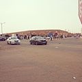
Reggane (2014)

Reggane (2014)
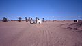
Southern outskirts of Reggane (1990)

Beginning of the Tanezrouft slope south of Reggane (1990)

Reggane (2013)

Reggane (1960)


.jpg)

Web links
- www.tagesschau.de ( Memento from May 31, 2009 in the Internet Archive ) Report on the consequences of the French nuclear weapons tests in the Algerian Sahara
Individual evidence
- ↑ Population figures 2008 (Office National des Statistiques). (French) (PDF; 83 kB)
- ↑ ourairports.com
- ↑ Reggane in the Encyclopedia Astronautica (English)
- ↑ Jean-Jacques Serra: The CIEES (Inter-arms Special Weapons Test Center) (English)
- ↑ the experiments were called Gerboise blanche , Gerboise rouge and Gerboise verte .
- ↑ Essai nucléaire à Reggane: 150 prisonniers algériens utilisés comme cobayes humains (November 13, 2015)
- ↑ Information about the film on imdb.de
- ↑ through an article in the newspaper Le Parisien (February 16, 2010): Quand les appelés du contingent servaient de cobayes
- ↑ Soldiers abused for nuclear tests, "Die Presse" from February 16, 2010 ( Memento from May 11, 2019 in the Internet Archive )
- ^ Report of the fr. Ministry of Defense, in French ( Memento of September 25, 2007 in the Internet Archive )
- ↑ Bruno Barrillot: French Nuclear Tests in the Sahara, Science for Democratic Action, April 2008 ( PDF )
Adrar | Akabli | Aougrout | Aoulef | Bordj Badji Mokhtar | Bouda | Charouine | Deldoul | Fenoughil | In Zghmir | Ksar Kaddour | Metarfa | Ouled Ahmed Timmi | Ouled Aissa | Ouled Said | Reggane | Sali | Sebaa | Talmine | Tamentite | Tamest | Timocts | Timiaouine | Timimoun | Tinerkouk | Tit | Tsabit | Zaouiet Kounta