Clef (Wuppertal)
|
Clef
City of Wuppertal
Coordinates: 51 ° 16 ′ 6 ″ N , 7 ° 12 ′ 4 ″ E
|
||
|---|---|---|
| Height : | 170 m above sea level NHN | |
|
Location of Clef in Wuppertal |
||
Clef or Am Clef is a locality in the mountainous city of Wuppertal . The local situation emerged from one of the medieval courtyards of Barmen .
Location and description
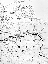
The settlement areas of the three full courtyards and two Kotten residential area Clef were distributed along today's streets Am Clef and Heckinghauser Strasse south of the Elberfeld – Dortmund railway line in today's residential areas of Heidt and Heckinghausen in the Heckinghausen district . Today only the area of the two western settlement areas in the area of the Barmer thermal power station on the street Am Clef is called Clef, the three eastern settlement areas are now part of the Heckinghausen center area. The thermal power station emerged from the power station of the valley station of the Barmer Bergbahn .
All five Clefs settlement areas are now part of a closed inner-city commercial and residential development. The westernmost settlement area, still called Ritterklef (also Reuterscleff ) in 1863 , is located in the area of the streets Fischertal , Gewerbeschulstraße and Saarbrücker Straße . Lehmbach's Klef (also Leimbachscleff ) was on Heinrich-Jansen-Strasse between Gewerbeschulstrasse and Saarbrücker Strasse .
The three other settlements were to the east of the Heckinghauser Strasse cemetery . Krebsklef was located at the intersection of Heckinghauser Straße , Krebsstraße and Grillparzerweg , the Krebs-Clef house , built in 1782 by the Krebs family, was demolished in 1980 despite the status of a listed building. Egeldicksklef was right next to it in the area of Heckinghauser Straße , Rankestraße and Schnurrstraße and the fifth settlement area was again adjacent at the intersection of Heckinghauser Straße and Werléstraße .
The Fischertaler Bach used to be called Clever Bach because of its location .
Etymology and history

Clef, Clev is an old form of cliff (compare Latin clivus - hill) and refers to the mountain slope south of the settlement areas, which rises sharply up to the southern heights of Wuppertal . In all medieval documents, the respective owner's name precedes the toponym Clev .
The earliest mention of the Clever settlement areas with a certain date comes from the Beyenburger official account (account of the rent master to the Bergisch-Ducal camera administration ) of the year 1466. This shows that the residential area was already divided into three courtyards and two cottages at that time. The farms belonged to a Kurt to Clev , a Peter to Clev and a Koene to Clev , the Kotten are called Peters Cleff and Greven Cleff .
Due to inadequate source material it is not occupied, but possible that Clev to the mentioned already in 1244 " goods in Barmen " ( " Bona de Barme ") in the Electoral Cologne was one area that by Count Ludwig von Ravensberg as allod into possession the Count von Berg passed under Count Heinrich IV . Territorially, the area around Clev was part of Oberbarmen until the beginning of the 14th century to the Electoral Cologne district of Schwelm , which was annexed by the Counts of the Mark until 1324 . From 1420 it belonged to the Bergisches Amt Beyenburg . Ecclesiastically it belonged to the establishment of a separate Barmer parish to parish to Schwelm.
1641 the size of Clevs is given as 110 acres , the settlement places are now called Peters Cleff , Deusen and Grieten Cleff , Krebs Cleff , Greven Cleff and Alberts Cleff .
In 1715 the Topographia Ducatus Montani by Erich Philipp Ploennies recorded the neighboring farms. With the other farms in the Barmen farming community , the Clever Höfe were part of the Bergisch Office of Beyenburg until 1806.
Until the middle of the 19th century, the Clever Höfe were independent localities, but with the construction of the railway line they were all completely integrated into inner-city development.
literature
- Walter Dietz: Barmen 500 years ago. An examination of the Beyenburger official accounts from 1466 and other sources on the early development of the place Barmen (= contributions to the history and local history of the Wuppertal. Vol. 12, ISSN 0522-6678 ). Born-Verlag, Wuppertal 1966.
Individual evidence
- ↑ a b Wolfgang Stock: Wuppertal street names. Their origin and meaning. Thales Verlag, Essen-Werden 2002, ISBN 3-88908-481-8 .
- ↑ Barmer city map from 1863


