Red Ndao
| Kabupaten Red Ndao Rote Ndao Governorate
|
||
|---|---|---|
 |
||
| Symbols | ||
|
||
| Basic data | ||
| Country | Indonesia | |
| province | East Nusa Tenggara | |
| Seat | Ba'a | |
| surface | 1,280.1 km² | |
| Residents | 119,711 (2010) | |
| density | 94 inhabitants per km² | |
| ISO 3166-2 | ID-NT | |
| Website | www.rotendaokab.go.id (id) | |
| politics | ||
| Bupati | Leonard Haning | |
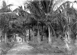
| Coconut palms on roti | ||
Coordinates: 10 ° 28 ′ S , 123 ° 23 ′ E
Rote Ndao is a government district ( Kabupaten ) in the Indonesian province of East Nusa Tenggara . It is named after the islands of Roti and Ndao and was separated from the government district of Kupang in 2002 .
119,711 people live in Rote Ndao (2010 census).
geography
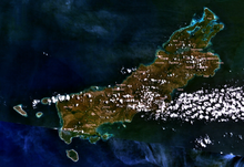
Rote Ndao has an area of 1,280.10 km². It consists of the island of Roti and the small islands surrounding it. To the west are the islands of Ndao , Nuse (Nusa) and Doo , to the east Usu , Nusa Manupui and Boti , to the north Ndoa , Nusa Kodi , Huana , Batuhun and Nusa Bibi and to the southwest Pamana (Dana, Dona, Ndana), Helihana , Landu , Manuk , Batu Bibi , Liu , Nusa Nak and Lai . Pamana, the southernmost island in Indonesia. With the island of Pamana, Rote Ndao is the southernmost administrative district in Indonesia. The capital is Ba'a on the island of Roti.
The administrative district is divided into the districts ( Kecamatan ) ( sub- districts) Rote Barat Daya , Rote Barat Laut , Lobalain , Rote Tengah , Rote Selatan , Pantai Baru , Rote Timur and Rote Barat . In 2012, the Landu Leko and Ndao Nuse districts were newly formed.
Web links
Individual evidence
- ↑ Partai Democrat: Ketua DPC-PD Kab Rote Ndao Leonard Haning, Menjadi “Sulung” bagi Rakyatnya , January 30, 2013 ( Memento of the original from May 11, 2013 in the Internet Archive ) Info: The archive link was automatically inserted and not yet checked. Please check the original and archive link according to the instructions and then remove this notice. , accessed January 4, 2015.
- ^ Profile Wilayah Kabupaten Rote Ndao. Archived from the original on September 12, 2012 ; Retrieved March 23, 2013 .
- ↑ Map of Roti ( Memento of the original from December 9th, 2015 in the Internet Archive ) Info: The archive link was inserted automatically and has not yet been checked. Please check the original and archive link according to the instructions and then remove this notice. , accessed March 17, 2013
- ^ Map of Roti ( Memento of December 16, 2010 in the Internet Archive ), accessed on March 17, 2013
- ↑ Penduduk Indonesia menurut desa 2010 ( Memento from March 27, 2014 in the Internet Archive ) (Indonesian; PDF; 6.0 MB), accessed on March 23, 2013
- ^ Map of Roti


