
Sweet lake
| Sweet lake | ||
|---|---|---|

|
||
| Geographical location | Saxony-Anhalt , Germany | |
| Tributaries | Evil seven | |
| Drain | Salza | |
| Places on the shore | Seeburg , Aseleben | |
| Data | ||
| Coordinates | 51 ° 29 ′ 43 " N , 11 ° 40 ′ 22" E | |
|
||

The Süße See is a lake in the district of Mansfeld-Südharz in Saxony-Anhalt , Germany . He is fed by the evil seven , which leaves him near Seeburg towards Bindersee . Since the salty lake was drained at the end of the 19th century, of which only Kerner and Bindersee remained, the Süße See has been the largest natural standing water in the district of Mansfeld-Südharz. Contrary to what the name suggests, the lake water is salty, as with the other existing or drained Mansfeld lakes.
Dimensions

The lake is 4.9 km long from the mouth of the Böse Sieben to its outlet, and at its widest point at Aseleben it is barely 1 km wide. The circumference is 11.76 km, the area about 250 ha. It is a maximum of 7 m deep, but on average 4.3 m. The water is elongated in shape and tapers on the west side.
location

The sweet lake is located in the unitary community Seegebiet Mansfelder Land , the southeastern part of the district, approx. 20 km west of Halle (Saale) and approx. 8 km east of Eisleben (based on the lake center) at an altitude of 90 m above sea level. NN am Riß , a landscape that begins at Volkstedt and then spreads to the east.
On the eastern bank is the town of Seeburg with the striking Seeburg Castle built on a peninsula . The deserts of Lipsdorf , Badendorf and Edenstedt are also located on the lake, and Aseleben is on the south bank .
There are several vineyards on the Süßen See that belong to the Saale-Unstrut area . They belong to the Mansfeld Lakes Wine Route. The European long-distance hiking trail E11 ( Netherlands - Masuria ) runs along the northern shore of the lake .
Emergence
The lake was created by the natural leaching of rock salt in the subsurface and the collapse of the overlying rock (compare: Arendsee ). In contrast to the many remaining mining holes in the wider area, the bank areas consist of natural (existing) soil.
history
Recently, with the help of an underwater drone, the remains of a burial mound were detected on the lake bed at a depth of 4 m, a circular system with a diameter of 6 m. At another point there were remains of pile dwellings within a radius of 20 m. This also means that the lake can only have formed after this time. Around 1000 to 600 BC The eastern end of the lake was densely populated. Remains of medieval settlements from the 13th and 14th centuries were found on the southern bank .
photos

Seeburg Castle

Seeburg Castle, view from the Seeperle

Seeburg Castle, view from the B 80

View from the north bank over the lake
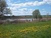
Western part of the lake


Web links
See also
Individual evidence
- ^ Barrow in the Süßen Lake near Halle? , in: Archeology in Germany 05 | 2018, p. 74 f.