Saint-Jean-de-Touslas
| Saint-Jean-de-Touslas | ||
|---|---|---|

|
|
|
| local community | Beauvallon | |
| region | Auvergne-Rhône-Alpes | |
| Department | Rhône | |
| Arrondissement | Lyon | |
| Coordinates | 45 ° 40 ′ N , 4 ° 40 ′ E | |
| Post Code | 69700 | |
| Former INSEE code | 69213 | |
| Incorporation | 1st January 2018 | |
| status | Commune déléguée | |
| Website | www.stjeandetouslas.fr | |
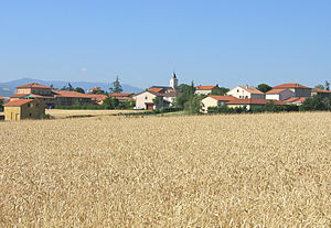
 View of Saint-Jean-de-Touslas |
||
Saint-Jean-de-Touslas is a commune Déléguée in the French community Beauvallon with 860 inhabitants (as of January 1 2017) in the department of Rhône in the region of Auvergne Rhône-Alpes .
On January 1, 2018, Saint-Jean-de-Touslas was merged with the municipalities of Saint-Andéol-le-Château and Chassagny to form the municipality ( Commune nouvelle ) Beauvallon. Since then it has had the status of a Commune déléguée. The municipality of Saint-Jean-de-Touslas belonged to the arrondissement of Lyon and was part of the canton of Mornant (until 2015: canton of Givors ).
geography
Saint-Jean-de-Touslas is about 24 kilometers southwest of Lyon . Saint-Jean-de-Touslas is surrounded by the neighboring villages of Saint-Andéol-le-Château in the north and northeast, Saint-Romain-en-Gier in the east and southeast, Dargoire and Tartaras in the south and Chabanière with the Commune deleguée Saint-Maurice -sur-Dargoire to the west.
Population development
| year | 1962 | 1968 | 1975 | 1982 | 1990 | 1999 | 2006 | 2012 |
|---|---|---|---|---|---|---|---|---|
| Residents | 280 | 294 | 341 | 517 | 549 | 616 | 656 | 832 |
| Source: Cassini and INSEE | ||||||||
