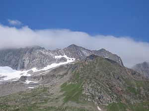
Schönbichler Horn
| Schönbichler Horn | ||
|---|---|---|
|
The Schönbichler Horn as seen from the Berliner Hütte |
||
| height | 3134 m above sea level A. | |
| location | Tyrol , Austria | |
| Mountains | Zillertal Alps | |
| Dominance | 0.4 km → Furtschaglspitze | |
| Notch height | 53 m ↓ Schönbichler Scharte | |
| Coordinates | 47 ° 0 '30 " N , 11 ° 46' 23" E | |
|
|
||
| rock | Graphite-biotite slate | |
| First ascent | 1853 during the national survey | |
| Normal way | via the Berliner Höhenweg as a glacier-free high tour from the Furtschaglhaus | |
| particularities | Highest point of the Berliner Höhenweg | |
|
Seen from the southwest |
||
The Schönbichler Horn is 3134 m above sea level. A. high summit in the Zillertal Alps , in the Austrian state of Tyrol . It is part of the Greiner ridge, which runs from northwest to southeast . The Schönbichler Horn is one of the most climbed three-thousanders in the Zillertal Alps, as the much-traveled Berliner Höhenweg (with a stamp for long-distance hikers) runs just below its summit . Anton von Ruthner reported that the mountain had been climbed on the occasion of the national survey since 1853, and again as part of the military cartography.
Location and surroundings
The Schönbichler Horn is 3.5 kilometers as the crow flies east of the southeastern end of the Schlegeis reservoir . Neighboring peaks in the northwest in the course of the Greinerkamm are the Talggenköpf with up to 3179 m , in the south, separated by the Schönbichler Scharte ( 3081 m ), the 3190 m high Furtschaglspitze . Two larger glaciers collide with the Schönbichler Horn. In the north and east is the extensive Waxeggkees , in the south the Furtschaglkees , which as part of the Schlegeiskees has an east-west extension of over four kilometers.
Base and ascent
The Schönbichler Horn can be easily climbed from both directions thanks to the course of the Berliner Höhenweg, which connects the Furtschaglhaus ( 2293 m ) refuge in the southwest and Berliner Hütte ( 2042 m ) in the northeast. In the upper area below the summit there are wire rope insurances on both sides. From the Furtschaglhaus the ascent takes, according to literature, a good 2½ hours, from the Berliner Hütte it takes 3 hours. The entrances for many climbing tours to the Furtschaglspitze, the Talggenköpf and the Großer Greiner ( 3201 m ) can be reached from the Schönbichler Horn .
Literature and map
- Heinrich Klier, Walter Klier : Alpine Club Guide Zillertal Alps , Munich 1996, ISBN 3-7633-1269-2
- Alpine club map 1: 25,000, Zillertal Alps , western sheet 35/1
Web links
- Detailed directions on tourenziel.de - from the Berliner Hütte to the Furtschaglhaus
Individual evidence
- ^ Carl Diener in Eduard Richter : The development of the Eastern Alps , III. Volume, Berlin 1894, p. 24
- ^ H. Klier, W. Klier: Alpenvereinsführer Zillertaler Alpen , Munich 1996, p. 305 f., Margin no. 1550 ff.


