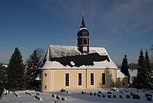
Schönbrunn (Selva)
|
Schönbrunn
City of Selva
Coordinates: 50 ° 39 ′ 11 ″ N , 13 ° 3 ′ 15 ″ E
|
||
|---|---|---|
| Height : | 450 m | |
| Residents : | 454 (May 9, 2011) | |
| Incorporation : | January 1, 1999 | |
| Postal code : | 09429 | |
| Area code : | 037369 | |
|
Location of Schönbrunn in Saxony |
||
Schönbrunn is a district of the Saxon town of Selva in the Ore Mountains .
geography
location
The Waldhufendorf Schönbrunn is located about 1 kilometer west of Selva in the Ore Mountains . The location extends for about 2 kilometers along a stream that flows east of the Zschopau . The Häuslerweiler Scheibe in the east belongs to Schönbrunn .
In the west and north-west the Heidelbachtal borders the corridor, in the east the Zschopau forms the natural border.
At a short distance, the federal highway 101 crosses Freiberg - Annaberg-Buchholz Schönbrunn at the eastern end of the village. This is where the former state road 220 to Mittelschmiedeberg and the S 222 to Geyer begin . There is also a connection to Falkenbach via a municipal road.
Neighboring places
| Drebach | Raft place | |

|
Selva | |
| Falkenbach | Streckewalde |
history
The first documentary mention of Schonbron dates back to April 8, 1386. Margrave Wilhelm I von Meißen assigned the rule of Scharfenstein with associated villages, including Schönbrunn, as a widow's seat to the widow Anargs von Waldenburg .
A pilgrimage church was mentioned in Schönbrunn as early as 1353, with the Reformation in 1536/37 the place became an independent parish .
The first school was built in 1699, and in 1716 the stone bridge over the Zschopau to Selva was built.
August Schumann mentions Schönbrunn in the State Lexicon of Saxony in 1823:
“The place has over 45 houses and around 360 residents, who in 1800 kept 147 cows and 280 sheep, in 1800 there were 320 consumers. The relatively important corridor , which can also be used for grain and even more for flax cultivation , separates the Heydelbach from the Drebacher in the north. […] In 1525 many rebellious peasants were beheaded here on Duke Heinrich's orders, which his brother's serious measures prompted. "
On February 1, 1866, the Wolkenstein train station of the Zschopautalbahn was built on Schönbrunner Flur - Schönbrunn was never included in the station name.
In 1873/1874 a new school building was built, and a compulsory fire brigade was founded in 1877. In 1904 the church was expanded and rebuilt. In 1913 the place was connected to the public electricity network. With the construction of a gas pipeline to Schönfeld, some houses were connected to gas as early as 1925. In 1930 the road from the Wolkensteiner Bridge to the confluence of the Heidelbachtal valley was built as an emergency work .
On January 1, 1999, the previously independent municipalities of Falkenbach, Gehringswalde, Hilmersdorf and Schönbrunn merged with the city of Wolkenstein, and Schönbrunn became a district of Wolkenstein.
Development of the population
|
|
|
literature
- Schönbrunn near Selva . In: August Schumann : Complete State, Post and Newspaper Lexicon of Saxony. 10th volume. Schumann, Zwickau 1823, p. 556 f.
- The parish Schönbrunn In: New Saxon Church Gallery, Ephorie Marienberg. Strauch Verlag, Leipzig, pp. 687-694 ( digitized version )
- District Office Middle Erzgebirgskreis, Ed .: On the history of the cities and municipalities in the Middle Erzgebirgskreis , a time table (parts 1–3)
- Richard Steche : Schönbrunn. In: Descriptive representation of the older architectural and art monuments of the Kingdom of Saxony. 5th issue: Amtshauptmannschaft Marienberg . CC Meinhold, Dresden 1885, p. 29.
Web links
- Schönbrunn in the Digital Historical Directory of Saxony
- Disc in the Digital Historical Directory of Saxony
Individual evidence
- ↑ Small-scale municipality sheet for Selva, City. (PDF; 0.6 MB) State Statistical Office of the Free State of Saxony , September 2014, accessed on January 29, 2015 .
- ↑ Gerhard Reuter, Hermann Pährisch: A document from the year 1386. In: Erzgebirgische Heimatblätter 2012/1, p 16-18.
- ↑ a b cf. Schönbrunn in the Digital Historical Directory of Saxony
- ↑ cf. Schönbrunn near Selva . In: August Schumann : Complete State, Post and Newspaper Lexicon of Saxony. 10th volume. Schumann, Zwickau 1823, p. 556 f.
- ^ Railway stations in Saxony , accessed on January 3, 2013.
- ↑ Area changes from January 1, 1999 to December 31, 1999 on the website of the State Statistical Office of the Free State of Saxony , p. 4 (PDF; 38 kB), accessed on December 30, 2010.


