Schlatt (Hechingen)
|
Schlatt
City of Hechingen
|
|
|---|---|
| Coordinates: 48 ° 20 ′ 36 ″ N , 9 ° 1 ′ 33 ″ E | |
| Height : | 552 m above sea level NN |
| Area : | 6.78 km² |
| Residents : | 798 (December 31, 2015) |
| Population density : | 118 inhabitants / km² |
| Incorporation : | April 1, 1972 |
| Postal code : | 72379 |
| Area code : | 07477 |
|
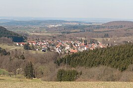
Southeast view of Schlatt
|
|
Schlatt is a district of Hechingen in the Zollernalbkreis in Baden-Württemberg ( Germany ).
geography
Schlatt is about six kilometers east of the city center at the entrance of the Killertal on the northern edge of the Swabian Alb and is traversed by the Starzel . To the south of the village, the Starzel has dug like a gorge into the clay slate there and formed a waterfall.
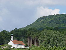
The townscape is shaped by the baroque cemetery chapel on the Kirchenköpfle in the northeast. On the north-western edge there is an old quarry , in which brick raw materials were extracted and processed in the attached brickworks . The district area of the place is 678 hectares.
Neighboring places
The following places border on Schlatt, they are named starting in the north in clockwise direction and belong to the Zollernalb district : Beuren , Jungingen , Boll , Stetten and Hechingen.
history

The place Sclata was first mentioned in 1134 in a founding report of the Zwiefalten monastery . Schlatt belonged to the County of Zollern for a long time until it was sold to Württemberg in 1415 . Count Eitelfriedrich I von Hohenzollern bought back large parts of the county between 1433 and 1437, including Schlatt. During the Thirty Years' War , the Swedes, allied with Württemberg, burned the village on Shrovetide in 1634. Between 1830 and 1866 a famine and wave of emigration associated with the recession weakened the place, so that the population fell from 706 to 591.
During the regional reform in Baden-Württemberg , Schlatt was incorporated into Hechingen on April 1, 1972.
traffic
The B 32 connects the place with Sigmaringen and Lake Constance in the south and Hechingen in the east.
Schlatt is a regional train stop on the Hechingen – Gammertingen line of the Hohenzollerische Landesbahn .
Personalities
- Josef Blumenstetter (* 1807 in Schlatt, † 1885 in Hechingen), Catholic clergyman and member of the Frankfurt National Assembly
- Dionysius Schuler (* 1854 in Schlatt; † 1926 Gorheim Monastery in Sigmaringen ), Minister General of the Franciscan Order and titular Archbishop of Nazianz
- Hans Speidel (* 1900 in Schlatt; † 1984 in Hechingen), district administrator in Hechingen, honorary citizen of Schlatt
Web links
Individual evidence
- ↑ www.schwarzwaelder-bote.de
- ^ Federal Statistical Office (ed.): Historical municipality directory for the Federal Republic of Germany. Name, border and key number changes in municipalities, counties and administrative districts from May 27, 1970 to December 31, 1982 . W. Kohlhammer, Stuttgart / Mainz 1983, ISBN 3-17-003263-1 , p. 528 .

