
Boll (Hechingen)
|
Boll
City of Hechingen
|
|
|---|---|
| Please only enter the coat of arms as a file path! Coordinates: 48 ° 19 ′ 48 ″ N , 8 ° 59 ′ 14 ″ E | |
| Height : | 550 m above sea level NN |
| Area : | 11.48 km² |
| Residents : | 1256 (December 31, 2015) |
| Population density : | 109 inhabitants / km² |
| Incorporation : | April 1, 1972 |
| Postal code : | 72379 |
| Area code : | 07471 |
 Boll seen from the north, in the background the Raichberg , the pilgrimage church Maria Zell and the Hohenzollern castle
|
|
Boll is a district of Hechingen in the Zollernalbkreis in Baden-Württemberg ( Germany ).
geography
The village is located directly below the Albtraufs , the northern steep drop of the Swabian Alb . It is located at the northeastern foot of the Zoller ( 858 m above sea level ), below the Zeller Horn ( 913 m above sea level ) and the Raichberg ( 957 m above sea level ) at an altitude of 550 m above sea level. NHN . The Zellerbach , which flows through the village, rises on the Zeller Horn , and the Reichenbach rises east of the village in Friedrichstal , and passes the village around 300 meters to the north and takes in the Zellerbach there. The district area of the village is 1148 hectares .
Neighboring places
The following places border on Boll, they are named starting in the north in a clockwise direction and belong to the Zollernalb district : Stetten , Schlatt , Jungingen , Starzeln , Onstmettingen , Thanheim and Zimmer .
history

The name of the village first appeared in a document from the Zwiefalten monastery in 1266, much later than most other places in the County of Zollern . For example, Hechingen was mentioned in 786 in a document from the St. Gallen monastery .
On the northern steep slope of the Zeller Horn, Zell Castle was from the 13th century on the site of today's Maria Zell pilgrimage church . There was also a settlement called Zell, which disappeared in the 15th century . The Lords of Zell were owners of the land around the Zollerberg long before the land was taken over by the Hohenzollern .
In the middle of the 14th century, the local nobility of Bollem, the Lords of Boll, sold their possessions and rights in the village. During the decline of the county of Hohenzollern from 1415 to 1429, the village was pledged to Württemberg . In the Bickelsperg camp book of 1435, which contains a precise description of the property and the rights of the Zollern counts derived from it, the vast majority of the place appears again in the possession of the Hohenzollern. In the 16th century, Boll belonged to the Stetten office . In 1544 around 170 people in 35 families lived in Boll. The proximity to Hohenzollern Castle by no means always brought advantages. Especially during the Thirty Years' War , the sieges of Hohenzollern Castle also affected the village at the foot of the mountain: plundering soldiers and requisitions were the order of the day. This also left its mark on the population. In the 18th century, the place, starving in considerable poverty, probably had hardly more than 40 inhabitants. The road to Hechingen, completed in 1838, brought a significant improvement to the entire infrastructure. Previously there was only one footpath and the last part of the way to Boll had to be made through the Zellerbach. However, real progress only arrived after the transition from Hohenzollern-Hechingen to Prussia in 1850. Boll now belonged to the Hohenzoller Lands . The transition brought far-reaching financial and economic improvements, which could also be seen in the steadily growing population. In 1880 Boll already had 682 inhabitants.
During the regional reform in Baden-Württemberg , Boll was incorporated into the city of Hechingen on April 1, 1972.
politics
Up until the March Revolution in 1848, the Prince of Hohenzollern-Hechingen appointed a Vogt to administer Boll, and elections have been held ever since. Today a local council of seven members is elected, the mayor is Meta Staudt (2015).
coat of arms
Under the head of a shield in silver and black, a black shepherd's horn with a black fetter.
Culture and sights

The village of Boll at the foot of Hohenzollern Castle

The parish church of St. Nikolaus from Wingenrain

Obelisk for the former Friedrichstal hunting lodge
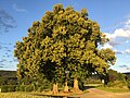
Natural monument Zwei Linden


Economy and Infrastructure
One of the largest nurseries in Baden-Württemberg used to exist in Boll. Today there are a few small companies and craft businesses in Boll. There are also three inns.
traffic
The K7109 connects Boll with Hechingen and Stetten.
Transportation
The public transport is the Verkehrsverbund Neckar-Alb-Donau guaranteed (naldo). The place is in the honeycomb 332. The city tariff Hechingen applies.
Sons and daughters
- Otto Daiker (1911–1968), motorcycle racing driver
Individual evidence
- ^ Federal Statistical Office (ed.): Historical municipality directory for the Federal Republic of Germany. Name, border and key number changes in municipalities, counties and administrative districts from May 27, 1970 to December 31, 1982 . W. Kohlhammer, Stuttgart / Mainz 1983, ISBN 3-17-003263-1 , p. 528 .