Schwarzbach (Elmbach)
| Schwarzbach | ||
|
The Schwarzbach below Brandenstein Castle |
||
| Data | ||
| Water code | DE : 2478124 | |
| location |
East Hessian mountainous region
Hessian-Franconian mountainous region |
|
| River system | Rhine | |
| Drain over | Elmbach → Kinzig → Main → Rhine → North Sea | |
| source | northeast of Schlüchtern - Gundhelm 50 ° 22 ′ 13 ″ N , 9 ° 40 ′ 59 ″ E |
|
| Source height | approx. 548 m above sea level NHN | |
| muzzle | near Schlüchtern - Elm in the Elmbach Coordinates: 50 ° 21 '32 " N , 9 ° 33' 7" E 50 ° 21 '32 " N , 9 ° 33' 7" E |
|
| Mouth height | approx. 230 m above sea level NHN | |
| Height difference | approx. 318 m | |
| Bottom slope | approx. 28 ‰ | |
| length | 11.5 km | |
| Catchment area | 17.298 km² | |
| Discharge A Eo : 17.298 km² at the mouth |
MQ Mq |
240.4 l / s 13.9 l / (s km²) |
|
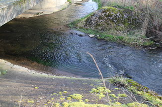
The Schwarzbach (right) flows into the Elmbach (from back to left) |
||
The Schwarzbach is an eleven and a half kilometer long, coarse material rich, silicate low mountain range in the Vorder- and Kuppenrhön and in the Sandstone Spessart and a left and eastern tributary of the Elmbach in the Hessian Main-Kinzig district .
geography
course
The Schwarzbach rises at an altitude of about 548 m above sea level. NHN in the Bergwinkel northeast of the Schlüchtern district of Gundhelm .
Its direction of flow is initially west. Later it changes its course to the southwest, its main flow direction, which it essentially maintains up to the mouth. At Gundhelm it is fed by the Weissbach on the left .
It finally flows into the Schlüchtern district of Elm at an altitude of about 230 m above sea level. NHN from the left into the less arid and only 6.5 km long Elmbach .
The approximately 11.5 km long course of the Schwarzbach ends approximately 318 meters below its source, so it has a mean bed gradient of around 28 ‰.
Catchment area
The 17.30 km² catchment area of the Schwarzbach lies in the Vorder- and Kuppenrhön and in the Sandstone Spessart . It is drained through it via the Elmbach, the Kinzig , the Main and the Rhine to the North Sea.
It borders
- in the northeast to the catchment area of the Kalbach , which drains over the Fliede and Fulda into the Weser ;
- in the southeast of the Hammersbach , which drains into the Main via the Schmale Sinn , the Sinn and the Franconian Saale ;
- in the south of that of the Grennelbach , which flows into the Kinzig, and that of the Kinzig itself;
- in the northwest to that of the Elmbach;
- and in the north to that of the cress water , which flows into the lilac.
The highest point is the Hoherain at 588 m above sea level. NHN in the east of the catchment area.
Tributaries
- Weissbach ( left ), 4.6 km
- Mausbach [GKZ 24781249922] ( right ), 1.3 km
Kinzig river system
Mills
- Gundhelm
- Johannesmühle (also called Waldmühle or Hilbergsmühle)
- Quite a mill
- Hommel mill
- Miter mill
- Gerzmühle (Gölsmühle)
- Elm
- Brandensteiner Mill
- Lower mill (on a ditch derived from the Schwarzbach)
Web links
- Course and catchment area of the Schwarzbach on the water map service of the Hessian Ministry for the Environment, Climate Protection, Agriculture and Consumer Protection ( information )
References and comments
- ↑ a b Topographic map 1: 25,000
- ↑ a b Water map service of the Hessian Ministry for the Environment, Climate Protection, Agriculture and Consumer Protection ( information )
- ↑ Designation according to the property map


