Schwiederstorf
|
Schwiederstorf
Unified municipality Neu Wulmstorf
|
|
|---|---|
| Coordinates: 53 ° 25 ′ 19 ″ N , 9 ° 47 ′ 51 ″ E | |
| Height : | 46-67 m |
| Residents : | 922 (December 1, 2016) |
| Incorporation : | July 1, 1972 |
| Postal code : | 21629 |
| Area code : | 04168 |
|
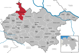
Location of Schwiederstorf in Neu Wulmstorf
|
|
|
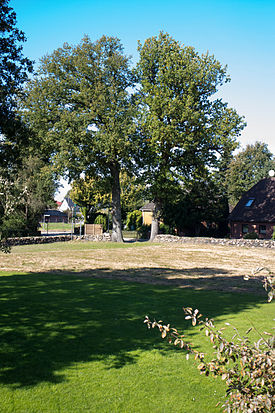
Crossing from Elstorf to Schwiederstorf am Schwarzenberg
|
|
(Swiersdbod inLow German ) is part of theNeu Wulmstorf communityinthe Harburg districtin northeastLower Saxonyin theHamburg metropolitan region. The population of Schwiederstorf amounts to approx. 922 people.
The small, actually nameless "Schwiederstorf settlement" is located about one kilometer east of the village in the Harburg Forest ( Harburg Mountains ). Although the distance is negligible, one has the impression that there are two districts, such as B. Neu-Wulmstorf-Tempelberg. A little further south-east lies the Karlstein natural monument in the Harburg mountains.
Together with Elstorf , Schwiederstorf forms roughly the geographical center of the municipality of Neu Wulmstorf. The agricultural character of Schwiederstorf has declined sharply in the last few decades and therefore today offers many new residents a new home in a green and scenic location with convenient transport links.
Neighborhoods
In the south Schwiederstorf borders on Elstorf-Bachheide , in the southwest on Eversen-Heide , in the north on Daerstorf , in the east on the Harburg mountains and in the west on Elstorf . In terms of nature, Schwiederstorf is located at the transition from the Apenser Lehmgeest (town center) to the Black Mountains (forest settlement).
history
Schwiederstorf and the other southern villages of the municipality are several hundred years old. Schwiederstorf was first mentioned in a document in 1355.

Traces of the Neolithic beaker culture , such as the Elstorf large stone grave located 2 km to the east or the Daerstorf large stone grave, prove that the area was settled earlier.
During the French period , Schwiederstorf had 124 inhabitants and belonged to the Département des Bouches de l'Elbe . On December 1, 1910 Schwiederstorf had 163 inhabitants.
Elstorf and Schwiederstorf were taken shortly before the end of the war on April 20, 1945 by the "A-Company" of the infantry unit "1st Rifle Brigade" and the "8th King's Royal Irish Hussars" of the English troops.
Incorporation
On July 1, 1972, the formerly independent communities Schwiederstorf, Elstorf, Rade and Rübke were incorporated after Daerstorf had already joined the community of Neu Wulmstorf in 1970.
coat of arms
The coat of arms shows the Karlstein and the imperial crown . In a legend , Charlemagne is associated with the Karstein and the surrounding area as part of a battle against the Saxons.
Population development
| year | 1812 | 1910 | 1925 | 1933 | 1939 | (?) | 2016 |
|---|---|---|---|---|---|---|---|
| population | 124 | 163 | 171 | 174 | 248 | 850 | 922 |
nature
Schwiederstorf is in the immediate vicinity of the following nature reserves and landscape protection areas:
regional customs
" Faslam " has been celebrated in Schwiederstorf since the 17th century , which is the northern German form of carnival , but has its origins in the festivities of the farmhands .
The Faslam, which is celebrated every year in February over three days, ends on Sunday with a traditional egg scoop, with mostly disguised Faslam brothers and sisters walking through the town with loud music and collecting eggs and money at the front doors.
Economy and Transport
The railway connection in Neu Wulmstorf is guaranteed by the Hamburg-Harburg - Cuxhaven railway line , which has been operated as the Hamburg S-Bahn since 2008 to Stade . There is a connection to the A 1 for road traffic in the south of the municipality via the Rade junction . The district will be further developed with the planned A 26 from Stade to Hamburg. Other trunk roads are federal highway 73 and federal highway 3 . With the bus companies HVV and KVG you can reach every place within the municipality.
communication
Schwiederstorf is connected to DSL with a maximum of 100 Mbit / s via fiber optics ( FTTN ), and the communications service provider EWE laid fiber optic cables in many streets in 2016. Cable TV is not available in the entire place. Open WiFi is only available to a very limited extent.
Web links
- Map Buxtehude, 1951, Reichsamt für Landesaufnahme, sheet 2524
- Reinhard Dzingel: Field names and their meaning using the example of the Timmersbarch in Schwiederstorf . (PDF; 2.3 MB) Moisburg, December 16, 2011
Individual evidence
- ↑ a b Interesting facts about the community of Neu Wulmstorf . Population figures as of December 2016, leaflet from the Neu Wulmstorf municipality, January 2017
- ↑ Reinhard Dzingel: Justification for the spelling of the Low German place names of the community Neu Wulmstorf, Harburg district . (PDF; 82 kB) Schwiederstorf, October 31, 2010, p. 3
- ^ A b Albrecht Friedrich Ludolph Lasius : The French Kayser State under the government of the Kayser Napoleon the Great in 1812 . Kißling, Osnabrück 1813, p. 57 f . ( limited preview in Google Book search).
- ^ A b Register of municipalities in Germany 1900, Kingdom of Prussia, Province of Hanover, District of Lüneburg, District of Harburg
- ^ A report compiled from German sources and contemporary witness reports and military records of the English. (PDF; 1.7 MB) (No longer available online.) In: nicolai-kirche-elstorf.de. Archived from the original on April 8, 2016 ; Retrieved April 8, 2016 . Info: The archive link was inserted automatically and has not yet been checked. Please check the original and archive link according to the instructions and then remove this notice.
- ^ Federal Statistical Office (ed.): Historical municipality directory for the Federal Republic of Germany. Name, border and key number changes in municipalities, counties and administrative districts from May 27, 1970 to December 31, 1982 . W. Kohlhammer, Stuttgart / Mainz 1983, ISBN 3-17-003263-1 , p. 229 .
- ^ NI GVBl., June 23, 1972, Law on the reorganization of the municipalities in the Harburg area. In: Niedersächsisches Gesetz- und Verordnungsblatt , 1972, No. 30, pp. 320–322
- ^ A b c Michael Rademacher: German administrative history. (No longer available online.) Archived from the original on September 24, 2015 ; accessed on March 9, 2015 . Info: The archive link was inserted automatically and has not yet been checked. Please check the original and archive link according to the instructions and then remove this notice.


