South Riding (Virginia)
| South Riding | ||
|---|---|---|
 |
||
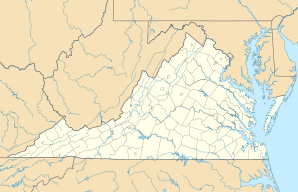
| Location in Virginia | ||
|
|
||
| Basic data | ||
| Foundation : | 1994 | |
| State : | United States | |
| State : | Virginia | |
| County : | Loudoun County | |
| Coordinates : | 38 ° 55 ′ N , 77 ° 30 ′ W | |
| Residents : | 24,256 (as of 2010) | |
| Postal code : | 20152 | |
| Area code : | +1 703 | |
| FIPS : | 5174100 | |
South Riding is a civil parish and census-designated place in Loudoun County , Virginia . The planned settlement had a population of 24,256 in 2010; since the development is not yet finished, the population continues to rise. South Riding has existed since 1994 .
geography
The county seat of Leesburg is 16 miles away and the capital Washington, DC is 30 miles east of South Riding. Chantilly , Fairfax County is 5 miles away. The nearby US Highway 50 and State Route 28 provide quick access to the Dulles / Reston / Tysons Corner technology area .
Post Code
South Riding uses the zip code 20152, which according to the United States Postal Service also belongs to nearby Chantilly. Because of the large population growth in the South Riding, most residents of the Greater Washington, DC area of Chantilly are using South Riding, Virginia as their address instead of Chantilly, making it easier for mail to be delivered, as most people in the Washington, DC area are part of adjacent Fairfax County.
Education
There are two elementary schools in South Riding, Freedom High School and a daycare center.
In the future there will also be a shopping center, office buildings, a hotel and a public safety center.
Individual evidence
- ↑ https://www.census.gov/quickfacts/fact/table/southridingcdpvirginia/RHI105210 ( page no longer available , search in web archives ) Info: The link was automatically marked as defective. Please check the link according to the instructions and then remove this notice.
