Sparne
| Sparne | ||
|
Course of the Spaarne |
||
| Data | ||
| Water code | NL : 13 16, NL : 13 40 | |
| location | Netherlands | |
| River system | North Sea Canal | |
| origin | Outflow of the Ringvaart of the Haarlemmermeer polder south of Haarlem and Heemstede 52 ° 20 ′ 20 ″ N , 4 ° 38 ′ 24 ″ E |
|
| Source height | 0.6 m below sea level | |
| muzzle | In the IJ near Spaarndam Coordinates: 52 ° 24 '43 " N , 4 ° 40' 48" E 52 ° 24 '43 " N , 4 ° 40' 48" E |
|
| Mouth height | 0.6 m below sea level | |
| Height difference | 0 m | |
| Bottom slope | 0 ‰ | |
| length | 10.2 km | |
| Right tributaries | Songs | |
| Big cities | Haarlem | |
| Small towns | Spaarndam | |
| Communities | Heemstede, Haarlem, Haarlemmerliede en Spaarnwoude | |
| Ports | Spaarndam, Haarlem, Heemstede | |
| Navigable |
Class Va (km 3.80 to km 8.17) Class II (km 8.17 to km 14.04) |
|
|
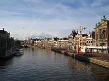
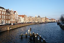
Gravestenenbrug and the banks of the Spaarne in Haarlem, 2008 |
||
The Spaarne is a 10.24 km long, canalized river in the Dutch province of North Holland . The river, which only flows to the north to a small extent, forms a connection between the Ringvaart of the Haarlemmermeer and the North Sea Canal . The water flows through the center of the city of Haarlem , which is why it is nicknamed Spaarnestadt . The water level of the river, which plays an important role in the drainage of North and South Holland , is artificially kept at 0.6 m below sea level by pumping stations along its entire length .
etymology
The name Spaarne probably comes from “spier”, an outdated word for thatch or reed . In Dutch (“het Spaarne”) the grammatical gender of the river is neuter.
geography
course
The Spaarne begins as an outflow of the Ringvaart of the Haarlemmermeerpolders in the south of the city of Haarlem and the municipality of Heemstede . After the Spaarne has crossed the city center of Haarlem, it flows via a pumping station and the Rijnland lock near Spaarndam into a non-polded part of the former IJ inlet . The outflow of this lake takes place via the side channel C into the North Sea channel . The water level of the North Sea Canal is 0.4 m above sea level. NHN about 20 cm higher than that of the river Spaarne.
Kilometrage
Although the weak flow of Spaarne from south to north runs, starting chainage of the water as part of the waterway North Sea channel Spaarne-Kaagerplassen at km 3.80 to the north and ends at 14.04 km to the south.
history
Originally the Spaarne formed a natural connection between the Haarlemmermeer and the IJ, at that time a bay of the Zuiderzee . After several floods in 1248, which include the Allerkindleinsflut counts, the population at the Spaarnemündung in the IJ built a dike with sluices . The Spaarndammerdijk was the most important drainage system of the Hoogheemraadschap van Rijnland water board, first mentioned in 1255 . In the following years the dyke village Spaarndam and other sluices and locks were built here . The inhabitants of the dyke village lived from fishing and the income from the ship duty .
In 1845, a modern steam pumping station went into operation in Spaarndam. In 1939 it was switched to diesel operation. The diesel engines with a power of 309 and 403 kilowatts installed during the renovation in 1990 each drive five chain pumps with a diameter of 5.70 and a length of 24 meters. The pumping station, which can only be operated by one person, conveys a maximum water volume of 32 m³ / s. In the event of flooding, an Archimedean screw can be used to pump out an additional 5 m³ / s.
After the drainage of the Haarlemmermeer , which was once the largest lake in the Netherlands (17,000 hectares), which was completed in 1852 , the runoff and the depth of the Spaarne decreased considerably. In addition, after the completion of the North Sea Canal (1876), a large part of the water taken from the polder flowed off via the side canal F connected to the Ringvaart. After much pressure from the industrial companies based on the Spaarne, the municipality of Haarlem finally arranged for the river bed to be dredged in order to prevent the threat of silting up .
As a connection between the Ringvaart of the Haarlemmermeerpolders and the North Sea Canal, the Spaarne is still of great economic importance today. The northern section to the center of Haarlem can be reached via the North Sea Canal by ships of the Rhine category . In addition to cargo ships, the Spaarne is also used by numerous sports boats. The river is also a popular mooring for houseboats , especially in the quieter, southern part .
Tributaries and canals
The only natural tributary of the Spaarne is the Liede, which runs parallel to the Spaarne a few kilometers east and is also an outflow of the Ringvaart of the Haarlemmermeerpolders. The song flows into the Spaarne north of Haarlem via its bulge called Mooie Nel . Further tributaries of the Spaarne are numerous drainage ditches as well as branch canals and the canals of Haarlem. As a result, the Spaarne is indirectly connected to the Haarlemmertrekvaart and the Leidsevaart , which are no longer economically important today.
Canals, rivers and other bodies of water connected to the Spaarne are (in the order of the kilometers from north to south):
| Right left | at km | Canal / river |
|---|---|---|
| R. | 4.28 | Drainage canal at Spaarndam |
| L. | 4.34 | Mooie Nel and songs |
| R. | 5.38 | Jan Gijzenvaart |
| L. | 7.54 | Branch canal to the industrial port of Haarlem |
| R. | 7.72 | Kloppersingel |
| R. | 8.17 | Nieuwe Gracht |
| L. | 8.75 | Castle whale |
| R. | 8.83 | Bakenessergracht |
| R. | 9.37 | Kampersingelgracht |
| L. | 9.40 | Castle whale |
| L. | 9.51 | Heerensingelgracht |
| L. | 9.54 | Zomervaart |
| R. | 11.43 | Crayennestervaart |
| R. | 12.08 | Bronsteevaart |
| R. | 12.08 | Bronsteevaart |
| R. | 12.42 | Heemsteedsch Kanaal |
bridges
The Spaarne is crossed by a total of ten movable bridges . Historic bridges are the Catharijnebrug opened in 1903, the Melkbrug from 1886 and the Gravestenenbrug built in 1950. The Schoterbrug, at 260 meters by far the longest Spaarnebrücke, was opened on June 6th, 2009.
- Schoterbrug: ( bascule bridge , under construction)
- Waarderbrug (bascule bridge)
- Prinsenbrug, Rijksweg 200 (bascule bridge)
- Spaarnespoorbrug, Haarlem- Amsterdam railway line (bascule bridge)
- Catharijnebrug ( swing bridge )
- Gravestenenbrug (bascule bridge)
- Melkbrug (swing bridge)
- Langebrug (bascule bridge)
- Buitenrustbrug, Provinciale weg 205 (bascule bridge)
- Schouwbroekerbrug (bascule bridge)
See also
literature
- AJ Enschedé: Bijdrage tot de geschiedenis van den Grafelijkheidstol te Sparendam, 1874, Haarlem, OCLC 65668998
- Ludy Giebels: Zeven eeuwen Rijnlandse uitwatering in Spaarndam en Halfweg. Van beveiliging naar beheersing , 1994, Leiden, ISBN 907238105X
- G. 't Hart: Geschiedenis van de kleine en grote Haarlemmersluis te Spaarndam , Haerlem Jaarboek 1967, 1968, Haarlem, OCLC 64464874
- JM Sterck-Proot: Haarlems oudste tijden: een vroeg-middeleeuwsch stadsbeeld , 1930, Tjeenk Willink Haarlem, OCLC 781539799
- Bert Sliggers et al. a .: De loop van het Spaarne. De geschiedenis van een rivier 1987, Schuyt Haarlem, 1987, ISBN 906097221X


