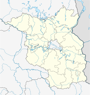
Spree Bridge Werder
Coordinates: 52 ° 6 ′ 46 ″ N , 14 ° 1 ′ 50 ″ E
| Spree Bridge Werder | ||
|---|---|---|
| The bridge in 2014 | ||
| use | Road traffic, pedestrians, cyclists | |
| Convicted | District road K 6726 , Spreeradweg | |
| Subjugated | Spree | |
| place | Werder / Spree , municipality of Tauche | |
| construction | Pfahljoch Bridge | |
| completion | 1991 | |
| location | ||
|
|
||
The Spreebrücke Werder is a road, bicycle and pedestrian bridge over the Spree in Werder , a district of the Brandenburg municipality of Tauche in the Oder-Spree district . The Pfahljoch Bridge was built in 1991 and made entirely of wood to preserve the landscape of the protected floodplain .
Geography and natural space
Geology and conservation
The wooden bridge spans the Spree, which flows in this section of the river in the glacial Brieschter valley under the name Krumme Spree from west to east and separates the Beeskower Platte from the Lieberoser Platte to the south . The Spree lowland between Alt-Schadow and Trebatsch is designated as a landscape protection area Krumme Spree . The area is also part of the coherent European ecological network of special protection areas Natura 2000 as the Spree FFH area . The profile of the Federal Agency for Nature Conservation (BfN) provides for the 2,324 hectares comprehensive FFH area under the number 3651 to 303 the following characterization: Nationally significant rivers with outstanding connectivity and spread function for otter , beaver and numerous species of fish, Aue with typical habitats.
Location and overpass
The structure is located in the southwest of the Oder-Spree district and crosses the K 6726 district road over the river. About 200 meters further south follows the border to the district of Dahme-Spreewald , in which the road continues as K 6118 in the Plattkows district , a district of the Märkische Heide community . The Werder Spree Bridge is also part of the Spree Cycle Path , which changes sides of the river here. To the east between Werder and Kossenblatt the cycle path runs on the south side, to the west between Werder and Alt Schadow on the north side of the Krummen Spree, which has a large number of old and secondary branches in the entire area. A rest area has been set up next to the bridge for cycle tourists.
Construction and material
The bridge was built and opened in 1991. The client was the Beeskow District Office , civil engineering department. The planning and statics were carried out by the F. Pott engineering office from Nordhorn , as was the case with the Briescht Spree bridge built a year later .
In order not to impair the landscape of the river valley, the entire bridge was built from wood. Were used Basralocus from South America and Bongossi timber from Cameroon , an ironwood of particular hardness and high density . The driving pile from Basralocus has an average cross-section of 35 x 35 cm and is 10 m long, of which 5 m are driven into the river bed. Its mass is 2.5 tons. The two pile yokes are made from 22.55 m³ (28.18 t) and 65.6 m³ (78.72 t) bongossi wood. The bridge structure consists of 104.56 m³ (130.7 t) bongossi wood. The hot-dip galvanized steel cables ( V2A steel ) have a mass of 1775.5 kg. The bridge is designed for the vehicle class SLW 30 , i.e. for a total load of 300 kilonewtons , wheel load of 50 kN and axle load of 130 kN. The desired service life of the bridge is estimated at 50 to 70 years and, according to the client, corresponds to the service life of a reinforced concrete bridge .
Another, similarly constructed bridge was built around 100 meters north over a branch of the Spree in 2012 after two old branches had been desludged and reconnected. The measure within the framework of the "development concept for the renaturation of the oxbow lakes of the Spree" in accordance with the EU Water Framework Directive (WFD) for the near-natural development of rivers is intended in particular to open up the habitat for species typical of rivers . The branch branches off from the main river immediately west of the Werder Spree bridge.
Web links
Individual evidence
- ↑ Olaf Juschus: The young moraine south of Berlin - investigations into the young Quaternary landscape development between Unterspreewald and Nuthe. S. 2. Dissertation, Humboldt University Berlin, 2001. Also in: Berliner Geographische Arbeit 95. ISBN 3-9806807-2-X , Berlin 2003. See Figure 2 Plates and glacial valleys in the young moraine south of Berlin in Chapter 1 and Chapter 4 Fig. 32 and subsections 4.3.4.3 and 4.3.4.5 .
- ↑ Federal Agency for Nature Conservation (BfN): Map service for protected areas in Germany. Detail in the area of the municipality of Tauche.
- ↑ 3651-303 Spree. (FFH area) Profiles of the Natura 2000 areas. Published by the Federal Agency for Nature Conservation . Retrieved November 25, 2017.
- ↑ Brandenburg viewer, digital topographic maps 1: 10,000 (menu - "More data" - click and select accordingly; switch to the district boundaries "real estate cadastre" and there "districts".)
- ↑ Information board Spreebrücke Werder on site, as of 2014.
- ↑ Iris Stoff: Bridge is taking shape. In: Web magazine of the Märkische Onlinezeitung (MOZ), September 18, 2012.
- ↑ Blickpunkt, online portal for the state of Brandenburg: Construction of a new bridge over the old arm of the Spree. July 27, 2012.


