Stöckigsbach (Main)
| Stöckigsbach | ||
|
Stöckigsbach |
||
| Data | ||
| Water code | DE : 243118 | |
| location |
Steigerwald
|
|
| River system | Rhine | |
| Drain over | Main → Rhine → North Sea | |
| source | between the Bocksberg and the Gangolfsberg 49 ° 56 ′ 20 ″ N , 10 ° 29 ′ 17 ″ E |
|
| Source height | 450 m above sea level NHN | |
| muzzle | north of Knetzgau in the Main Coordinates: 50 ° 0 ′ 1 ″ N , 10 ° 32 ′ 50 ″ E 50 ° 0 ′ 1 ″ N , 10 ° 32 ′ 50 ″ E |
|
| Mouth height | 215 m above sea level NHN | |
| Height difference | 235 m | |
| Bottom slope | 16 ‰ | |
| length | 14.7 km | |
| Catchment area | 35.36 km² | |
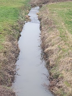
The Stöckigsbach is a 14 km long brook in the northern Steigerwald in the Lower Franconian district of Haßberge , which flows into the Main from the left after a north-easterly run north of Knetzgau . The stream flows through the new Knetzberge-Böhlgrund natural forest .
geography
course
The Stöckigsbach rises in the rainy northern Steigerwald (approx. 850 liters per year) at an altitude of 450 m above sea level. NHN about 2.7 km north of the hamlet of Neuhausen , which is part of the Michelau district of Prüßberg . Its source lies in a forest between the Bocksberg ( 463 m above sea level ) in the east and the Gangolfsberg ( 469 m above sea level ) in the west.
It first crosses the Neuhauser Forest and is reinforced there by some water-rich ditches. South of the Kleiner Knetzberg ( 447 m above sea level ), the Eisenbach flows on its right side . The Stöckigsbach then passes the Hollacher Berg ( 409 m above sea level ) from the south in an easterly direction . The stream, which then runs north, crosses the town of Zell am Ebersberg and is reinforced there by the Marsbach coming from the east .
The stream, which continues northwards, now crosses under the A 70 . It then flows between the places Knetzgau and Sand am Main , and then directly north of Knetzgau at an altitude of 215 m above sea level. NHN coming from the left to flow into the Main .
Its 14.7 km long run ends about 235 meters below its source, so it has an average bed gradient of 16 ‰.
Catchment area
The 35.36 km² catchment area of the Stöckigbach is located in the northern Steigerwald and in its foreland . It is drained via the Main and the Rhine to the North Sea.
It borders:
- in the north to that of the Main
- in the east to that of the Aurach
- in the south to the Rauhe Ebrach
- and to the west of the Schwappach .
The highest point is 491 m above sea level. NHN high Euerberg in the south of the catchment area.
The catchment area is largely forested on the upper reaches, otherwise arable land and meadows in the floodplains dominate. Larger settlements are the villages of Westheim in the west and Zell am Ebersberg in the east of the catchment area and Knetzgau in the north of the estuary.
The catchment area is characterized by clay and marl rock from the grave field formation of the Middle Keuper .
Tributaries
| Surname | location | Length [in km] |
EZG [in km²] |
estuarine place |
Mouth height [m. ü. ŇHN ] |
|---|---|---|---|---|---|
| Lead forest ditch | right | 0.62 | in the Neuhauser Forest | 360 | |
| Torwiesenbach | right | 1.98 | in the Neuhauser Forest | 329 | |
| Eisenbach | right | 2.63 | south of the Kleiner Knetzberg | 307 | |
| Black well | Left | 1.18 | south of the Großer Knetzberg | 307 | |
| Farnbach | right | 1.21 | south of the Hollacher Berg | 292 | |
| Marsbach | right | 2.05 | Zell am Ebersberg | 268 | |
| Milscherangerbach | Left | 4.40 | Knetzgau | 220 |
Places on the Stöckigsbach
Locations on the run with their affiliations.
- Knetzgau market
- Zell am Ebersberg
- Knetzgau
See also
Individual evidence
BayernAtlas ("BA")
Official online waterway map with a suitable section and the layers used here: Course and catchment area of the Stöckigsbach
General introduction without default settings and layers: BayernAtlas of the Bavarian State Government ( notes )
Water directory Bavaria ("GV")
- ↑ Length according to: Directory of stream and river areas in Bavaria - Main river area, page 58 of the Bavarian State Office for the Environment, as of 2016 (PDF; 3.3 MB) (number of pages may change.)
- ↑ Catchment area according to: Directory of brook and river areas in Bavaria - Main river area, page 58 of the Bavarian State Office for the Environment, as of 2016 (PDF; 3.3 MB) (number of pages may change.)
